SECO Continues Tracking Hurricane Matthew
SECO Energy continues to monitor and track Hurricane Matthew and its path to Florida. SECO is urging members to gather emergency supplies and be ready for service interruptions while the hurricane is passing through Florida and for a period of time thereafter.
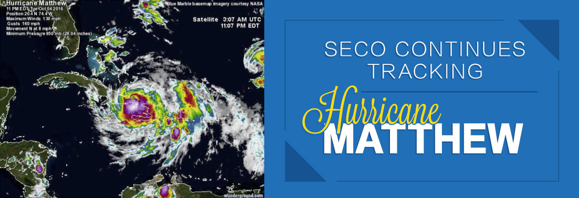
As of Wednesday morning, Hurricane Matthew was downgraded to a Category 3 hurricane with sustained winds up to 125 mph. The storm is currently located about 35 miles north-northwest of the eastern tip of Cuba and is moving north at 8 mph. The storm is still predicted to turn northwest Wednesday night and is expected to remain a major hurricane as it moves over the Bahamas Wednesday and Thursday. By Thursday evening, Matthew will be near Florida’s east coast – with the center located 25 to 30 miles off the coast. The state will feel its effects through Friday night.
The forecast for Florida includes rain bands and strong, potentially damaging wind gusts – especially within rain bands and thunderstorms. Members in SECO’s service area can expect heavy rain, gusty winds that may strengthen to tropical-storm-force.
SECO asks members to keep a close watch on the hurricane’s impact on the area and be prepared for the possibility of prolonged service interruptions. Members should check emergency supplies, fill vehicles with gas, stock up on non-perishables and check property for objects that could cause damage during high winds.
Make sure cell phones and tablets are fully charged – include extra chargers in your emergency supplies. Bookmark SECO’s Storm Center on your smartphone or tablet. It’s simple to report an outage using the account last name and house number.
As a not-for-profit electric cooperative, SECO is dedicated to being our members’ first source for accurate storm information. “Like” SECO’s Facebook page and “follow” the company on Twitter to stay updated about storms affecting our area.