SECO Watching Tropical Disturbances in Atlantic Basin
SECO Energy is keeping a close watch on the tropical disturbances forming in the Atlantic Basin as of Friday afternoon. The peak of Atlantic Hurricane season begins in September and seas are churning.
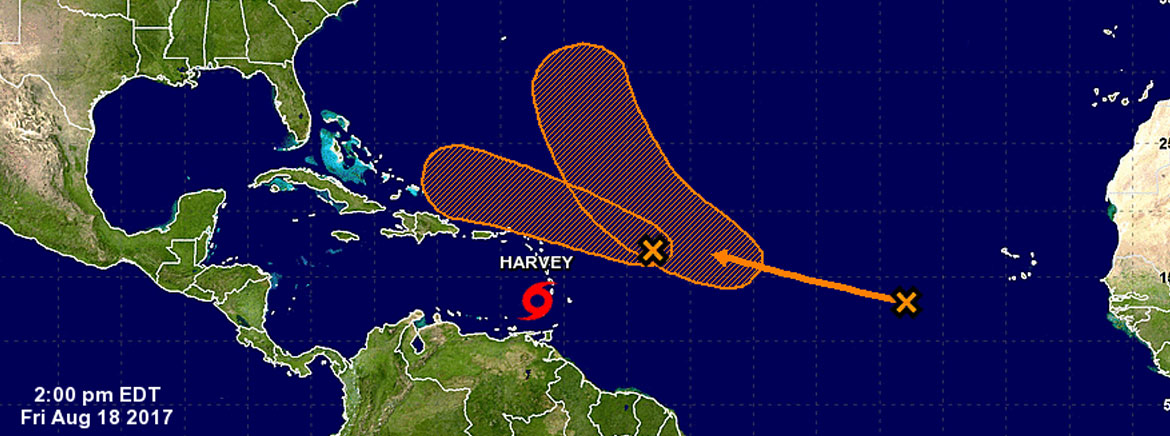
Invest 92 has the greatest possibility of impacting SECO’s service area, possibly early next week. This system is currently located 600 miles east-northeast of the Leeward Islands and is moving west-northwestward at 20 miles per hour. The National Hurricane Center (NHC) reports the upper-level winds are becoming less favorable for cyclone formation, but there is still a 60% chance that a cyclone will form within five days.
Another system forming is Disturbance 2. According to the NHC, Disturbance 2 is located in the far eastern Atlantic Ocean, moving west-northwestward at 20 miles per hour and chance of cyclone formation is only 40%. Forecasters do not believe Disturbance 2 will threaten Florida.
Tropical Storm Harvey is tracking west to Central America and Mexico at 21 miles per hour, and will make landfall on the Yucatan Peninsula early Monday morning.
SECO employees are Storm Ready and waiting to respond if outages occur. SECO is prepared for inclement weather and reminds members that it is best to be informed and prepared.
If you have a portable or backup generator, now is the time to test that it is running properly and you have an adequate supply of fuel on hand. Members can visit SECO’s website for storm preparation tips and view an emergency checklist online. For members with smartphones or tablets, bookmark SECO’s Storm Center for easy outage reporting and updates.
As a not-for-profit electric cooperative, SECO is dedicated to being our members’ first source for accurate storm information. “Like” SECO’s Facebook page and “follow” the company on Twitter to stay updated about storms affecting our area.