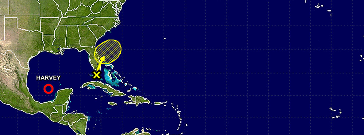
Invest 92L Trekking East of SECO’s Service Area
SECO Energy continues to monitor developing tropical disturbances that could impact its service area.
Early this week, the National Hurricane Center (NHC) predicted the disturbance named Invest 92L could douse Central Florida with rain and occasional gusty winds. As of Wednesday afternoon, the odds of Invest 92L developing into more than a low-pressure trough are lessening. The system is predicted to move slowly northwest and north over Florida beginning Thursday before clearing the state this weekend.
SECO members should prepare for heavy rains, gusty winds and thunderstorms in the coming days while Invest 92L moves off into the Atlantic Ocean. There is a medium chance for the system to gain intensity and develop into a tropical depression or weak tropical storm, but the tropical storm force winds will remain offshore and not affect SECO’s service territory.
SECO’s employees are Storm Ready and waiting to respond if outages occur. SECO is prepared for inclement weather and reminds members that it is best to be informed and prepared.
If you have a portable or backup generator, now is the time to test that it is running properly and you have an adequate supply of fuel on hand. Members can visit SECO’s website for storm preparation tips and view an emergency checklist. For members with smartphones or tablets, bookmark SECO’s Storm Center for easy outage reporting and updates.
As a not-for-profit electric cooperative, SECO is dedicated to being our members’ first source for accurate storm information. “Like” SECO’s Facebook page and “follow” the company on Twitter to stay updated about storms affecting our area.