

SUNDAY UPDATE-INVEST MODELS SHOW FL SWING
SUNDAY WEATHER UPDATE – the models have changed
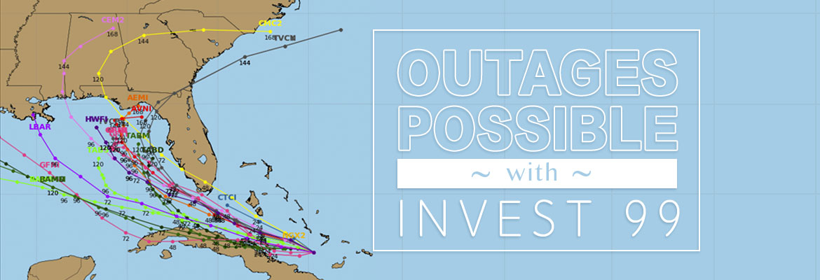
This morning’s forecast and models of the system we’ve been watching show that the projected track has changed. The models are split now – some showing the system turning NW after entering the Gulf and moving across Central and Northern Florida. The NHC forecast states that gusty winds and heavy rainfall will hit South Florida and The Keys later today. The NHC warns that the central and northern Florida and the eastern Gulf areas should monitor the disturbance. A NOAA Hurricane Hunter aircraft is scheduled to investigate the system this afternoon. We will send out another update after that.
SECO is Storm Ready. Our locally-based customer service staff is ready and available to respond to member inquiries in person, by phone or online. SECO’s System Operations directs the SECO cavalry 24 hours a day, seven days a week – each truck is equipped to respond to member concerns or service interruptions in the field quickly and safely. Members should ensure their smartphones/tablets are charged and report outages online through Storm Center.
SECO is urging members to always be prepared. View our emergency checklist. As a not-for-profit electric cooperative, SECO is dedicated to being its members’ first source for accurate storm information. “Like” SECO’s Facebook page and “follow” the company on Twitter to stay updated about storms affecting your area.
For members who rely on back-up generators during storm season, remember to read and follow all manufacturer’s safety warnings.Learn more about generator safety here.


