StormCenter logo

Archive

Hurricane Hermine Wake and Restoration Process

Overnight, the SECO Energy system held up remarkably well given the high winds and rain that came in the wake of Hurricane Hermine.  At height of the Thursday overnight outages, about 7,500 members were without power. As of 8 am on Friday, about 3,000 members remain without power.


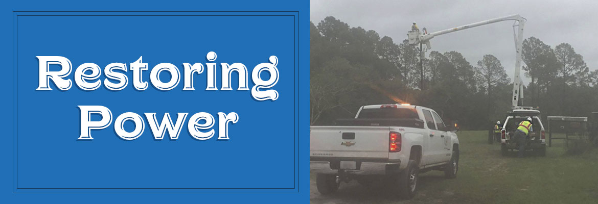
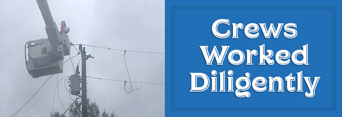
Employees worked throughout the night and field crews are performing under tough conditions. Fresh crews and tree trimmers stepped in this morning to relieve the overnight crews.


SECO expects severe weather throughout the day. Gusty winds up to 45 mph are forecast through 5 pm with periods of heavy rain and lightning at times.  The key component of the current outage equation is there are 170 individual outages affecting those 3,000 members.  That is a high number of individual outages, and some SECO members in less populated areas may need to prepare for a restoration effort that extends into the weekend


SYSTEM OPS UPDATE:

By-County Outages:

  • There are 1,125 without power in Marion County – largely in Blichton and Rainbow Lakes and Waterways Ocala.
  • There are only 127 members without power in Lake County.
  • Sumter County recovered well overnight after unofficial reports of tornados came with multiple outages. About 521 remain without power in Sumter County, mostly along the Highway 301 corridor north and south of Bushnell.
  • Hernando County (far north along the 301 corridor) has 15 without power.
  • 14 members are without power in Pasco County.
  • There are 99 members without power in Levy County.
  • Citrus County has 609 members without power – generally along Highway 41 and in Inverness. There are Citrus outage pockets on the north and south sides of Highway 44.


RESTORATION PROCESS:

Remember that bucket trucks and line work cannot withstand winds in excess of 35 mph – restoration work must be suspended in high winds.  SECO’s emergency restoration plan determines the system’s restoration priority of each affected feeder. Essential services such as shelters, hospitals, fire/law enforcement facilities, schools, and government agencies are the highest priority. Line repairs that will restore power to large groups of members are next, and then individual electric services in less populated areas.


If a member is unsure if SECO is aware of an outage, report it using your last name and house number on Storm Center.

Hermine Upgraded to Hurricane

On Thursday afternoon, the National Hurricane Center upgraded Tropical Storm Hermine to a Category 1 hurricane. Maximum sustained winds have increased to 75 mph. Currently, the hurricane is 115 miles south-southwest of Apalachicola and is moving north-northeast at 14 mph. Locally, tornado warnings have been issued for several counties in SECO’s service area.


SECO Energy is Storm Ready and is braced for Hermine’s impact on its service area. Members should expect 4-8 inches of rain during the event with isolated higher totals. Strong winds will occur on Friday and will have more of an impact on SECO’s service territory than before Hermine makes landfall. Tornadoes remain a concern until Hermine passes away from the state on Friday.


SECO has enacted its emergency restoration plan in preparation for Hurricane Hermine’s effects. Bucket trucks and line work cannot withstand winds in excess of 35 mph. Once winds subside, SECO’s Operations crews and additional contractor and tree trimming crews will work together to restore power quickly and safely. Additional reinforcements are on standby.


The company’s emergency restoration plan determines the system’s restoration priority of each affected feeder. Essential services such as shelters, hospitals, fire/law enforcement facilities, schools, and government agencies are the highest priority. Line repairs that will restore power to large groups of members are next, and then individual electric services in less populated areas. SECO urges members to continue tracking Hurricane Hermine and prepare to wait out the storm as it passes through Central Florida.


Use these practical suggestions:

  • If using a landline, have a non-electric phone for emergencies.
  • Invest in and charge a battery-operated cell phone charger.
  • Buy a battery-powered radio and a supply of fresh batteries.
  • Keep flashlights and extra batteries handy.
  • Dig out your first aid kit and refill prescription medications.
  • Stock a three-day supply of bottled water.
  • Fill bathtubs with water to flush toilets.
  • Purchase canned or packaged nonperishable food.
  • Buy an old-fashioned crank can opener.
  • Review your homeowners and flood insurance policies.


If neighbors have power but you do not, check your panel for tripped breakers, as this is common. If the breakers aren’t tripped, report the outage using your smartphone or tablet through the SECO Storm Center – or call us.


As a not-for-profit electric cooperative, SECO is dedicated to being its members’ first source for storm information. “Like” SECO’s Facebook page and “follow” the company on Twitter to stay updated.

SECO Braced for Tropical Storm Hermine

On Thursday morning, Tropical Storm Hermine turned northeast and is moving at 12 mph. Hermine’s maximum sustained winds are 60 mph with higher gusts, and tropical-storm-force winds extend up to 140 miles east of the center. Current models show the track to our west. Hermine is forecast to hit the Florida coast as a hurricane tonight or early Friday morning between Apalachicola and Cross City. Once inland, Hermine should diminish in intensity and track across northwest Florida into southeast Georgia by Friday morning.


SECO Energy is Storm Ready and is braced for Hermine’s impact on its service area. Members should expect 4-8 inches of rain during the event with isolated higher totals. Strong winds will occur on Friday and will have more of an impact on SECO’s service territory than before Hermine makes landfall. Isolated tornado threats remain a concern until Hermine passes away from the state on Friday.


SECO has enacted its emergency restoration plan in preparation for Hermine’s effects. Bucket trucks and line work cannot withstand winds in excess of 35 mph. Once winds subside, SECO’s Operations crews and additional contractor and tree trimming crews will work together to restore power quickly and safely. Additional reinforcements are on standby.


The company’s emergency restoration plan determines the system’s restoration priority of each affected feeder. Essential services such as shelters, hospitals, fire/law enforcement facilities, schools, and government agencies are the highest priority. Line repairs that will restore power to large groups of members are next, and then individual electric services in less populated areas. SECO urges members to continue tracking Hermine and prepare to wait out the storm as it passes through Central Florida.


Use these practical suggestions:

  • If using a landline, have a non-electric phone for emergencies.
  • Invest in and charge a battery-operated cell phone charger.
  • Buy a battery-powered radio and a supply of fresh batteries.
  • Keep flashlights and extra batteries handy.
  • Dig out your first aid kit and refill prescription medications.
  • Stock a three-day supply of bottled water.
  • Fill bathtubs with water to flush toilets.
  • Purchase canned or packaged nonperishable food.
  • Buy an old-fashioned crank can opener.
  • Review your homeowners and flood insurance policies.


If neighbors have power but you do not, check your panel for tripped breakers, as this is common. If the breakers aren’t tripped, report the outage using your smartphone or tablet through the SECO Storm Center – or call us.


As a not-for-profit electric cooperative, SECO is dedicated to being its members’ first source for storm information. “Like” SECO’s Facebook page and “follow” the company on Twitter to stay updated.

Tropical Depression #9 Upgraded to Tropical Storm Hermine

As of Wednesday afternoon, Tropical Depression #9 is upgraded. Tropical Storm Hermine’s (pronounced Her-MEAN) maximum sustained winds are 40 mph and its location is 400 miles south of Apalachicola and is moving very slowly north at 2 mph. Hermine is expected to increase in speed when turning northeast toward Florida’s west coast. The latest models,predict that Hermine could make landfall somewhere between Apalachicola and Cross City on Thursday as a weak Category 1 hurricane.


In significant storms, SECO Energy engages resources to ensure power is restored quickly and safely. SECO’s Operations crews have already been supplemented with tree trimming crews and contractors. Additional reinforcements are on standby.


SECO Energy, Tropical Depression #9 Upgraded to Tropical Storm Hermine


SECO’s emergency restoration plan determines the system’s restoration priority of each affected feeder. Essential services such as shelters, hospitals, fire/law enforcement facilities, schools, and government agencies are the highest priority. Line repairs that will restore power to large groups of members are next, and then individual electric services in less populated areas. It’s important to understand that bucket truck maneuvers and electric line work cannot withstand winds in excess of 35 mph. Thus, SECO crews and contractors cannot begin restoration until winds subside.


Vice President of Corporate Communications & Energy Services Kathryn Gloria stated, “SECO is concerned about our members’ wellbeing. It’s critical to prepare for those rare moments when you must take cover in the dark and wait it out. As this slow-moving storm edges closer to Florida, members prepare to hunker down when the storm makes landfall on Thursday.”


Use these practical suggestions:

  • If using a landline, have a non-electric phone for emergencies.
  • Invest in and charge a battery-operated cell phone charger.
  • Buy a battery-powered radio and a supply of fresh batteries.
  • Keep flashlights and extra batteries handy.
  • Dig out your first aid kit and refill prescription medications.
  • Stock a three-day supply of bottled water.
  • Fill bathtubs with water to flush toilets.
  • Purchase canned or packaged nonperishable food.
  • Buy an old-fashioned crank can opener.
  • Review your homeowners and flood insurance.

If power is lost, turn off/unplug appliances to protect them when power is restored, to prevent electrical fires and to lessen the chances of a circuit overload when service is restored. Leave the porch light switch on so that you and the repair crews patrolling can confirm that power is restored.


SECO Energy, Tropical Depression #9 Upgraded to Tropical Storm Hermine. Leave your porch lights on.


If it appears that neighbors have power but you do not, check your panel for tripped breakers, as this is common. If the breakers aren’t tripped, report the outage using your smartphone or tablet through the SECO Storm Center – or call us.


If you operate a generator, run it outside in a well-ventilated area, as carbon monoxide emissions from a generator are a silent killer that you can’t see, smell or taste. Do not connect the generator directly to your main electrical panel. If installed incorrectly, generator power could flow into SECO’s electric system, causing injury or death to neighbors or crews who may be under the impression that power lines are not energized.


For more information on preparing, refer to SECO’s Emergency Checklist under the Reliability tab.


As a not-for-profit electric cooperative, SECO is dedicated to being its members’ first source for accurate storm information. “Like” SECO’s Facebook page and “follow” the company on Twitter to stay updated about storms affecting your area.

Storm Preparation & Generator Safety

Portable Generators:


During storm and hurricane season, a portable generator can come in handy if your power is interrupted, but portable generators must always be used with safety in mind.  Read and follow the manufacturer’s safety instructions contained in the generator operations manual.


According to the National Safety Council, www.nsc.org, generators should NEVER be used in an enclosed space – always run the generator outdoors away from windows, vents and doors.  Portable generator engines emit carbon monoxide (CO) that if inhaled can be fatal to humans and pets.  CO is a colorless, odorless, invisible killer.  Do not attempt to use a generator when it is wet, as this poses a risk for electrocution and death.


Permanent Generators:


Are you thinking of installing a generator at your home or business for use during power interruptions?  If so, heed these tips before purchasing and installing:


  1. Installing a generator is not an average do-it-yourself project.
  2. A qualified electrical contractor must perform the installation of the emergency generator, as well as the disconnect and transfer switchgear.
  3. Do not attempt to connect the generator directly to your electric panel.
  4. Always properly disconnect from SECO’s service before starting your generator.
  5. Before use, read and follow the safety instructions contained in the generator operations manual.


Improperly installing or using a generator can lead to property damage, injuries or even death.  Visit our section on generator safety to learn more.

SECO Ready for TD#9 Landfall

As of Tuesday morning, Tropical Depression #9 (TD#9) is located about 240 miles west of Key West and 200 miles west-northwest of Cuba. The National Hurricane Center is predicting TD#9 will strengthen into a tropical storm today.


TD#9 has maximum sustained winds of 35 mph, and is moving west-northwest at 7 mph. The storm is expected to turn northeastward on Wednesday with a slight speed increase. Models are forecasting that TD#9 will make landfall as a tropical storm, or a weak Category 1 hurricane on Thursday afternoon or evening near the Florida Big Bend between Apalachicola and Cross City. The system will track east-northeastward, emerging off the northeast Florida coast early Friday morning.


The forecast above is based on the NHC projections for the state. Showers and thunderstorms will continue to impact SECO’s service area this week – with the greatest coverage of rain on Thursday as it travels through central and northern Florida. SECO members should see an increase in wind gusts from today through Thursday. Sustained tropical-storm-force winds may impact parts of the service territory Thursday night, especially from Inverness to Ocala northward in a 3 to 6-hour period (with higher winds if landfall is a weak Category 1 hurricane). There is a slim chance for tornadoes by Wednesday and Thursday.


SECO Energy is Storm Ready, Line Crews Working


SECO is Storm Ready – the cooperative has staged additional Operations and contractor personnel who are ready to respond to member concerns or service interruptions in the field quickly and safely. Our locally-based customer service staff is ready and available to respond to member inquiries in person, by phone or online. Members should ensure their smartphones/tablets are charged and report outages online through Storm Center. SECO has provided an emergency checklist for members.


As a not-for-profit electric cooperative, SECO is dedicated to being its members’ first source for accurate storm information. “Like” SECO’s Facebook page and “follow” the company on Twitter to stay updated about storms affecting your area. For members who rely on back-up generators during storm season, remember to read and follow all manufacturer’s safety warnings. Learn more about generator safety here.

Tropical Depression #9 Tracking to Florida

National Hurricane Center has upgraded Invest 99 to Tropical Depression #9 (TD#9). As of Monday morning, the storm is currently located 25 to 35 miles northwest of Havana, Cuba and 100 miles southwest of Key West, Florida. Tropical Depression #9 is expected to track west to west-northwest and into the southeastern Gulf of Mexico through Monday.


This system is expected to strengthen and organize into a tropical storm as it moves into the warmer waters of the Gulf on Tuesday and Wednesday. On Thursday, this system is forecasted to turn northeastward and then eastward – landfall is projected in the Florida Panhandle by most models.


The forecast above is based on the NHC projections for the state. SECO’s service area specifically, will likely experience heavy rainfall, sustained winds upward of 40 mph and periods of stronger gusts, especially on Thursday and Friday. Members can expect tree-caused outages due to the wind and rain.


SECO is Storm Ready. Our locally-based customer service staff is ready and available to respond to member inquiries in person, by phone or online. SECO’s Operations leadership directs the SECO cavalry 24 hours a day, seven days a week – each truck is equipped to respond to member concerns or service interruptions in the field quickly and safely. Additional Operations personnel are staged to respond quickly this week. Members should ensure their smartphones/tablets are charged and report outages online through Storm Center.


SECO has provided an emergency checklist for members on the Storm Preparation section of our website.


As a not-for-profit electric cooperative, SECO is dedicated to being its members’ first source for accurate storm information. “Like” SECO’s Facebook page and “follow” the company on Twitter to stay updated about storms affecting your area. For members who rely on back-up generators during storm season, remember to read and follow all manufacturer’s safety warnings. Learn more about generator safety here.

INVEST UPGRADED TO TROPICAL DEPRESSION TRACKING FOR FLORIDA

At 5 p.m. on Sunday, National Hurricane Center upgraded Invest 99 to Tropical Depression #9 (TD#9). The storm is currently located in the Florida Straits between Cuba and the Keys. Wind speed is 35 mph and the storm is moving west at 9 mph. The NHC is projecting movement to the west and then a turn to the north or northeast over the next few days. The models are projecting that the storm will eventually move north and either make a hard turn into Florida or move into the Florida Panhandle. Please see the hyperlinks or the attached graphic as a reference.


The forecast above is based on the NHC projections for the state. For SECO’s service area specifically, the cooperative is estimating that a turn to the north and east may begin Tuesday, with a Thursday evening landfall in the Panhandle – but that is an estimate. Regardless of exact landfall location, SECO’s service area will likely experience 35 to 40 mph wind gusts on Thursday and Friday. Heavy rain will be possible all week and especially on Thursday and Friday. Members can expect tree-caused outages due to the wind and rain.


SECO is Storm Ready. Our locally-based customer service staff is ready and available to respond to member inquiries in person, by phone or online. SECO’s System Operations directs the SECO cavalry 24 hours a day, seven days a week – each truck is equipped to respond to member concerns or service interruptions in the field quickly and safely. Additional operations personnel are staged to respond quickly. Members should ensure their smartphones/tablets are charged and report outages online through Storm Center.


SECO Energy, INVEST UPGRADED TO TROPICAL DEPRESSION TRACKING FOR FLORIDA, storm models


SECO has provided an emergency checklist for members here.


As a not-for-profit electric cooperative, SECO is dedicated to being its members’ first source for accurate storm information. “Like” SECO’s Facebook page and “follow” the company on Twitter to stay updated about storms affecting your area. For members who rely on back-up generators during storm season, remember to read and follow all manufacturer’s safety warnings. Visit SECO’s website to learn more about generator safety.

SUNDAY UPDATE-INVEST MODELS SHOW FL SWING

SUNDAY WEATHER UPDATE – the models have changed

This morning’s forecast and models  of the system we’ve been watching show that the projected track has changed. The models are split now –  some showing the system turning NW after entering the Gulf and moving across Central and Northern Florida.  The NHC forecast states that gusty winds and heavy rainfall will hit South Florida and The Keys later today.  The NHC warns that the central and northern Florida and the eastern Gulf areas should monitor the disturbance.  A NOAA Hurricane Hunter aircraft is scheduled to investigate the system this afternoon.  We will send out another update after that.
SECO is Storm Ready. Our locally-based customer service staff is ready and available to respond to member inquiries in person, by phone or online. SECO’s System Operations directs the SECO cavalry 24 hours a day, seven days a week – each truck is equipped to respond to member concerns or service interruptions in the field quickly and safely.  Members should ensure their smartphones/tablets are charged and report outages online through Storm Center.


SECO is urging members to always be prepared. View our emergency checklist. As a not-for-profit electric cooperative, SECO is dedicated to being its members’ first source for accurate storm information. “Like” SECO’s Facebook page and “follow” the company on Twitter to stay updated about storms affecting your area.


For members who rely on back-up generators during storm season, remember to read and follow all manufacturer’s safety warnings.Learn more about generator safety here.

SECO Monitoring Atlantic Storms

According to the National Oceanic and Atmospheric Administration (NOAA), the most active period in the Atlantic Hurricane season begins in mid-August and ends in mid-October. SECO Energy continues to monitor tropical depression Invest 99 and the possibility it could make landfall in Florida early next week.


As of late Thursday afternoon, tropical wave Invest 99 is an unorganized, broad area of low pressure moving westward at 15 to 20 mph through the southeastern Bahamas. Winds associated with the system have decreased to below tropical storm strength.


Spaghetti models are predicting possible landfall in southern Florida or continue into the southeastern Gulf of Mexico. If conditions are favorable, the depression could strengthen and become Hurricane Hermine as early as Friday. At that point, the storm could pick up steam and make landfall again somewhere on Florida’s west coast. This system could bring heavy rain and winds to SECO’s service area early next week.


Even though it is too early to predict when and how Central Florida will be affected, SECO is urging members to make preparations in advance. SECO has provided an emergency checklist for members on our website.


Kathryn Gloria, Vice President of Corporate Communications and Energy Services stated, “It has been 11 years since Hurricane Wilma made landfall in Florida, and members may feel confident that Florida will continue to be lucky and larger storms will pass us by. Emergency supplies sell out quickly when storm watches and warnings go into effect, gather your supplies beforehand. I urge all SECO members to prepare for the possibility of increased storm activity during this peak time.”


SECO Stands Storm Ready


SECO is Storm Ready. Our locally-based customer service staff is ready and available to respond to member inquiries in person, by phone or online. SECO’s System Operations directs the SECO cavalry 24 hours a day, seven days a week – each truck is equipped to respond to member concerns or service interruptions in the field quickly and safely.


As a not-for-profit electric cooperative, SECO is dedicated to being our members’ first source for accurate storm information. “Like” SECO’s Facebook page and “follow” us on Twitter to stay updated about storms affecting our area.


For members who rely on back-up generators during storm season, remember to read and follow all manufacturer’s safety warnings. Visit our website to learn more about generator safety.