

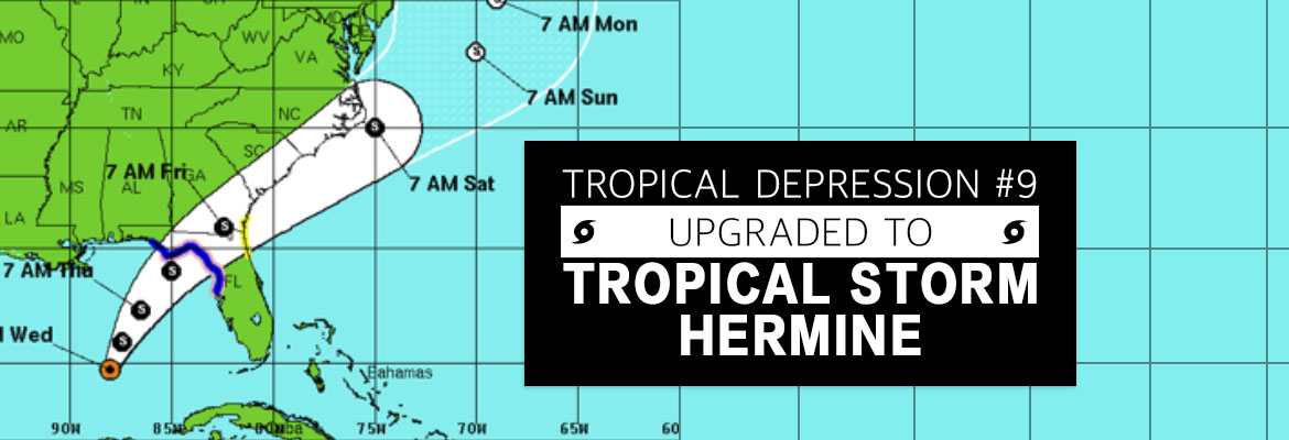
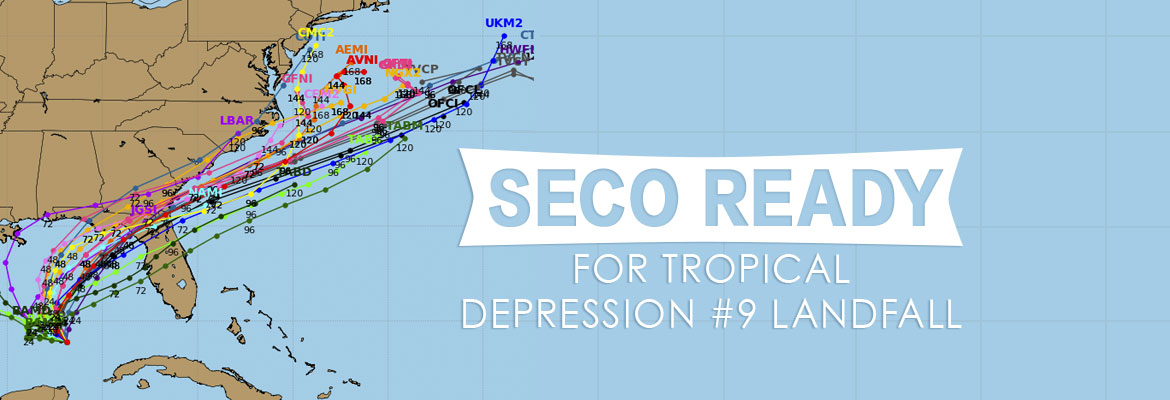
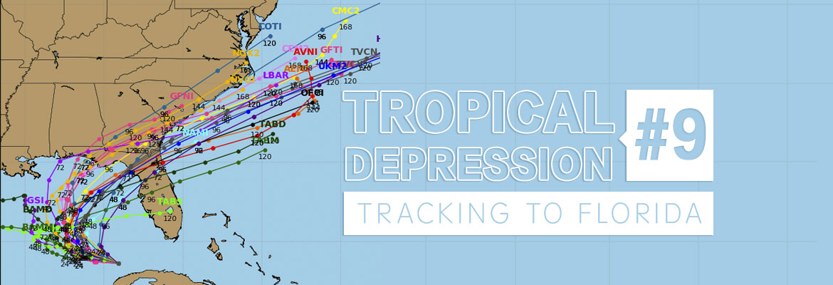
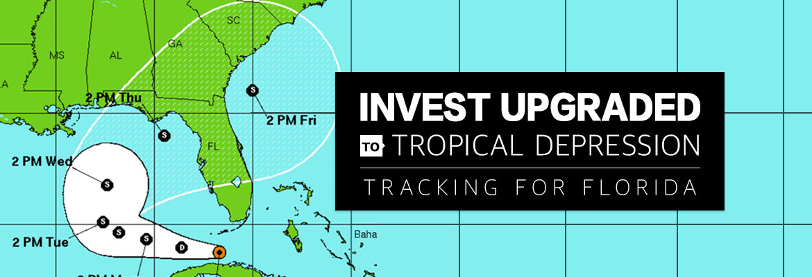
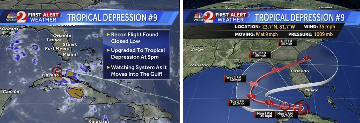
Tropical Depression #9 Upgraded to Tropical Storm Hermine
As of Wednesday afternoon, Tropical Depression #9 is upgraded. Tropical Storm Hermine’s (pronounced Her-MEAN) maximum sustained winds are 40 mph and its location is 400 miles south of Apalachicola and is moving very slowly north at 2 mph. Hermine is expected to increase in speed when turning northeast toward Florida’s west coast. The latest models,predict that Hermine could make landfall somewhere between Apalachicola and Cross City on Thursday as a weak Category 1 hurricane.
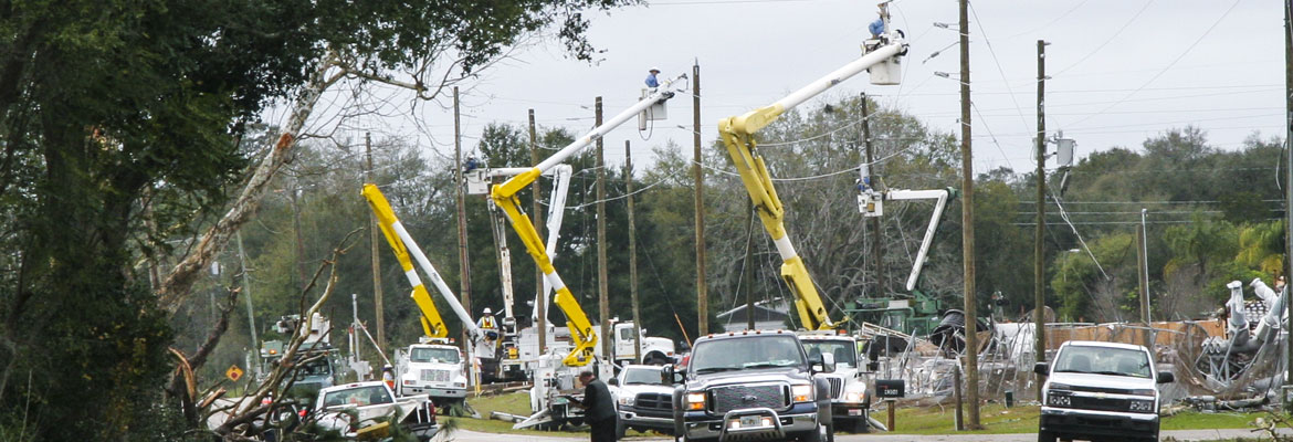
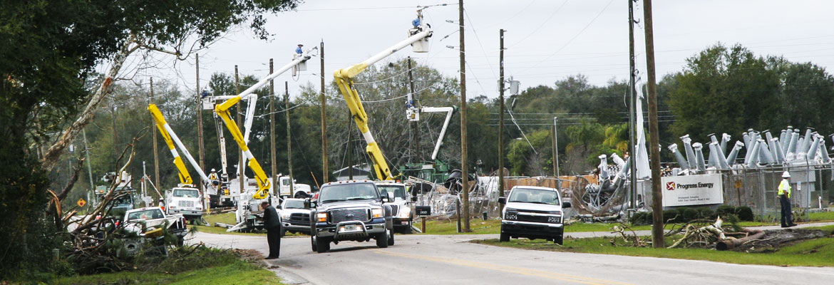
In significant storms, SECO Energy engages resources to ensure power is restored quickly and safely. SECO’s Operations crews have already been supplemented with tree trimming crews and contractors. Additional reinforcements are on standby.
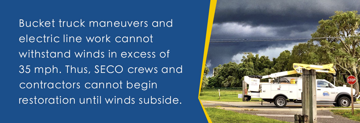
SECO’s emergency restoration plan determines the system’s restoration priority of each affected feeder. Essential services such as shelters, hospitals, fire/law enforcement facilities, schools, and government agencies are the highest priority. Line repairs that will restore power to large groups of members are next, and then individual electric services in less populated areas. It’s important to understand that bucket truck maneuvers and electric line work cannot withstand winds in excess of 35 mph. Thus, SECO crews and contractors cannot begin restoration until winds subside.
Vice President of Corporate Communications & Energy Services Kathryn Gloria stated, “SECO is concerned about our members’ wellbeing. It’s critical to prepare for those rare moments when you must take cover in the dark and wait it out. As this slow-moving storm edges closer to Florida, members prepare to hunker down when the storm makes landfall on Thursday.”
Use these practical suggestions:
- If using a landline, have a non-electric phone for emergencies.
- Invest in and charge a battery-operated cell phone charger.
- Buy a battery-powered radio and a supply of fresh batteries.
- Keep flashlights and extra batteries handy.
- Dig out your first aid kit and refill prescription medications.
- Stock a three-day supply of bottled water.
- Fill bathtubs with water to flush toilets.
- Purchase canned or packaged nonperishable food.
- Buy an old-fashioned crank can opener.
- Review your homeowners and flood insurance.
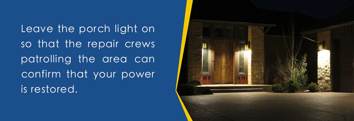
If power is lost, turn off/unplug appliances to protect them when power is restored, to prevent electrical fires and to lessen the chances of a circuit overload when service is restored. Leave the porch light switch on so that you and the repair crews patrolling can confirm that power is restored.
If it appears that neighbors have power but you do not, check your panel for tripped breakers, as this is common. If the breakers aren’t tripped, report the outage using your smartphone or tablet through the SECO Storm Center – or call us.
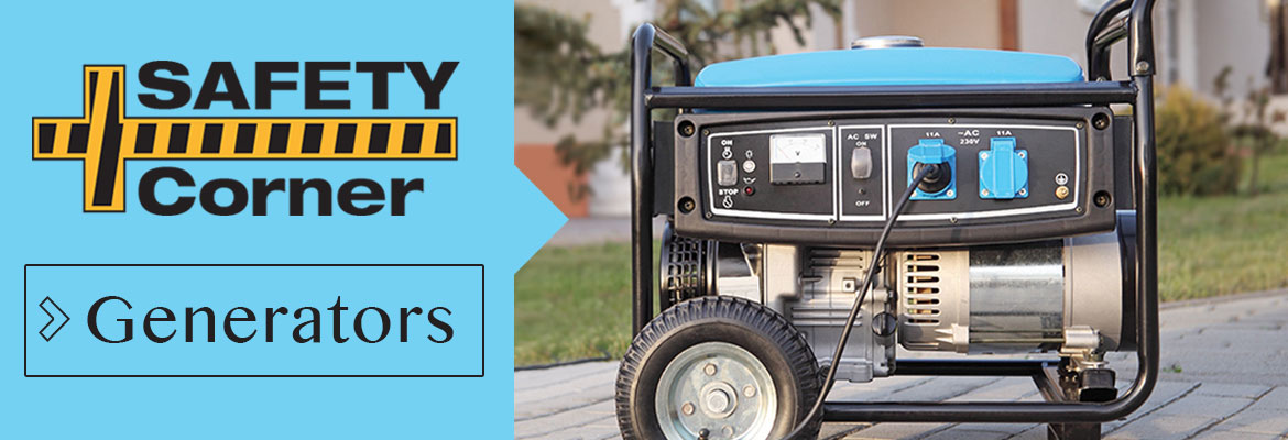
If you operate a generator, run it outside in a well-ventilated area, as carbon monoxide emissions from a generator are a silent killer that you can’t see, smell or taste. Do not connect the generator directly to your main electrical panel. If installed incorrectly, generator power could flow into SECO’s electric system, causing injury or death to neighbors or crews who may be under the impression that power lines are not energized.
For more information on preparing, refer to SECO’s Emergency Checklist under the Reliability tab.
As a not-for-profit electric cooperative, SECO is dedicated to being its members’ first source for accurate storm information. “Like” SECO’s Facebook page and “follow” the company on Twitter to stay updated about storms affecting your area.


