StormCenter logo

Archive

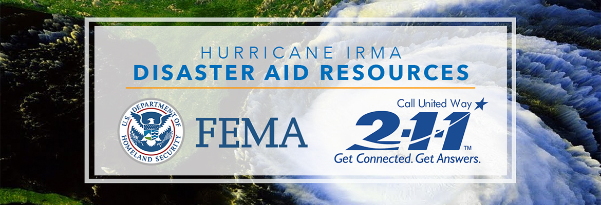
Hurricane Irma Aftermath: Disaster Aid Resources

As a result of the damage caused by Hurricane Irma, every county in SECO Energy’s service territory is eligible for the Federal Emergency Management Agency’s (FEMA) Individual Assistance and Public Assistance programs. Local, state and federal officials have allocated funds to rebuild Florida. The programs provide financial assistance to eligible applicants affected by Irma. Please, contact the appropriate agency for your situation.


FEMA Individual Assistance: FEMA made every county in our service territory – Lake, Marion, Sumter, Hernando, Citrus, Pasco and Levy – eligible for Individual Assistance. Steps to begin applying:

  • Residents who sustained losses should register at www.DisasterAssistance.gov
  • If you do have Internet access, register by calling 1-800-621-3362
  • The toll-free telephone numbers operate from 7 a.m. to 10 p.m. (local time)


Disaster Unemployment Assistance (DUA), call 1-866-487-2365. To be eligible, individuals must:

  • Not be eligible for regular Unemployment Insurance (UI);
  • Be unemployed as a direct result of the disaster;
  • Be able and available for work, unless injured as a direct result of the disaster;
  • File an application within 30 days of the date of announcement of DUA availability;
  • Have not refused an offer of employment in a suitable position.


Information for Small Businesses: Governor Scott has re-started the Florida Small Business Bridge Loan Program to assist small businesses affected by Irma. The program is intended to provide short-term, interest-free loans to small businesses that have sustained physical or economic damage. The application period runs from September 14, 2017 to October 31, 2017. To complete the application or find more information, visit www.floridadisasterloan.org. Reach the Florida Small Business Development Center Network – which runs the loan program – at 1-850-898-3489.


Flood Insurance:

    • If you have a National Flood Insurance Program (NFIP) flood policy, you may be eligible for reimbursement of actions taken to protect your property. Call your insurance agent to learn more.
    • To file a flood insurance claim under the NFIP, contact your insurance agent immediately. You may also call 1-800-621-FEMA (3362)

If you need help with utility payment, contact Florida 2-1-1.  As a not-for-profit electric cooperative, SECO is dedicated to being our members’ first source for accurate storm information. “Like” SECO’s Facebook page and “follow” the company on Twitter to stay updated about storms affecting our area.

Strong Thunderstorms Cause Widespread Power Outages

SECO Energy was “Storm Ready” this weekend and has restored power to all members affected by lines of strong thunderstorms that passed through its seven Central Florida counties on Sunday. Tornado warnings and watches were in effect throughout the day Sunday.


SECO took steps before the weekend began, to prepare for the possibility of the thunderstorms and high winds creating power outages. Field crews, tree trimming contractors, warehouse and customer support employees worked overnight replacing broken poles, removing fallen trees and communicating with members.


The storm came in from the west and first reached northern Marion and Levy Counties just before 2:00 p.m. on Sunday. The high winds brought down a large oak tree near the Ocala Park area that destroyed three spans of lines and other equipment. That large outage began a series of wind and tree-related service disruptions that continued into the evening.


An additional line of storms brought the possibility of tornados and hail as it blew through Citrus, Marion and Northern Lake Counties before impacting Sumter and south Lake Counties around 9:00 p.m. Sunday. High wind speeds and heavy rain accompanied this second line of storms along with unconfirmed reports of tornados in the area.


The total outages during the storms per county were:


Marion and Levy: 5,342
Citrus: 2,239
Lake: 977
Sumter: 938


Kathryn Gloria, Vice President of Corporate Communications and Energy Services stated, “SECO’s system held up very well when the storms brought high wind and rains yesterday. Less than 9,500 members experienced an outage during the storms last night and early this morning. Field crews and tree trimming contractors are out in full force today inspecting the system for damage along with identifying and removing damaged trees that have the potential to cause outages in the future.”


Gloria added, “We are thankful that our employees returned home to their families safely after working in adverse conditions over the weekend. We appreciate our members’ patience and support during the disruptions, and we’re grateful that the storm caused only minimal damage in our service area.”


SECO Energy is Storm Ready. Visit our Reliability page to learn how to build an emergency kit and take steps to keep your family safe when storms blow through SECO’s territory.


“Like” SECO’s Facebook page and “follow” @SECOEnergy on Twitter for news releases and cooperative updates.

Tropical Storm Colin – Sunday evening update

The National Hurricane Center has upgraded the tropical depression to Tropical Storm Colin. The TS is now moving north at approximately 8 mph and is projected to make landfall in the Big Bend area of Florida. All models continue to focus on that area – see attached. This storm is lopsided with all the severe weather on the east side of the storm system and nothing on the west side. This means the worst rain and wind is on the side of the storm that will pass by or on top of SECO Energy.

The current track of TS Colin means that Citrus, Marion and Sumter Counties can expect the worst impact from the storm. Lake County will still see periods of rain and rain bands from TS Colin – just not as severe as the other SECO Energy counties. Since TS Colin is moving slow, it may be late on Monday before SECO sees the worst. The rain bands extend many miles to the east and north. The wind forecast for our area remains unchanged – sustained winds around 20 mph with stronger gusts in thunderstorms. SECO is STORM READY. Please be sure your phone is charged and that you bookmark our Storm Center link to report outages online.

Kathryn Gloria, Vice President of Corporate Communications and Energy Services is reminding members that SECO is Storm Ready for its members. “SECO is prepared for the almost daily afternoon storms that affect our service area and we are prepared for stronger storms as well. As a not-for-profit electric cooperative, we are dedicated to being our members’ first source for accurate storm information. “Like” SECO’s Facebook page and “follow” us on Twitter to stay updated about storms affecting our members.”

For members who rely on back-up generators during storm season, remember to read and follow all manufacturer’s safety warnings. Visit SECO’s website to learn more about generator safety and preparing for storm season.