SECO Energy Braced for Tropical Storm Elsa
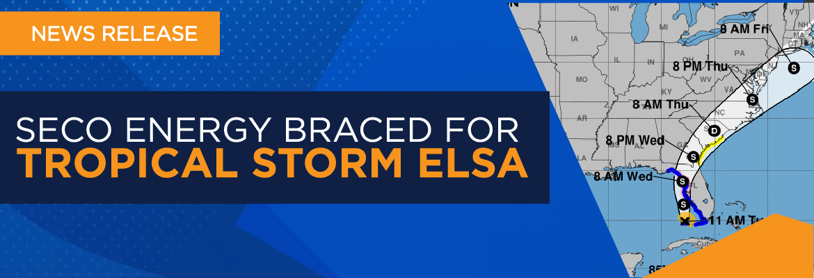
SECO Energy is monitoring Tropical Storm Elsa as it creeps closer to Florida’s Gulf Coast with a predicted landfall near Cedar Key. SECO Energy is StormReady and prepared for Tropical Storm Elsa’s impact to its service area late Tuesday night through Wednesday.
Tropical Storm Elsa has remained intact as it moved across Cuba and through the Florida Straits. The current forecast from the National Hurricane Center (NHC) shows Tropical Storm Elsa moving north northwest with maximum sustained winds up to 60 mph. Earlier today, the Key West airport reported wind gusts up to 48 mph.
The weather forecast for SECO’s service area has changed significantly since Monday. Members in Citrus, Hernando, Levy and Marion Counties may experience maximum sustained winds up to 35 mph with gusts up to 55 mph. Members in Lake and Sumter Counties may experience maximum sustained winds up to 28 mph with gusts up to 40 mph. It’s important to understand that when wind speeds exceed 35 mph, bucket trucks are grounded for safety. SECO will suspend restoration operations until wind speeds fall under 35 mph.
The heaviest winds and rain are expected to arrive just after midnight Wednesday morning and may last until noon. SECO members in all areas should be prepared for heavy rain from Tropical Storm Elsa beginning late Tuesday afternoon and lasting through Wednesday. The area along I-75 and west to the Gulf Coast will likely feel the most impact from Elsa. The grounds are already heavily soaked after a rainy June. More rain could bring trees down and create extended power outages.
In preparation, SECO Energy has called on outside crew reinforcements to assist with power restoration as a result of Tropical Storm Elsa. Over 100 contracted line crews and vegetation crews are arriving today ahead of the storm.
Shelters have opened in Citrus and Marion Counties. In Citrus County, the special needs shelter is open at Citrus County Renaissance Center at 3630 W. Educational Path, Lecanto, 34461. The general shelter is open at Lecanto Primary at 3790 W. Educational Path, Lecanto, 34461. In Marion County, West Port High School is open for special needs, general population and pets at 3733 SW 80th Avenue, Ocala, 34481.
CEO Jim Duncan urges members to prepare for the possibility of power outages from Tropical Storm Elsa’s heavy rain and wind. He stated, “We’ve been watching Tropical Storm Elsa since last week and the forecast has changed often. The wind speed predictions have changed significantly almost overnight. Expect a greater impact from Tropical Storm Elsa than we previously expected. This storm will bring heavy rain and wind to almost every corner of our service area very early Wednesday morning. Be prepared for the possibility of extended power outages from the storm.”
Duncan also reminded members that SECO Energy’s StormCenter outage reporting and communications platform offers outage alerts. “StormCenter is available for members to report outages using their smartphones or tablets 24 hours a day, 7 days a week. Members should also enroll in outage notifications and alerts via email, text, voice message, or all three. An alert is sent when the system recognizes that your service has been interrupted. The alert will include crew status and an estimated restoration time. You’ll also receive a notification when the service is restored that includes the cause of the outage if it is known at that time.”
Members should visit StormCenter and bookmark the site on their smartphones or tablets. At StormCenter, members can view the outage map, enroll or manage notifications, check the status of an existing outage, report an area light outage and more.
Stay up to date on weather affecting SECO Energy’s service area, the latest news releases and cooperative updates by liking SECO’s Facebook page and following @SECOEnergy on Twitter.