StormCenter logo

Archive

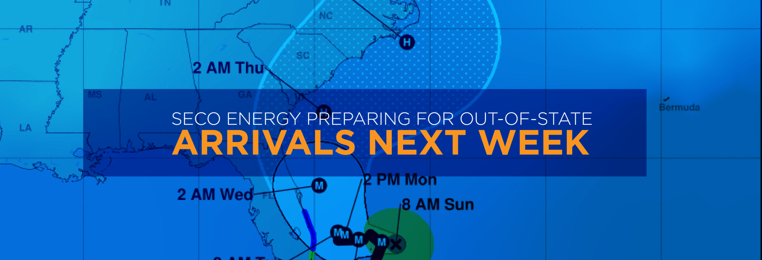
SECO Energy Braces for Hurricane Ian

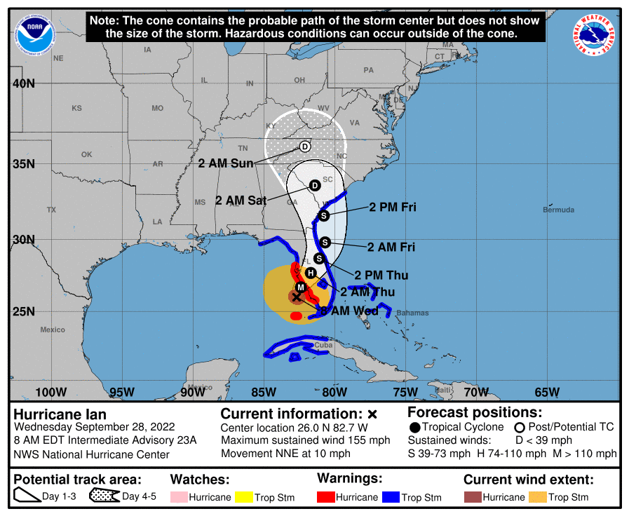
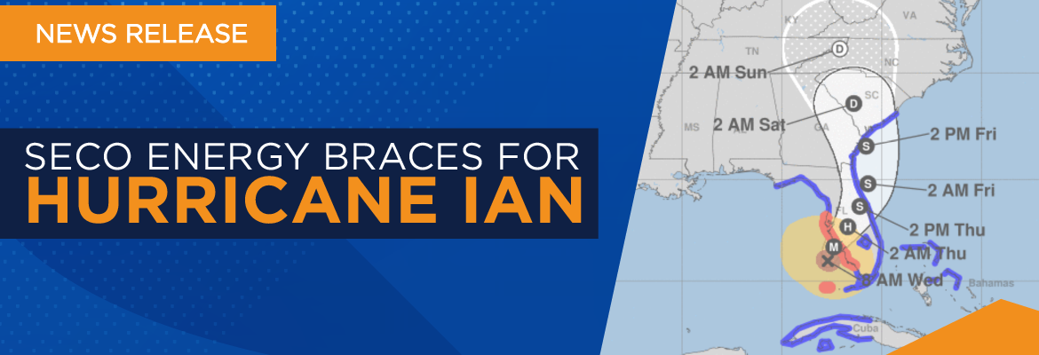
SECO Energy is bracing for the heavy rains and winds pummeling its service territory when Hurricane Ian crosses Central Florida later Wednesday and Thursday. Currently, Hurricane Ian is a major Category 4 hurricane with maximum wind speeds of 155 mph – just 2 mph shy of being a Category 5 hurricane.  


Hurricane Ian is situated in the Gulf of Mexico about 60 miles west of Naples. Based on the National Hurricane Center (NHC) forecast, the storm could lose strength before it makes landfall in the Charlotte Harbor area on the west coast of Florida Wednesday. As of 8 a.m. Wednesday, the hurricane is slowly moving north northeast at 10 mph.  


The latest track for Hurricane Ian has shifted slightly south. Residents along Florida’s west coast have been urged to evacuate the area. NHC forecasts heavy rains and flooding across Central and North Florida through Thursday. Hurricane Ian’s path is dangerously close to SECO Energy’s service area. Members will begin to experience gusty winds and large amounts of rain Wednesday afternoon as Ian closes in. Ian could potentially stall over Central Florida and dump rain through Friday. SECO members should prepare for extended power outages due to this major hurricane. SECO’s service territory will experience large amounts of rain, heavy winds, and the possibility of tornadoes and flash floods.   


CEO Curtis Wynn stresses caution during Hurricane Ian’s impact. Wynn stated, “Hurricane Ian is an extremely large, dangerous hurricane that may devastate SECO Energy’s service area. I urge members to be prepared for heavy rains and high wind speeds. Be cautious, don’t approach downed power lines, stay informed about Hurricane Ian’s track, and prepare to hunker down at home or at a local shelter if needed. The potential for tornadoes after a hurricane is high.” 


SECO Energy has closed its five Member Service Centers for the duration of Hurricane Ian so that all employees can focus on restoration efforts. SECO’s Emergency Restoration Plan determines the system’s restoration priority of each affected feeder. Essential services such as hospitals, shelters, schools and government agencies are the highest priority. Line repairs that will restore power to large groups of members are next, feeders that serve large commercial services and then individual electric services in less populated areas. 


Florida Governor Ron DeSantis declared a State of Emergency for all 67 Florida counties on Sunday, September 25. County Emergency Operations Centers (EOCs) in Central Florida are monitoring Hurricane Ian’s impact. Schools have closed across Central Florida and shelters are opening. For a list of shelters including general, pet-friendly and special-needs visit FloridaDisaster.org. SECO members who require continuous electric service to power life-sustaining medical equipment should have a backup power source or relocate to a shelter. Once SECO Energy enacts its Emergency Response Plan and after Hurricane Ian passes through SECO’s area, members should visit the cooperative’s Daily Restoration Plan Map to identify if crews are working in their area that day.   


StormCenter is SECO Energy’s outage and communications platform for members to report outages, check the status of an existing outage and enroll in outage communications and alerts via email, text, voice or all three. Visit StormCenter today and bookmark on your smartphone or tablet to report outages quickly and easily. 


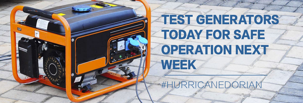
Major weather events can cause extended power outages. SECO Energy reminds members to follow safety protocols when using a generator during a power outage. Generators emit deadly carbon monoxide (CO) that is odorless and colorless. Thousands of people die each year from CO poisoning. Never operate a generator in an enclosed space, including a garage. Always place the generator at least 15 to 20 feet away from your home and never near open windows. 


Before operating a generator, thoroughly read and review the owner’s manual. Never plug a generator directly into an electrical outlet. This current flow is deadly for utility personnel. Keep children away from an operating generator and store fuel in approved containers. Do not smoke while fueling a generator. Always operate a generator in a dry space. If it is raining, use a canopy or cover. SECO Energy’s Hurricane Handbook includes generator safety tips and how to prepare for before, during and after a storm. 


“Like” SECO Energy on Facebook and follow @SECOEnergy on Twitter for prize drawings, news releases, and severe weather alerts affecting SECO Energy’s service territory. Manage your outage notification preferences at StormCenter. To see when SECO Energy crews/contractors are working in your area, visit our new System Improvement map. To learn more about SECO Energy as a not-for-profit cooperative, visit SECOEnergy.com > Your Co-op > About. 


Path of Hurricane Ian
Hurricane Ian’s current location on September 28, 2022. Graphic courtesy of the National Hurricane Center. 


SECO Energy Preparing for Out-Of-State Crew Arrivals Next Week

SECO Energy is StormReady and preparing for Hurricane Dorian’s effects on its service area next week. Line and tree crews from out of state begin arriving Monday and throughout the remainder of the week as needed to assist with restoration efforts.


Hurricane Dorian has strengthened to a CAT 5 hurricane and is moving west at 8 mph with maximum sustained winds of 160 mph. A slower westward motion should occur over the next days or two, followed by a gradual turn toward the northwest. Dorian should move closer to Florida’s east coast late Monday through Tuesday night. Currently, the eye is predicted to stay about 110 miles off the Treasure Coast.


For SECO Energy members, the current forecast means that the service territory will begin experiencing 30-35 mph sustained winds and 55 mph gusts starting Tuesday morning through Tuesday night. These conditions will undoubtedly result in outages. Trees will fall in already heavily saturated areas – bringing down lines and toppling poles. SECO has planned in advance for the storm. Crews from out of state begin arriving Monday and throughout the remainder of the week as needed from Alabama, New Jersey, Texas, Rhode Island, New York and Pennsylvania.


CEO Jim Duncan stated, “Hurricane Dorian’s track has been unpredictable, and the latest forecast may offer members a false sense of security. SECO’s service territory and Central Florida remain in the cone which puts us at risk of tropical-storm force winds and heavy rain. We are StormReady and caution members to remain on guard for this storm.”


SECO Energy’s Hurricane Handbook is available on SECOEnergy.com by clicking on the homepage banner. The Hurricane Handbook offers members tips for preparing before, during and after a storm. The cooperative has included tips on generator safety, downed power line safety, electric system 101, Florida’s Move Over Law and more.


StormCenter is SECO Energy’s outage and communications platform for members to report outages, check the status of an existing outage and enroll in outage communications and alerts via email, text, voice or all three. Visit StormCenter today and bookmark on your smartphone or tablet to report outages quickly and easily. Once the hurricane has passed SECO’s area later next week, members should use our Daily Restoration Plan Map to identify if crews are working in their area that day. Visit SECOEnergy.com and click on the homepage banner to access the map.


Stay up to date on weather affecting SECO Energy’s service area, the latest news releases and cooperative updates by “liking” SECO’s Facebook page and “follow” @SECOEnergy on Twitter.

Test Generators Today for Safe Operation Next Week

SECO Energy continues to monitor Hurricane Dorian’s uncertain track as it nears the Florida peninsula. Hurricane Dorian is now a Category 4 hurricane, but its track shifted to the east overnight. Forecasters predict Dorian may not make a Florida landfall. Instead it may travel along Florida’s east coast as a powerful CAT 3 or 4 hurricane, but hurricane-force winds extend for 30 miles and tropical storm force winds extend 105 miles. Even an off-coast path of a CAT 3 or 4 hurricane will impact SECO’s service territory – likely on Tuesday evening into Wednesday.


Major weather events often cause extended power outages. SECO Energy asks members using a generator to operate the equipment in a manner that promotes safety for yourself, SECO employees, its contractors and the public. Generators emit deadly carbon monoxide (CO) that is odorless and colorless. Thousands of people die each year from CO poisoning. Never operate a generator in an enclosed space including a garage. Always place the generator at least 15 to 20 feet away from your home and never in proximity to open windows.


Before operating a generator, thoroughly read and review the owner’s manual. Never plug a generator directly into an electrical outlet. This current flow is deadly for utility personnel. Keep children away from an operating generator and store fuel in approved containers. Do not smoke while fueling a generator. Always operate a generator in a dry space. If it is raining, use a canopy or cover. Test it today before the wind and rain hit next week. SECO Energy’s new Hurricane Handbook includes generator safety tips and preparation for before, during and after a storm.


CEO Jim Duncan warns members to remain vigilant. Duncan stated, “Hurricane Dorian’s track has shifted slightly to the east; however, SECO Energy’s service area will experience the effects of Dorian. Members should prepare for tropical-storm force winds and more rain in an already wet summer. Saturated ground will cause trees to fall on lines and may topple poles. Stay away from downed lines. Our members should prepare for the possibility of widespread and lengthy outages. If Dorian does not stay further offshore, we expect that damage may be significant and the restoration process lengthy.”


StormCenter is SECO Energy’s outage and communications platform for members to report outages, check the status of an existing outage and enroll in outage communications and alerts via email, text, voice or all three. Visit StormCenter today and bookmark on your smartphone or tablet to report outages quickly and easily. Once the hurricane has passed SECO’s area later next week, members should use our Daily Restoration Plan Map to identify if crews are working in their area that day. Click on the homepage banner to access the map.


Stay up to date on weather affecting SECO Energy’s service area, the latest news releases and cooperative updates by “liking” SECO’s Facebook page and “follow” @SECOEnergy on Twitter.

SECO News, September 2018

DUNCAN’S DIGEST


PEAK OF THE SEASON


During the Atlantic hurricane season, September is generally the month when hurricane and tropical storm activity peaks. SECO Energy is Storm Ready and prepared for the worst. As of early August, there were only four named storms in the Atlantic. But experience teaches us to remain vigilant.


May 2018 SECO News Duncan's Digest


SECO’s expertly designed and well-built infrastructure is able to withstand Florida’s daily summer thunderstorms. Our Operations crews are available round-the-clock 365 days of the year to come running when rare outages occur. But when a tropical storm or hurricane heads our way during storm season, we go into ALERT mode – activating our proven emergency response plan. It’s an all hands on deck scenario – our call center, communications team and other essential personnel also shift to a round-the-clock schedule to assist members and support our field employees/contractors.


We’re ready. Are you? Take steps to develop your family’s emergency plan well in advance. Supplies sell out quickly when storms are near, so don’t be the people in Walmart fighting over the last case of bottled water. If you need help getting started with your family’s hurricane and emergency preparation, our Storm Preparation checklist is available to view on our website.


Where can you find outage information? SECO’s all-new outage reporting and communications platform StormCenter is available 24 hours a day, seven days a week.


You can access StormCenter with your smartphone or tablet. Before an outage occurs, visit our website and enroll in outage notifications. StormCenter allows you to decide how you would like SECO to communicate outage notifications and restoration updates. You can choose to receive voice messages, text messages, emails or all three – and set “do not disturb” times for your selections. If a hurricane event causes widespread outages and restoration will take days, SECO also publishes a map devoted solely to the daily restoration plan. Visit the Daily Restoration Plan on our website.


The SECO communications team is active on social media as well. “Like” the SECO Energy Facebook page and “follow” us on Twitter for outage and local weather updates. Find outage information and photos, ask questions, play trivia or enter a drawing for a chance to win bill credits or other prizes.


Read on for more preparation ”Storm Ready” instructions about generators, shelters and county emergency operations centers. It could save your life.


Sincerely,


Jim Duncan

Chief Executive Officer


Medically Necessary Service September 2018 SECO News

MEDICALLY NECESSARY SERVICE


SECO Energy strives to provide world-class reliability to the over 200,000 homes and businesses in its service territory. Unexpected outages due to weather, vehicle accidents, equipment upgrades, trees or animal contact with lines, etc. means that SECO cannot guarantee 100 percent uninterrupted power.


If you or a loved one who is a resident on your premises needs an uninterrupted supply of electricity, please contact SECO. SECO will code your account as “critical” alerting our line technicians of a medical need in outage situations. Documentation from a physician is required to support the medical need – the required forms are available online.


Members who require medically essential equipment should take extra precautions during storm season. Have a plan in place for the possibility of lengthy outages. Consider evacuating to an area outside a storm’s probable track, purchasing and installing a generator or relocating to a designated shelter in your county.


A list of our seven counties’ Emergency Operating Centers (EOC) websites are listed below. Visit your county EOC website to sign up for county specific emergency alerts and notifications. The county EOC websites offer shelter information, hurricane preparedness tips and more.


Emergency Operating Center by County September 2018 SECO News

EMERGENCY OPERATING CENTER BY COUNTY


Your counties’ Emergency Operating Center is a good source of emergency information before, during and after a major storm event. Visit your county EOC website and sign up for emergency alerts today.


Create a plan today to keep you and your family safe in the event of an emergency.


Citrus County EOC Phone: (352) 527-2106 and (352) 746-5470


Hernando County EOC Phone: (352) 754-4083 and (352) 754-4111


Lake County EOC Phone: (352) 343-9420


Levy County EOC Phone (352) 486-5213


Marion County EOC Phone: (352) 369-8100


Pasco County EOC Phone: (727) 847-8137


Sumter County EOC Phone: (352) 689-4400


Read the full September SECO News online.