StormCenter logo

Archive

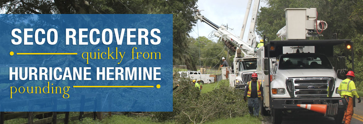
SECO Recovers Quickly from Hurricane Hermine Pounding

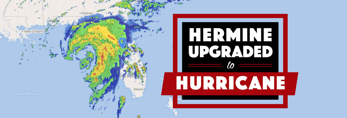
Late Thursday night and early Friday morning, Hurricane Hermine pounded SECO’s service territory with buckets of rain and high winds as it sped toward the Florida Panhandle.  In addition to the storms, WESH Channel 2 advised at least one tornado touched down in Sumter County near Webster. This event began a series of weather-related outages for SECO Energy members in the storm’s path.


At the height of the high winds and rainfall, approximately 7,500 members were without power.  As of 8 a.m. on Friday, the outages were reduced to under 3,000 members out. As of 7 p.m. on Friday,  SECO has less than 100 members without power.
SECO Energy, SECO Territory Pounded by Hurricane Hermine
Hurricane Hermine brought damage across the state, including broken trees and utility poles, flooding, roadway debris and at least one death in Marion County. Earlier today, NBC News reported that more than 250,000 consumers across the state are without power. Fortunately, most SECO Energy members weren’t affected with power outages due to an expertly designed, soundly built and well maintained system whose reliability is enhanced by an aggressive vegetation management program.


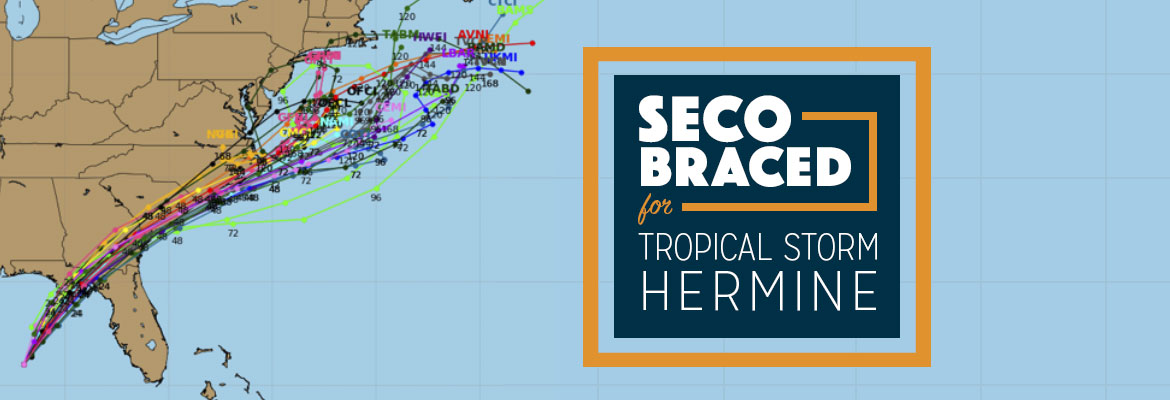
Vice President of Corporate Communications & Energy Services Kathryn Gloria stated, “SECO continually maintains, inspects and upgrades its system to provide the most reliable power possible to our members.  SECO is Storm Ready – it prepared well in advance for the possibility of Hurricane Hermine and its impact on our service area.  SECO continued to update members this week about Hurricane Hermine’s projected path and status and warned members to be prepared for outages if the storm made landfall near our area.”

SECO Energy, SECO Territory Pounded by Hurricane Hermine, power line pole being replace after major damage.


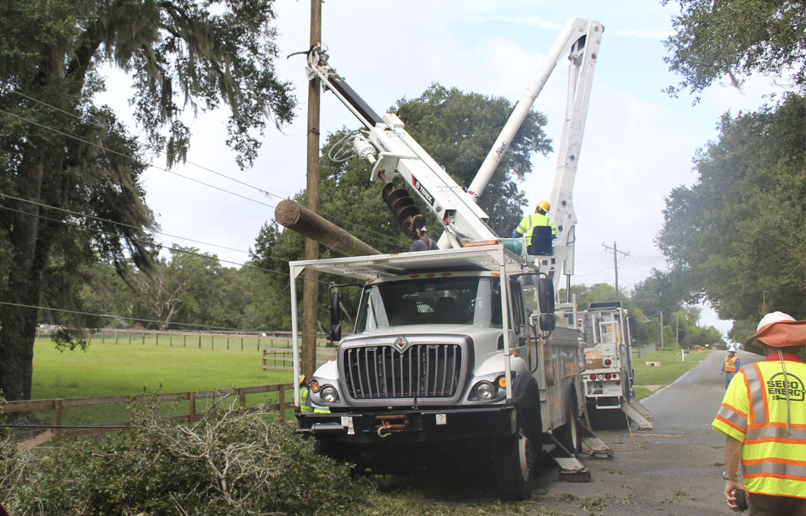
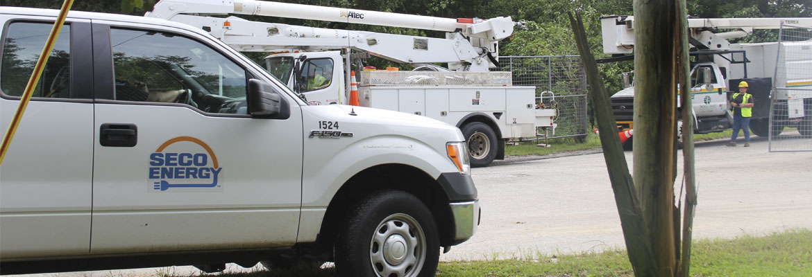
Part of SECO’s strategy included pairing a tree trimming crew with a line crew during restoration. As of 7 p.m. on Friday, there were less than 100 SECO members whose service has yet to be restored.  SECO is continuing its emergency restoration plan until every member on the system is restored. SECO predicts the remainder of members’ service will be restored before midnight Friday – unless additional storms on the tail of Hurricane Hermine come into play.


As a not-for-profit electric cooperative, SECO is dedicated to being its members’ first source for storm information. “Like” SECO’s Facebook page and “follow” the company on Twitter for the latest news releases and cooperative updates.

Hermine Upgraded to Hurricane

On Thursday afternoon, the National Hurricane Center upgraded Tropical Storm Hermine to a Category 1 hurricane. Maximum sustained winds have increased to 75 mph. Currently, the hurricane is 115 miles south-southwest of Apalachicola and is moving north-northeast at 14 mph. Locally, tornado warnings have been issued for several counties in SECO’s service area.


SECO Energy is Storm Ready and is braced for Hermine’s impact on its service area. Members should expect 4-8 inches of rain during the event with isolated higher totals. Strong winds will occur on Friday and will have more of an impact on SECO’s service territory than before Hermine makes landfall. Tornadoes remain a concern until Hermine passes away from the state on Friday.


SECO has enacted its emergency restoration plan in preparation for Hurricane Hermine’s effects. Bucket trucks and line work cannot withstand winds in excess of 35 mph. Once winds subside, SECO’s Operations crews and additional contractor and tree trimming crews will work together to restore power quickly and safely. Additional reinforcements are on standby.


The company’s emergency restoration plan determines the system’s restoration priority of each affected feeder. Essential services such as shelters, hospitals, fire/law enforcement facilities, schools, and government agencies are the highest priority. Line repairs that will restore power to large groups of members are next, and then individual electric services in less populated areas. SECO urges members to continue tracking Hurricane Hermine and prepare to wait out the storm as it passes through Central Florida.


Use these practical suggestions:

  • If using a landline, have a non-electric phone for emergencies.
  • Invest in and charge a battery-operated cell phone charger.
  • Buy a battery-powered radio and a supply of fresh batteries.
  • Keep flashlights and extra batteries handy.
  • Dig out your first aid kit and refill prescription medications.
  • Stock a three-day supply of bottled water.
  • Fill bathtubs with water to flush toilets.
  • Purchase canned or packaged nonperishable food.
  • Buy an old-fashioned crank can opener.
  • Review your homeowners and flood insurance policies.


If neighbors have power but you do not, check your panel for tripped breakers, as this is common. If the breakers aren’t tripped, report the outage using your smartphone or tablet through the SECO Storm Center – or call us.


As a not-for-profit electric cooperative, SECO is dedicated to being its members’ first source for storm information. “Like” SECO’s Facebook page and “follow” the company on Twitter to stay updated.

SECO Braced for Tropical Storm Hermine

On Thursday morning, Tropical Storm Hermine turned northeast and is moving at 12 mph. Hermine’s maximum sustained winds are 60 mph with higher gusts, and tropical-storm-force winds extend up to 140 miles east of the center. Current models show the track to our west. Hermine is forecast to hit the Florida coast as a hurricane tonight or early Friday morning between Apalachicola and Cross City. Once inland, Hermine should diminish in intensity and track across northwest Florida into southeast Georgia by Friday morning.


SECO Energy is Storm Ready and is braced for Hermine’s impact on its service area. Members should expect 4-8 inches of rain during the event with isolated higher totals. Strong winds will occur on Friday and will have more of an impact on SECO’s service territory than before Hermine makes landfall. Isolated tornado threats remain a concern until Hermine passes away from the state on Friday.


SECO has enacted its emergency restoration plan in preparation for Hermine’s effects. Bucket trucks and line work cannot withstand winds in excess of 35 mph. Once winds subside, SECO’s Operations crews and additional contractor and tree trimming crews will work together to restore power quickly and safely. Additional reinforcements are on standby.


The company’s emergency restoration plan determines the system’s restoration priority of each affected feeder. Essential services such as shelters, hospitals, fire/law enforcement facilities, schools, and government agencies are the highest priority. Line repairs that will restore power to large groups of members are next, and then individual electric services in less populated areas. SECO urges members to continue tracking Hermine and prepare to wait out the storm as it passes through Central Florida.


Use these practical suggestions:

  • If using a landline, have a non-electric phone for emergencies.
  • Invest in and charge a battery-operated cell phone charger.
  • Buy a battery-powered radio and a supply of fresh batteries.
  • Keep flashlights and extra batteries handy.
  • Dig out your first aid kit and refill prescription medications.
  • Stock a three-day supply of bottled water.
  • Fill bathtubs with water to flush toilets.
  • Purchase canned or packaged nonperishable food.
  • Buy an old-fashioned crank can opener.
  • Review your homeowners and flood insurance policies.


If neighbors have power but you do not, check your panel for tripped breakers, as this is common. If the breakers aren’t tripped, report the outage using your smartphone or tablet through the SECO Storm Center – or call us.


As a not-for-profit electric cooperative, SECO is dedicated to being its members’ first source for storm information. “Like” SECO’s Facebook page and “follow” the company on Twitter to stay updated.