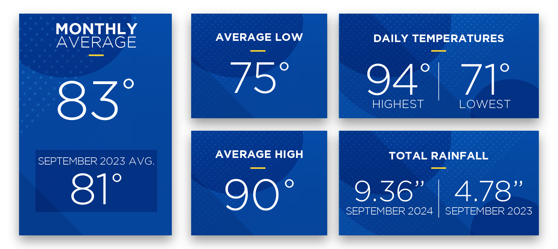
SECO News September 2025

Always Storm-Ready, Here for You
DEAR MEMBERS,
As we find ourselves in September, we enter the peak of hurricane season, which officially lasts until November 30. While we have been fortunate so far and have avoided the brunt of severe weather, we know from experience that circumstances can shift rapidly. That’s why it’s crucial to stay alert and prepare for the unexpected.
At SECO Energy, we understand that the prospect of severe storms can bring a sense of anxiety. I want to reassure you that we are here for you. Our employees are your neighbors, and we take pride in serving and protecting the communities we call home.
Preparation is key. We maintain a state of readiness all year. Readiness ensures that our crews are in place, we have a surplus of equipment on hand, and our electrical system is storm-ready to the greatest extent possible. While no utility can prevent outages during a hurricane or major storm, we are committed to restoring power as safely and efficiently as possible, following a structured restoration plan that prioritizes the most critical needs first.
If widespread damage occurs, our emergency response begins with restoring the infrastructure that powers essential services such as shelters, hospitals, schools, and emergency responders. Once we have addressed these critical areas, we turn our attention to restoring substations and main distribution lines to get power back on to the largest number of members. Following this, our crews work diligently to repair localized outages and individual services as quickly and safely as possible.
While forecasts for hurricane season can change, current trends suggest that storms may become more unpredictable, leading to sudden intensifications or unexpected shifts in path. This uncertainty underscores the importance of having a comprehensive emergency plan in place for you and your family.
Experts from Colorado State University’s Tropical Cyclones, Radar, Atmospheric Modeling, and Software Team (TC-RAMS) forecast an above-normal Atlantic hurricane season. The latest outlook includes 16 named storms with eight expected to become hurricanes — three of which may strengthen to Category 3 or higher.
The National Oceanic and Atmospheric Administration (NOAA) echoes this outlook, projecting a 65% chance of an above-normal season with 17 to 25 named storms. While increased wind shear in the Caribbean could reduce some activity, warm Atlantic waters and neutral El Niño/La Niña conditions are fueling the potential for more intense storms.
For helpful resources, including preparation checklists, safety tips, and post-storm guidance, please download our Hurricane Handbook at SECOEnergy.com > Safety > Hurricane Handbook or you can pick up a printed copy at any of our five Member Service Centers. And if you’ve had any changes to your contact information, please reach out to us. Staying connected with you during this hurricane season is our priority.
Thank you for being a valued member of our community. Together, we can weather any storm that comes our way.
Sincerely,


CURTIS WYNN
Chief Executive Officer
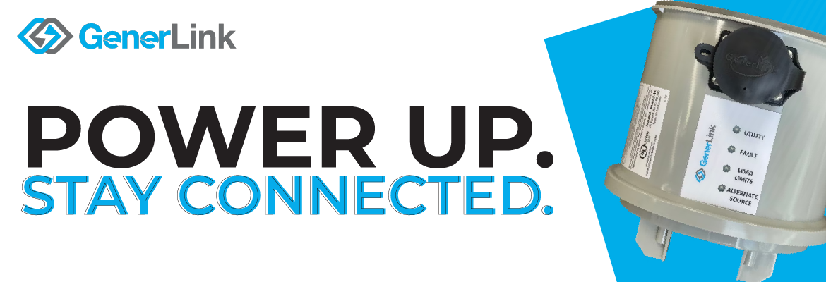
As hurricane season peaks in September, the threat of severe storms and power outages increases for Central Florida residents. At SECO Energy, we are committed to helping you stay safe, comfortable, and connected during weather emergencies. That’s why we’re excited to offer GenerLink™ — a UL-listed transfer switch available for $1,200 plus tax, including professional installation by a SECO Energy-certified technician.
GenerLink™ allows you to safely connect a portable generator to your home during a power outage — no rewiring, no hassle.
WHY CHOOSE GENERLINK?
- Safe & Reliable – Helps prevent dangerous backfeed, protecting utility crews and your home.
- Hassle-Free – No internal rewiring needed. Simply plug in your generator and go.
- SECO-Certified Professional Installation Only – Installed behind the meter by a qualified SECO Energy certified technician.
- Built to Last – Backed by a 7-year product warranty and a 15-year surge protection warranty.
*Installation is typically completed within two to four weeks of payment. No appointment or homeowner presence is required—just ensure clear access to the meter at your location.
Important Notice: SECO Meters and Unauthorized Equipment
GenerLink™ is the only generator transfer switch approved by SECO Energy for installation behind the meter. Only SECO-certified technicians are authorized to perform this installation.
No other product – including unapproved versions of GenerLink or similar devices – may be installed on or around SECO’s meter. Unauthorized equipment that attempts to replace or interfere with SECO’s metering system is strictly prohibited and poses serious safety and liability risk.
Order Today – Beat the Storm Rush
Don’t wait until the next storm is on the radar. Order now to avoid delays during peak storm season.
Generator Safety Starts with You
- Never plug a generator directly into a wall outlet. This can cause the electricity to backfeed, endangering lineworkers and damaging your home’s electrical system.
- Always operate generators outside, far from doors, windows and vents, to prevent carbon monoxide poisoning.
- Let your generators cool before refueling, and store fuel only in approved containers.
Visit SECOEnergy.com > Safety > Generator Tips for more generator safety information.
Severe weather can cause widespread damage, including fallen trees and downed power lines. When this happens, knowing how to stay safe and where to turn for local resources is essential.
One of the most serious storm-related hazards is a downed power line. High winds or falling debris can bring lines to the ground. Even if they appear harmless, always assume the line is energized – it can pose a serious and potentially fatal risk.
HERE’S WHAT TO DO IF YOU SEE A DOWNED LINE:
- Stay back — Keep at least 30 feet away and always assume the line is energized.
- Warn others — Make sure children, pets, and neighbors stay clear.
- Report it — Contact SECO Energy at (352) 793-3801 or call 911.
- Never drive over it — A downed line can energize your vehicle or the surrounding ground.
- Avoid touching anything near the line — Items like fences, puddles, tree limbs, and even wet grass may conduct electricity.
KNOW YOUR COUNTY’S EMERGENCY OPERATIONS CENTER
Each Florida county has its own Emergency Operations Center (EOC), which activates during major weather events. Your EOC coordinates local emergency response efforts, including:
- Shelter openings
- Evacuation routes
- Road closures
- Disaster recovery resources
Question From Member:
If my account is marked as medically necessary, does that make me a priority for power restoration during outages, and will I be exempt from paying my electric bill?
You Asked, We Answer:
We understand how vital electricity is for members who depend on life-sustaining medical equipment. Marking your account as “medically necessary” alerts our team to your specific needs during outages, helping us respond with care.
However, this designation does not guarantee priority restoration. In widespread outage events – particularly during hurricanes or any other natural disaster – SECO Energy follows a structured restoration plan. Our first priority is restoring power to essential services like hospitals, emergency shelters, and Emergency Operations Centers.
It’s also important to note that having a medically necessary designation does not exempt members from paying their electric bills.
We strongly encourage members who require electricity for medically necessary equipment to plan ahead for extended outages by securing a backup power source, such as a generator, or arranging for temporary relocation if necessary.
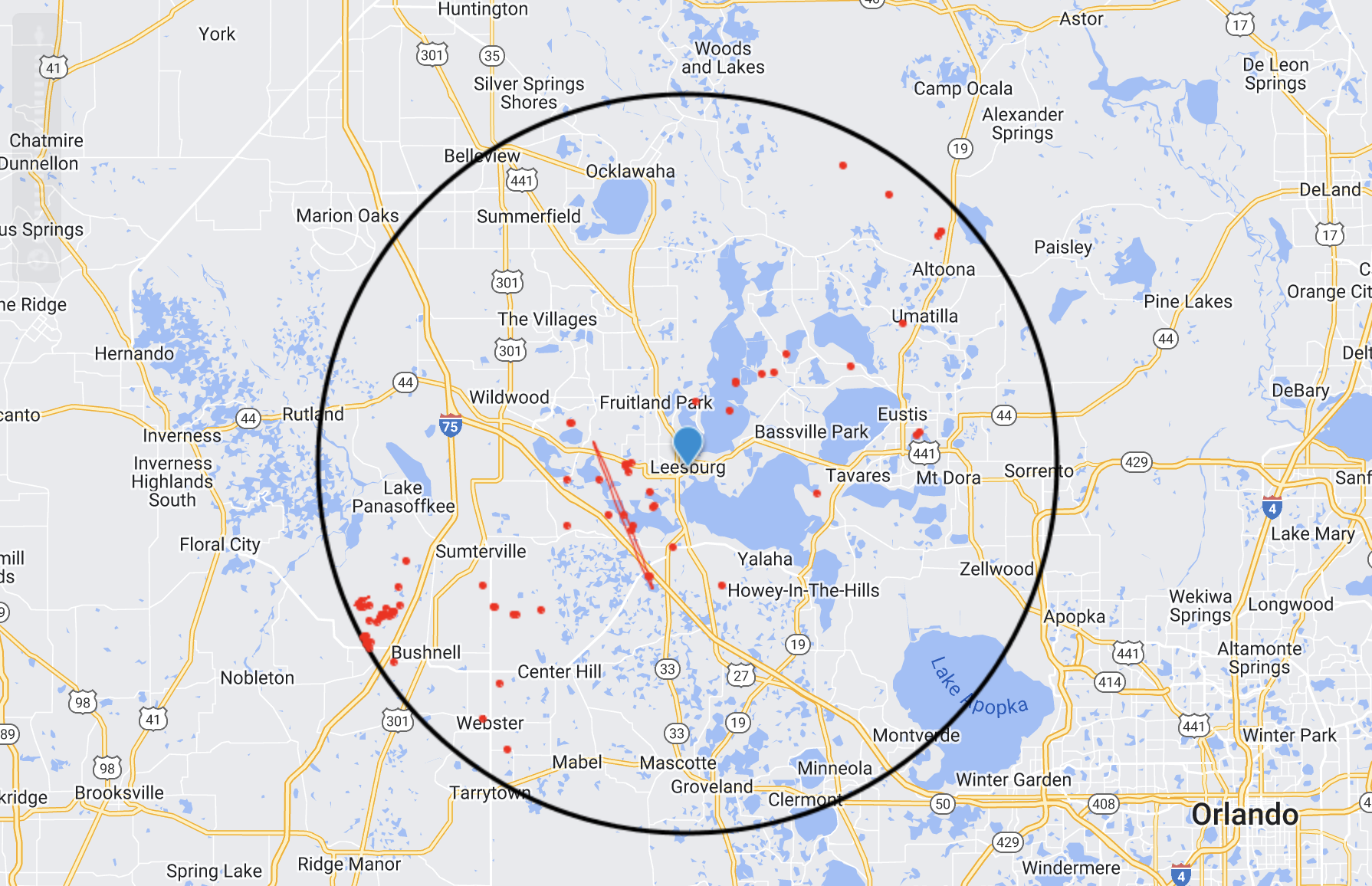
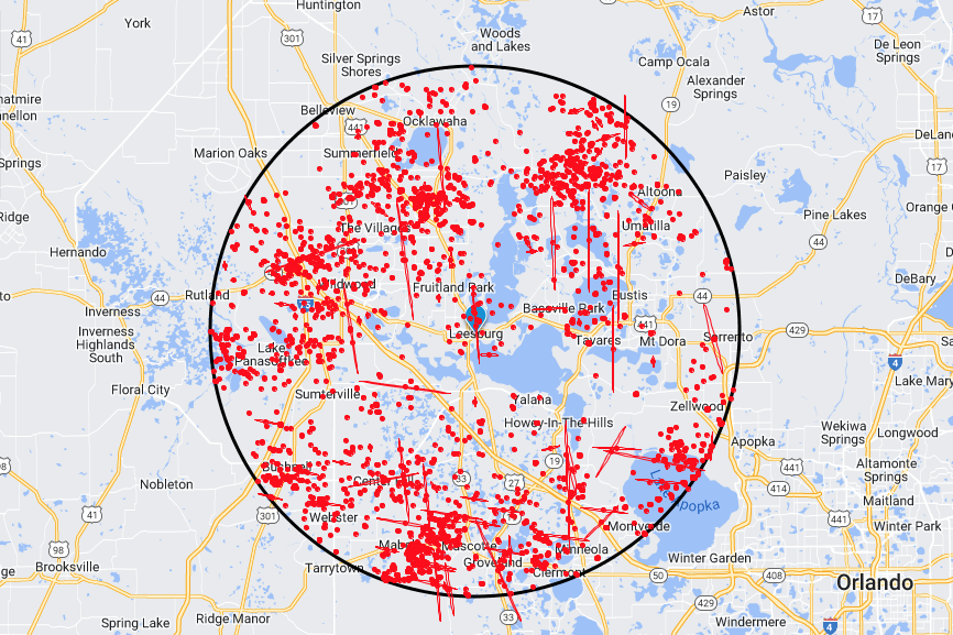
Whether you’re reporting an outage, checking the status of an existing outage, or reporting a malfunctioning street or area light, SECO’s StormCenter is your go-to resource for staying informed during outages. With StormCenter, you can enroll to receive outage and restoration alerts via email, text, voice, or a combination that works best for you. Setup is quick and easy, and it only takes a minute to get started!
HERE’S HOW TO ENROLL:
- Visit SECOEnergy.com/StormCenter from your desktop, tablet, or mobile device.
- Select “Manage Notifications” to customize how you’ll receive alerts.
- Verify or update your contact information to ensure you stay connected.
Take a moment today to enroll, update any contact information, and personalize your alert preferences so SECO can send you timely updates when it matters most. While you’re there, don’t forget to bookmark StormCenter on your device for quick access. You can also explore the interactive outage map for real-time updates and use LightFinder to report street or area light issues within SECO’s service area.
Read the full September SECO News