StormCenter logo

Archive

December 2024 Sunshine State Stats

Although winter officially arrived on December 21, the month ended warmer than it started, while dry conditions continued in Central Florida. The average temperature in December was 62 degrees, 2 degrees below the normal average, and 9 degrees lower than the November average. The average high for the month was 72 degrees, 2 degrees lower than the average high in December. Likewise, the average low temperature dropped to 52 degrees, also 2 degrees lower than the average low in December. 


The month’s highest temperature reached 83 degrees on December 17th, and the lowest temperature, 36 degrees, was recorded on December 4th. 


The December 2024 rainfall totaled 1.66 inches, .99 inch less than the typical December total of 2.65 inches, and well below the 4.31 inches that one year ago. Measurable rainfall occurred on 5 days, with only two days experiencing more than .02 inch of rain. The U.S. Drought Monitor labels the entire SECO Energy service area as “Abnormally Dry.” However, parts of Marion and Citrus Counties and all of Levy County are drier and qualify as “Moderate Drought” areas as of December 25, 2024.


The U.S. Drought Monitor is jointly produced by the National Drought Mitigation Center at the University of Nebraska-Lincoln, the United States Department of Agriculture, and the National Oceanic and Atmospheric Administration. Map courtesy of NDMC. 


Thunderstorm activity within a 20-mile radius of Leesburg International Airport occurred just two days. On December 11, WeatherSentry recorded 34 cloud-to-ground strikes, while a fast-moving front on December 29 generated 59 strikes. The images below indicate the location of strikes as recorded within the 20-mile radius of Leesburg International Airport (KLEE). 


Lightning Archive Report – 20-mile radius from Leesburg International Airport (KLEE)
Data and charts provided by weathersentry.dtn.com
 

Cloud to Ground Lightning – December 11, 2024

Cloud to Ground Lightning – December 29, 2024


January forecast from The Old Farmer’s Almanac:

The Old Farmer’s Almanac weather outlook for January 2025 predicts a week of sunny and warm conditions with scattered showers to start the year, followed by a solid week of sunny and warm conditions. A mid-month change to rain mixed with sun and cooling temperatures foretells a very cold final six days of the month. Bundle up! 


The estimated average temperature for January is 61 degrees, and the expected rainfall is 2 inches, which is .5 inch below the average for the month. 


SECO Smart Connect Program: A New Way to Save on Your Electric Bill

Review our new SECO Smart Connect Program – this is an opportunity for members to receive bill credits for allowing SECO Energy to make brief changes to the settings on residential devices during times of peak energy demand. By enrolling approved smart device(s), members can help limit the impact on the electric grid when the most energy is being used. Residential members who enroll in the SECO Smart Connect Program will receive enrollment and seasonal incentives via bill credits based on the type of device(s) enrolled. Learn more and enroll here.


Protect Your Appliances

Power surges are sudden, powerful increases in voltage that can damage or destroy household appliances and electronics. SECO Energy’s Surge Mitigator™ program offers a meter-based surge arrester designed to protect large appliances, such as motors and compressors, by reducing surges at the meter before they enter your home. Members can lease or purchase the Surge MitiGator surge protection program by completing a contact form.

November 2024 Sunshine State Stats

In November 2024, the monthly average temperature fell by 4 degrees from October, while the total rainfall plummeted to just .6 inches. This was well below the normal precipitation level of 2.53 inches in November and 5.27 inches less than what fell in October. 


The average temperature in November was 71 degrees, 2 degrees below the normal average. The average high for the month was 80 degrees, 4 degrees less than the average high in October. Likewise, the average low temperature dropped to 61 degrees, 6 degrees lower than in October. 


The month’s high temperature was 87 degrees on November 3rd and 12th, and the lowest temperature, 42 degrees, was recorded on the final day of November. 


Measurable rainfall occurred on 7 days, with only two days experiencing more than one-tenth inch of rain. SECO Energy serves three counties that are listed as “Abnormally Dry” by the National Integrated Drought Information System as of November 28, 2024.


All of Levy County and parts of Marion and Citrus Counties are in an “Abnormally Dry” status.

Map source: plantmaps.com


Thunderstorm activity was minimal in November. Only six cloud-to-ground lightning strikes were recorded by WeatherSentry within the 20-mile radius of Leesburg International Airport (KLEE); all occurred on the 6th.


December Forecast from The Old Farmer’s Almanac:

The Old Farmer’s Almanac weather outlook for December 2024 predicts the first week will be sunny and warm, followed by two days of cooler temperatures and showers. From December 10 to 14, sunshine returns, accompanied by cool temperatures. This will be followed by an eight-day period of isolated showers and warmer conditions. The final week, including Christmas and New Year’s Eve, is forecast to be sunny and cold. 


The estimated average temperature for December is 64 degrees, and the expected rainfall is 1.5 inches, which is 1 inch below the average for the month.


SECO Smart Connect Program: A New Way to Save on Your Electric Bill

Review our new SECO Smart Connect Program – this is an opportunity for members to receive bill credits for allowing SECO Energy to make brief changes to the settings on residential devices during times of peak energy demand. By enrolling approved smart device(s), members can help limit the impact on the electric grid when the most energy is being used. Residential members who enroll in the SECO Smart Connect Program will receive enrollment and seasonal incentives via bill credits based on the type of device(s) enrolled. Learn more and enroll here.


Protect Your Appliances

Power surges are sudden, powerful increases in voltage that can damage or destroy household appliances and electronics. SECO Energy’s Surge Mitigator™ program offers a meter-based surge arrester designed to protect large appliances, such as motors and compressors, by reducing surges at the meter before they enter your home. Members can lease or purchase the Surge MitiGator surge protection program by completing a contact form.

SECO Energy’s Pennies Program Donates $12,305 to Local Animal Shelters – Marion County

SECO Energy’s Pennies from Heaven program has donated $12,305 to local animal shelters and rescues. In February, the not-for-profit electric cooperative announced that for every new Surge MitiGator meter-based surge protection lease enrollment or purchase, members could choose a shelter or rescue to receive a $5 donation on their behalf.
 

Between February 1 to June 15, 2,461 members enrolled in SECO’s Surge MitiGator surge protection product that resulted in a total donation of $12,305 in Citrus, Lake, Marion and Sumter Counties. The total allocated in Marion County is $4,100 donated to the shelters listed below:


Endangered Animal Rescue Sanctuary – $200
Forest Animal Rescue – $200
Front Range Equine Rescue – $200
Fur Kids Pet Rescue Inc. – $200
Humane Society of Marion County – $1,000
Kindred Spirits Sanctuary – $200
Marion County Animal Services – $500
Ocala Wildlife Sanctuary Inc. (Owls Ocala Inc.) – $200
Pets in Distress Inc. – $200
Quality of Life Rehab and Foster – $200
Sheltering Hands – $200
SPCA of Marion County – $200
SPCA of Ocala – $200
Vocal (Voices of Change Animal League) – $200
Forest Animal Rescue – $200
Beauty’s Haven Farm and Equine Rescue Inc. (Levy County) – $200


Eddie Leedy, the Executive Director of the Humane Society of Marion County stated, “The Humane Society of Marion County values and cherishes our donors and business partners. Their support allows us to help thousands of animals each year. SECO Energy’s generous donation is so appreciated in these difficult times for non-profits.”


CEO Jim Duncan is pleased to help local shelters and rescues. Duncan stated, “Thank you, members, for making our Surgeo Loves Pets charitable initiative a success. I am grateful for members who recognize a need in their community and respond generously. Though the vast majority of Pennies funding is allocated for bill payment assistance and educational initiatives for our members, the animals in our local communities need assistance as well, and SECO is happy that the Pennies from Heaven donations will be put to good use.”


SECO Energy’s Surge MitiGator product helps to reduce damaging surges and voltage spikes at the meter. Visit our Surge MitiGator page to learn more about the product, to read its beastly 15-year warranty and to complete the web form to enroll.


“Like” SECO’s Facebook page and “follow” @SECOEnergy on Twitter for news releases and cooperative updates.

SECO Energy Employees Pledge Donations of $70,000 for United Way

SECO Energy employees have participated in an annual employee-funded United Way Pledge Drive for local communities for decades. During the 2020 United Way Pledge Drive, SECO employees donated $70,316 that will benefit local families living in SECO’s service area.


The $70,316 pledged by SECO employees for the 2020 drive is an increase of seven percent from the 2019 pledges. The donated funds will be distributed among ten local counties. The bulk of SECO employees live in Citrus, Lake, Marion and Sumter Counties and received the highest dollar amounts in donations. The breakdown by county is:


Citrus: $7,799
Lake: $14,316
Marion: $23,002
Sumter: $21,559
Other Counties (Hernando, Levy, Orange, Pasco, Polk and Volusia): $3,640


CEO Jim Duncan stated, “SECO’s ever-generous employees and their commitment to the communities we serve made our 2020 United Way Pledge Drive extremely successful. Our employees understand that local families need financial support year-round, and United Way is instrumental in leading the charge to improve lives. I truly appreciate the efforts of our employees and applaud their generosity.”


SECO’s Senior Consultant for Civic, Charitable & Government Relations Kathy Judkins spearheads the annual employee giving campaign. She stated, “United Way’s mission is to improve lives by mobilizing the caring power of communities around the world to advance the common good.” To join SECO Energy employees in supporting United Way, visit them online to donate or volunteer.


Learn more about SECO Energy’s Concern for Community online. “Like” SECO’s Facebook page and “follow” @SECOEnergy on Twitter for news releases and cooperative updates.

SECO News, September 2019

SECO News Duncan's Digest 2019


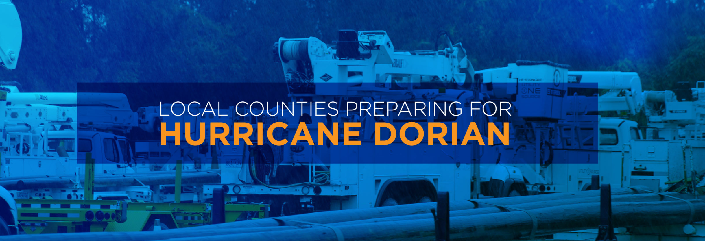
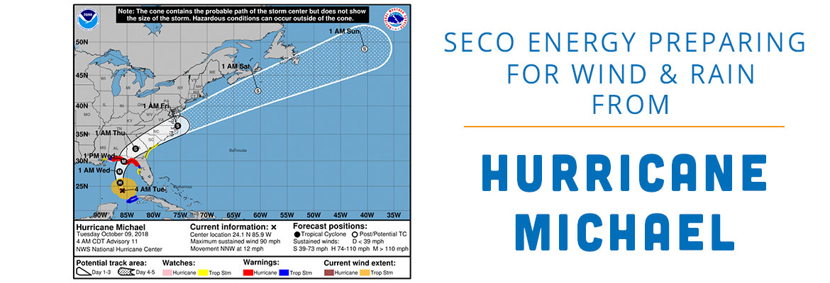
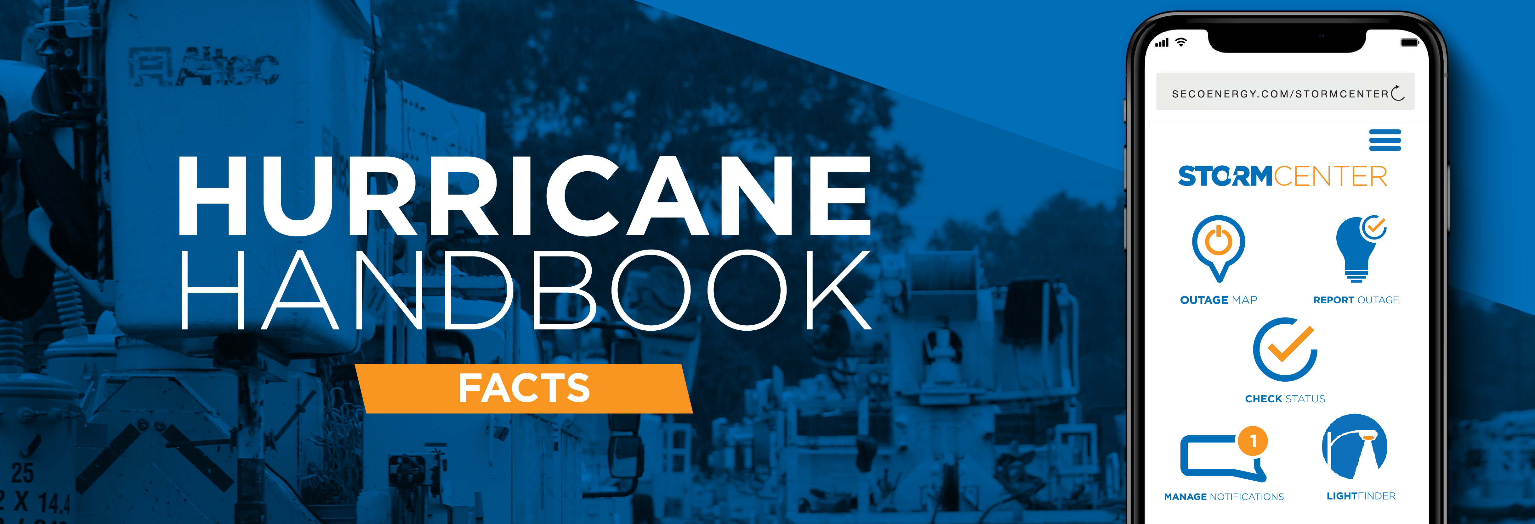
Welcome to our new Hurricane Handbook. Named storms can cause extended outages even for a system like SECO’s that is well built, constructed and maintained. To prepare for the worst, review our people/pets preparation checklists, outage notification enrollment instructions, Florida Special Needs Registry details, restoration priorities, damage assessment warnings and lessons on hunkering down. Learn about generator safety by to watch our newest video. For the chance to win an 8,000 watt Briggs Stratton portable generator, click on the website’s home page banner to register at SmartHub (SECO’s online account platform) by October 15. All members with SmartHub accounts as of October 15 will be entered in the drawing.


Sincerely,


Jim Duncan

Chief Executive Officer

SECO News September 2019 Hurricane Handbook

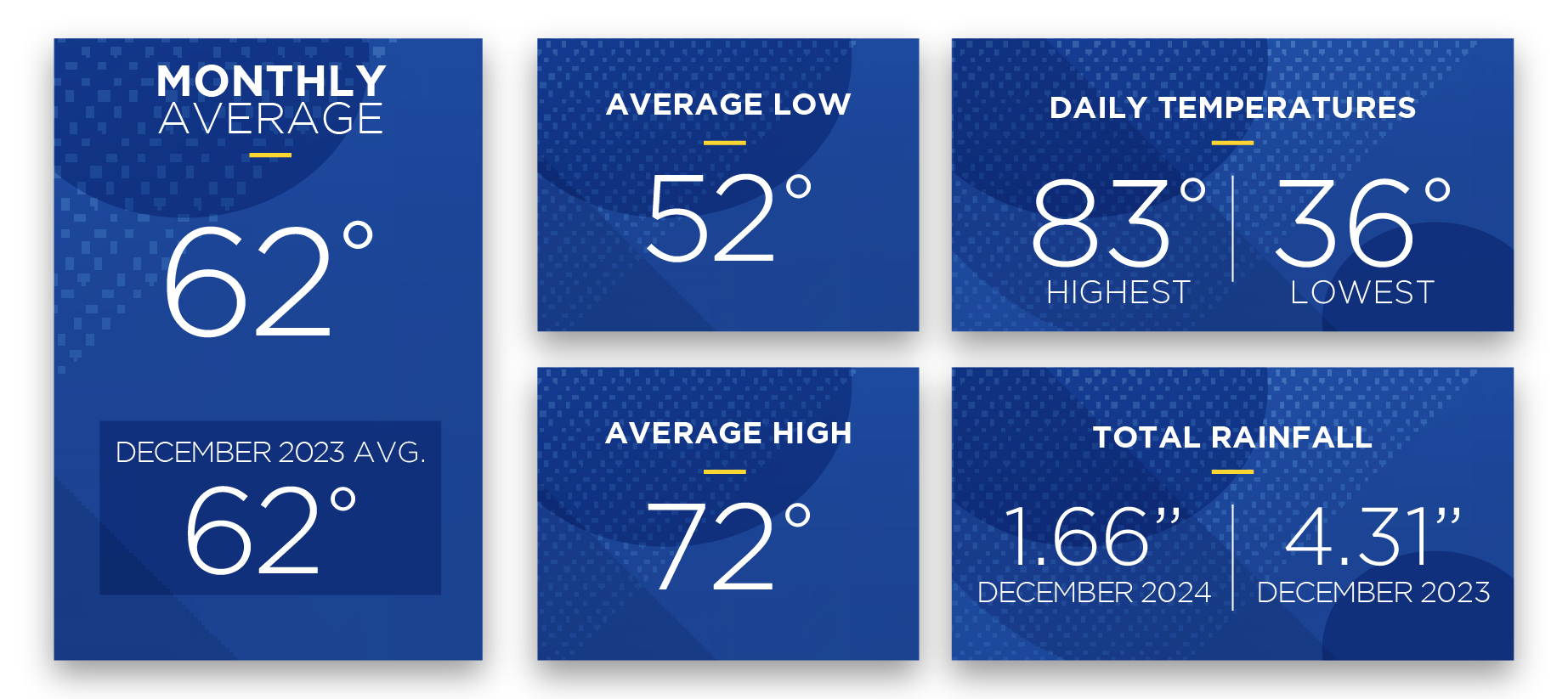
HURRICANE STRENGTH STATS


The Saffir–Simpson wind scale classifies hurricanes that exceed the intensities of tropical depressions and tropical storms into five categories distinguished by the intensities of sustained winds.


CAT 1 74 to 95 mph
CAT 2 96 to 110 mph
CAT 3 111 to 129 mph (major)
CAT 4 130 to 156 mph (major)
CAT 5 157 mph or higher (major)


Even tropical storms can cause significant damage and flooding. Most storm casualties are from drowning and not wind. Always heed weather warnings, evacuate as instructed and don’t drive into high water. Keep your family safe.


DISCONNECTING IN ADVANCE: MYTH OR FACT


Many years ago, it was a common practice for utilities to completely de-energize their electric systems ahead of a storm in an effort to proactively prevent damage during the storm. SECO Energy does not employ this practice.


RESTORATION PRIORITY – WHO’S FIRST?


SECO Energy provides world-class reliability to 200,000+ homes and businesses. Outages due to weather, vehicle accidents, equipment issues, animal or tree contact with lines result in utilities being unable to guarantee 100 percent uninterrupted electric service.


During emergency restoration with widespread damage, SECO Energy’s first responsibilities are shelters, hospitals, schools and government agencies like emergency ops centers, fire stations and law enforcement facilities. SECO’s next priority is large commercial accounts providing food, water and damage-recovery supplies. Feeders with the largest number of members served are next. Our goal is to restore service to the highest volume of members as quickly as possible.


SECO News September 2019 Before a Storm

FLORIDA’S SPECIAL NEEDS REGISTRY


Register with the Florida Division of Emergency Management at floridadisaster.org before a storm hits to receive county specific lifesaving information. If an evacuation or emergency is declared, you will receive important options from local emergency management by signing up with your county’s emergency alert notifications (Alert Citrus, Alert Hernando, Alert Marion, Alert Levy, Alert Lake, Alert Sumter, Alert Pasco). Visit your county’s Emergency Operations online to sign up for the alerts you would like to receive.


MEMBERS USING MEDICAL EQUIPMENT


Residential members’ accounts coded as having medically necessary service are not the first priority after a storm with widespread damage. These members should prepare before storm season and anticipate the possibility of extended outages that could last for days. If you are dependent on electric-powered medical equipment, register with your county emergency management center’s Special Needs Registry. Most important, purchase a generator for use during power outages.


OUTAGE NOTIFICATION PREFERENCES


Visit us online and click StormCenter at the top right. Scroll down and select “Manage Notifications.” Log in with your account number or phone number. View and update your preferences for email, text or voice notifications. Set do not disturb parameters.


ADD STORMCENTER APP TO MOBILE DEVICE HOME SCREEN


On our website, click StormCenter. Select the Outage Map tile. Tap the Share Arrow. Select “Add to Home Screen” from options.


BOOKMARK DAILY RESTORATION PLAN MAP


SECO utilizes this interactive map when the Emergency Response Plan is activated. This map is different from the StormCenter outage map. The Restoration Plan Map displays the areas where crews are working each day and helps you know when you can reasonably expect service restoration. Access this map from the website home page banner during emergencies.


SUPPLY STOCK UP – SEVEN DAYS


September 2019 SECO News Supply Stock Up - Seven Days


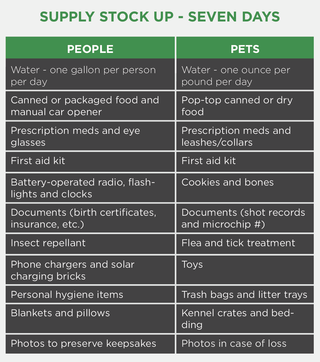
Turn your refrigerator and freezer to the coldest settings. Only open refrigerator and freezer doors when necessary. Move freezable foods into the freezer. A refrigerator will keep food cold for about four hours after a power outage; a full freezer will keep food frozen for about 48 hours. Move your emergency supplies into a secure room with no windows or fireplaces.


SECO News September 2019 During a Storm

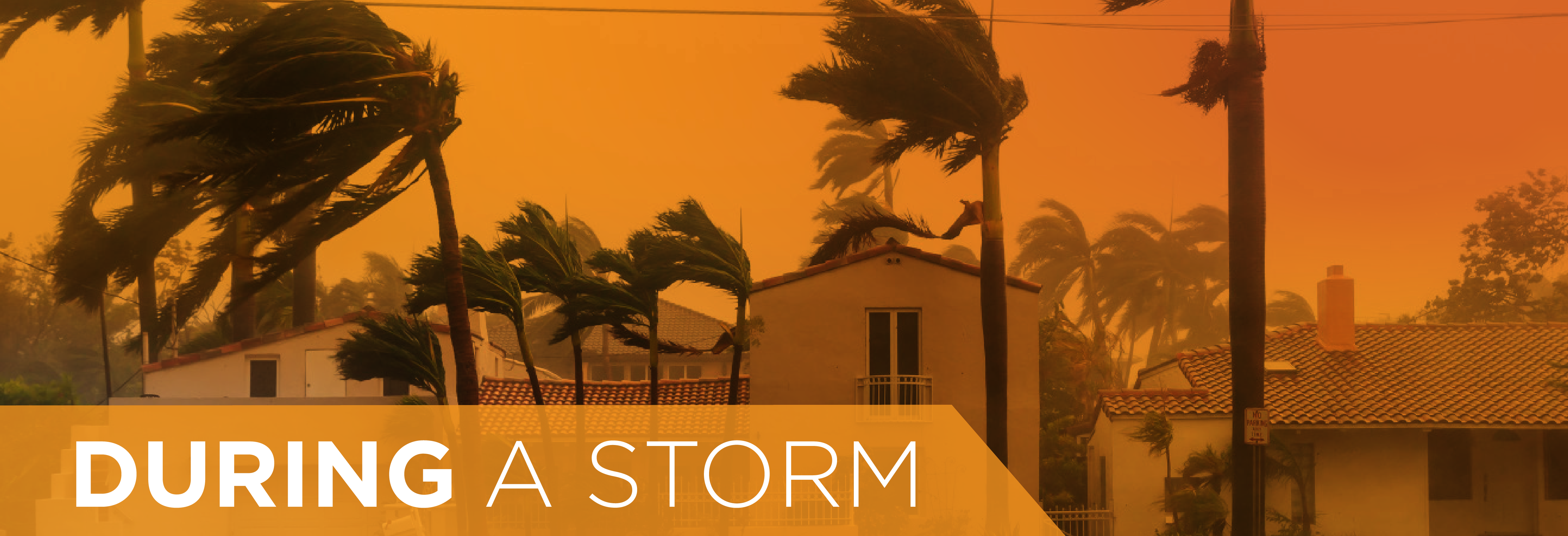
HUNKER DOWN – STAY INFORMED


During the storm, remain indoors and prepare to wait out the weather safely. Stay informed with a battery-powered weather radio. Be ready to re-locate your family and pets to a secure location in your home with no windows or fireplaces. Break out the family board games and preserve your phone’s battery power.


NO RESTORATION IN WINDS ABOVE 35 MPH

SECO Energy invests heavily in an aggressive vegetation management program to keep our overhead lines clear. Still, severe storms with high winds create tree-related outages. Once sustained wind speeds reach 35 mph, it is not safe to use bucket trucks or perform restoration. When wind speeds have fallen below 35 mph, SECO deploys employees and mutual aid to begin restoration efforts.


TORNADOES – WATCH VS WARNING

Tornadoes are vertical funnels of rapidly spinning air often referred to as nature’s most violent storm. Winds can reach speeds of 300 mph. Tornadoes are commonly associated with severe thunderstorms. It is extremely likely that during a hurricane you may experience a tornado.


TORNADO WATCH: Tornadoes are possible in/near the watch area. Check supplies and your safe room. Be ready to act fast if a warning is issued or you suspect a tornado is approaching.


TORNADO WARNING: A tornado has been sighted or indicated by weather radar. There is imminent danger to life and property. Go immediately to your safe room, interior room or hallway. Avoid windows.


IF YOU EXPERIENCE A TORNADO, stay clear of downed power lines and damaged buildings. Treat downed lines as if they are energized.


SECO News September 2019 Electric System 101


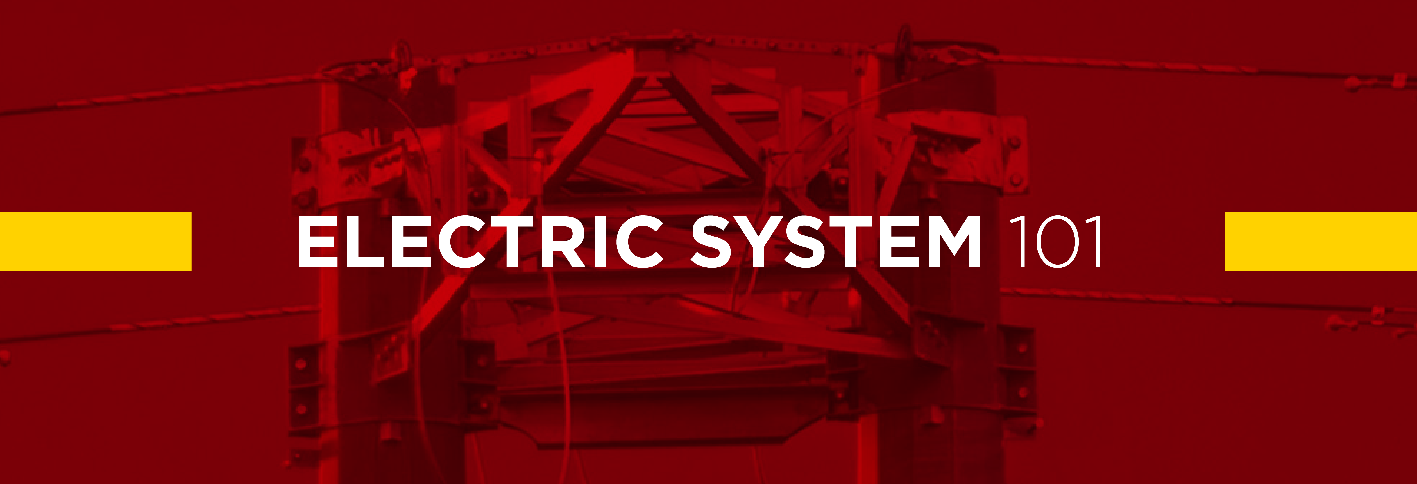
HIGH VOLTAGE TRANSMISSION LINES: These supply power to SECO’s 48 substations which serve 200,000+ homes and businesses. If a storm damages a transmission line, substations also lose power. Much of the transmission serving SECO’s substations is owned/operated by Duke Energy. If Duke’s lines are down, SECO Energy cannot restore power to our members until these lines are repaired.


DISTRIBUTION SUBSTATION: A substation serves thousands of members. Our line crews inspect substations to determine if problems stem from transmission lines feeding into the substation, the substation itself, or if problems exist further down the feeders and lateral lines.


FEEDER DISTRIBUTION LINES: When problems cannot be isolated at a substation, distribution lines are inspected. These larger lines originate from substations and distribute power to large groups of members in our service area.


LATERAL DISTRIBUTION LINES: These smaller lines deliver power to transformers, either mounted on poles or placed on pads for underground service and deliver power to smaller groups of members in less densely populated areas.


SERVICE LINES: The service line is the line between a transformer and your residence or business.


SECO News September 2019 Generator Safety

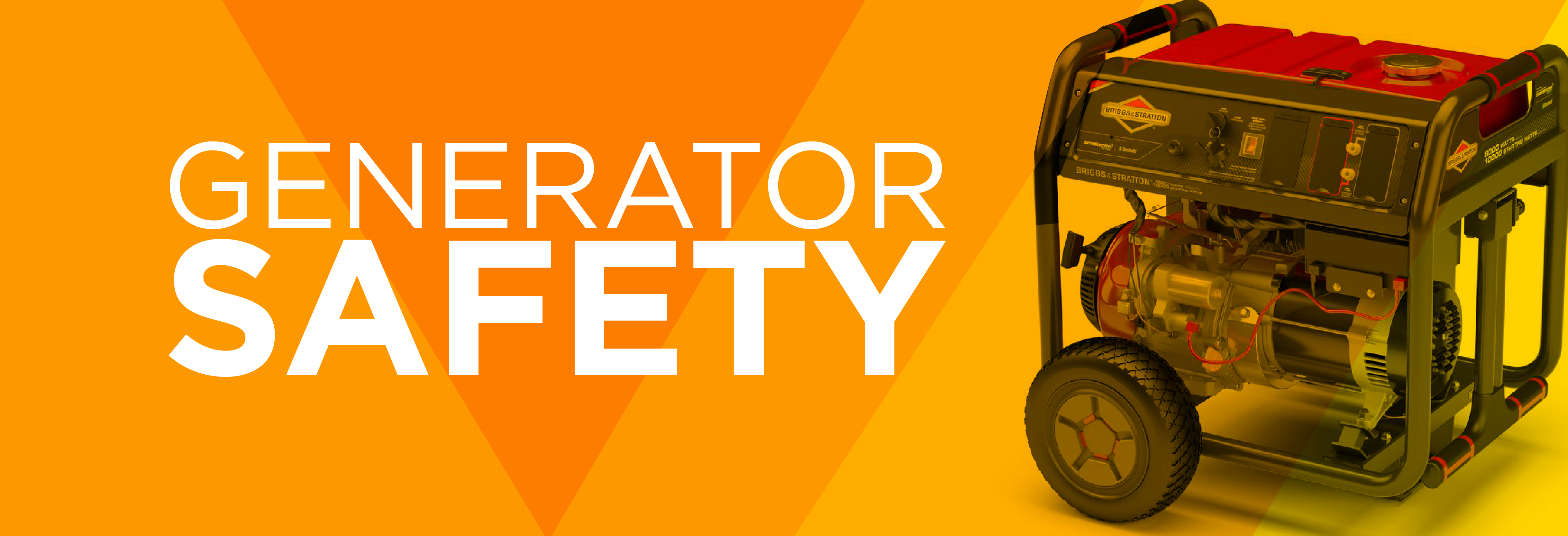
STATIONARY GENERATOR: A permanently affixed generator installed by a licensed technician with an approved disconnect and transfer switch that isolates your home’s circuits from SECO Energy and eliminates the risk of backfeeding on utility lines.


PORTABLE GENERATOR: A common type of generator that does not require a licensed technician to install. Use extension cords to plug certain appliances into the outlets on the generator. Never operate indoors.


More lifesaving information on generator safety can be found on our website. Click on the generator banner for a chance to win a new 8,000 watt Briggs Stratton portable generator. Enter by October 15.


SECO News September 2019 After a Storm
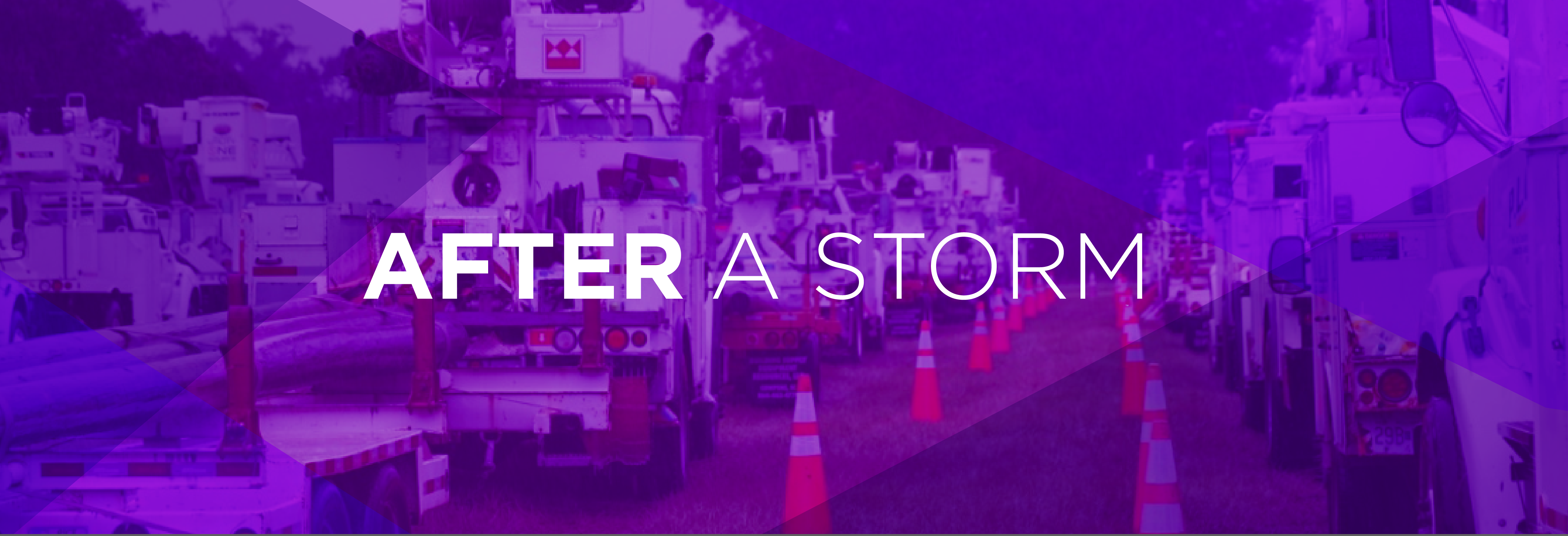
RETURNING HOME-ASSESS DAMAGE


If your home or business is damaged and it is safe, turn off your main breaker to prevent fires. If appliances are wet, turn off each appliance’s main breaker. Once you’ve turned the breaker off, unplug the wet appliance.


If fuses blow when your power is restored, turn off the breakers and contact a licensed electrician. Always call an electrician or an appliance repair service if in doubt.


DEBRIS CLEANUP


Once the storm has passed, ensure that you and your home are safe while power is being restored. Do not make piles that interfere with utility trucks. Keep piles away from power lines, transformers and downed lines for safety and speedy restoration. Call your county’s emergency operations center if public roadway debris prevents utility and emergency vehicle access.


SECO News September 2019 Move Over It's the Law


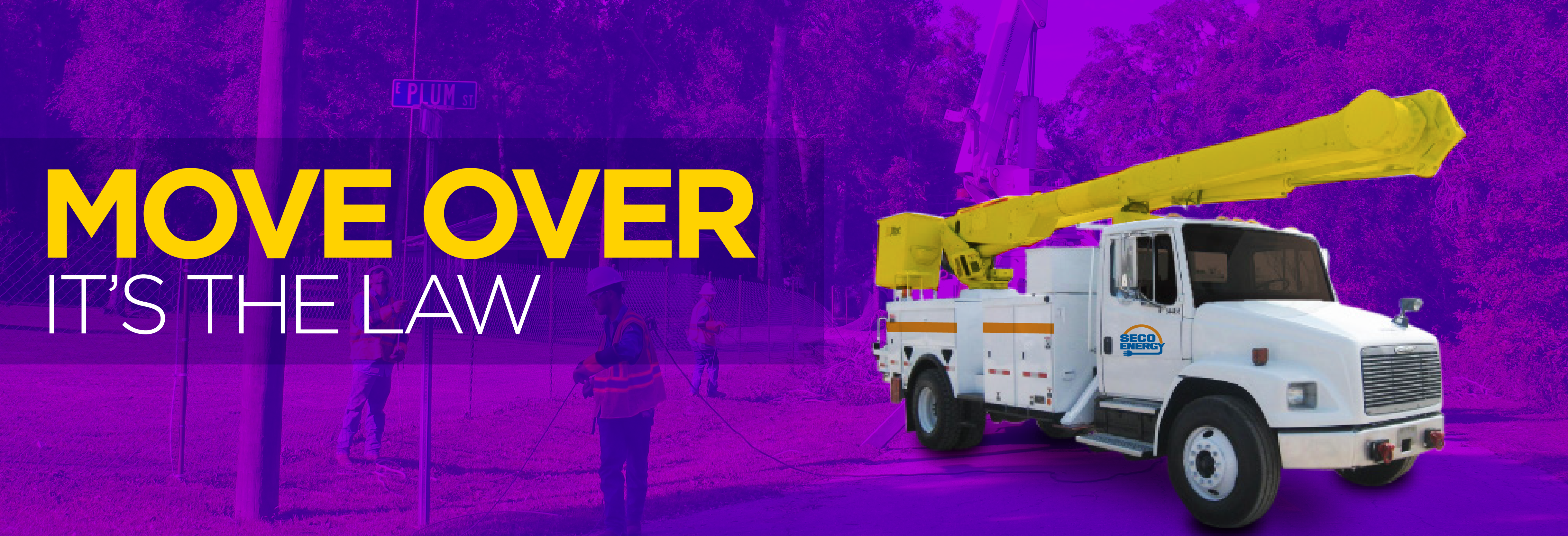
• Move over a lane for law enforcement, emergency, sanitation, utility vehicles and tow trucks.
• If you can’t move over, slow to 20 mph less than the posted speed limit.
• If the posted speed limit is 20 mph or less, slow down to 5 mph.


#MoveOverFL


Read the full September 2019 SECO News online.

Local Counties Preparing for Hurricane Dorian

Additional shelters are opening in the counties served by SECO Energy to assist residents in need of shelter during Hurricane Dorian. SECO members who require uninterrupted electricity to power medical devices are advised to wait out Hurricane Dorian at a shelter that meets their special needs. Deadly Hurricane Dorian stalled over parts of The Bahamas on Monday destroying property and is responsible for a reported five deaths.


Hurricane Dorian is spinning at about 120 mph at a forward speed of just 2 mph. Hurricane force winds extend 40 miles and tropical storm winds extend 160 miles. Dorian is expected to pick up forward motion later today and bring rain bands and sustained winds of about 25 mph to the SECO service territory. Overnight and into Wednesday, SECO Energy members east of I-75 will likely experience sustained winds of 35 mph and gusts up to 50 mph. SECO Energy is StormReady with 800 additional line and tree contractors from Rhode Island, Indiana, Alabama, Pennsylvania, Texas, New York and New Jersey.


CEO Jim Duncan stated, “Hurricane Dorian is forecast to move away from The Bahamas and move northwest with an eventual eastern turn that keeps it just off Florida’s coast. SECO Energy’s service area could begin to feel the hurricane’s effects late this afternoon. Members who live in homes or areas that are subject to flooding, suggested to evacuate, or need guaranteed power to sustain life should check in at a shelter today. If conditions deteriorate emergency personnel may be grounded and unable to help until the storm passes.”


Duncan added, “SECO Energy has been monitoring and preparing for Hurricane Dorian since early last week. The cooperative is prepared for power outages caused by Hurricane Dorian. Out-of-state crews began to arrive on Monday to assist. Please take this storm seriously and put your family’s safety first.”


Two shelters are open in Sumter County. A pet-friendly, general public shelter is available at the Sumter County Fairgrounds at 7620 SR 471, Webster. A special needs shelter is open in Wildwood at the Wildwood Community Center at 5600 Powell Road. Sumter County officials are concerned that flooding in the county will be worse than in 2017 with Hurricane Irma. Shelters are available for residents living in mobile homes, recreational vehicles and low-lying flood prone areas.


Six shelters are open in Lake County. The general public shelter is open at Mount Dora High School located at 700 N. Highland Street, Mount Dora. Two pet-friendly shelters are available at Round Lake Elementary 31333 Round Lake Road, Mount Dora and Spring Creek Elementary 44440 Spring Creek Road, Paisley. Three special needs, pet-friendly shelters are open at Leesburg Elementary 2229 South Street, Leesburg and Lost Lake Elementary 1901 Johns Lake Road, Clermont and Umatilla Elementary 401 Lake Street, Umatilla.


Marion County is opening four shelters. Two general population shelters are opening today at noon located at Fort McCoy Middle School at 16160 NE County Road 315, Ft. McCoy and North Marion Middle School at 20085 W Highway 329, Citra. A special needs only shelter is currently open at West Port High School at 3733 SW 80th Avenue, Ocala. A pet-friendly shelter at Lake Weir High School at 10351 SE Maricamp Road, Ocala opens at noon today.


Citrus, Hernando, Levy and Pasco Counties are not opening shelters at this time, but officials are closely monitoring Hurricane Dorian. Schools are closed on Tuesday (today) in Citrus, Hernando, Levy, Pasco and Sumter Counties. In Lake County, schools are closed Tuesday and Wednesday; in Marion County, schools are closed for the rest of this week.


SECO Energy’s Hurricane Handbook is available on SECOEnergy.com by clicking on the homepage banner. The Hurricane Handbook offers members tips for preparing before, during and after a storm. The cooperative has included tips on generator safety, downed power line safety, electric system 101, Florida’s Move Over Law and more.


StormCenter is SECO Energy’s outage and communications platform for members to report outages, check the status of an existing outage and enroll in outage communications and alerts via email, text, voice or all three. Visit StormCenter today at SECOEnergy.com>StormCenter and bookmark on your smartphone or tablet to report outages quickly and easily. Once the hurricane has passed SECO’s area later next week, members should use our Daily Restoration Plan Map to identify if crews are working in their area that day. Visit SECOEnergy.com and click on the homepage banner to access the map.


Stay up to date on weather affecting SECO Energy’s service area, the latest news releases and cooperative updates by “liking” SECO’s Facebook page and “follow” @SECOEnergy on Twitter.

Shelters Opening in Preparation of Hurricane Dorian

Shelters are opening in the counties served by SECO Energy that will feel the effects of Hurricane Dorian. SECO urges members who are dependent on electricity to operate life-sustaining devices to seek refuge at a shelter or have a backup source for power before Hurricane Dorian’s high winds and rain cause lengthy power outages.


In Sumter County, two pet-friendly shelters will open at 10 a.m. The Sumter County Fairgrounds at 7620 SR 471 in Webster will be available for the general population. The Wildwood Community Center at 5600 Powell Road in Wildwood is open for citizens with special needs. Sumter County officials will determine if additional shelter openings are necessary. Shelters are available for residents living in mobile homes, recreational vehicles and low-lying flood prone areas and east-coast evacuees.


Lake County is scheduled to open six shelters at noon today. The general public shelter is at Mount Dora High School located at 700 N. Highland Street in Mount Dora. Two public, pet-friendly shelters are opening at Round Lake Elementary 31333 Round Lake Road, Mount Dora and Spring Creek Elementary 44440 Spring Creek Road, Paisley. Special needs and pet-friendly shelters are opening at noon at Leesburg Elementary 2229 South Street, Leesburg and Lost Lake Elementary 1901 Johns Lake Road, Clermont and Umatilla Elementary 401 Lake Street, Umatilla.


At this time, shelters are not opening in Citrus, Hernando, Marion or Pasco Counties. Levy County is prepared to open shelters as needed. Schools are closed Tuesday in Citrus, Marion and Sumter Counties. In Lake County, schools are closed Tuesday and Wednesday.


Hurricane Dorian remains a CAT 5 storm with 165 mph sustained winds and has slowed to a 1 mph crawl. It is expected to maintain this slow speed for the next 24 hours. This pace will result in SECO Energy’s service area feeling the first effects around 2 a.m. on Wednesday morning and lasting through noon. The area will experience 25-30 mph sustained winds with 35-60 mph gusts.


CEO Jim Duncan stated, “Forecasters predict Hurricane Dorian will skirt Florida’s east coast and not make landfall in Florida. That track does not put SECO’s service area in the clear. SECO Energy is StormReady and prepared to begin what may be a lengthy restoration event. Crews from out of state begin arriving today to assist. Do not jeopardize your family’s safety – seek shelter in your county if needed.”


SECO Energy’s Hurricane Handbook is available on SECO’s homepage by clicking on the homepage banner. The Hurricane Handbook offers members tips for preparing before, during and after a storm. The cooperative has included tips on generator safety, downed power line safety, electric system 101, Florida’s Move Over Law and more.


StormCenter is SECO Energy’s outage and communications platform for members to report outages, check the status of an existing outage and enroll in outage communications and alerts via email, text, voice or all three. Visit StormCenter today at SECOEnergy.com and bookmark on your smartphone or tablet to report outages quickly and easily. Once the hurricane has passed SECO’s area later next week, members should use our Daily Restoration Plan Map to identify if crews are working in their area that day. Visit SECOEnergy.com and click on the homepage banner to access the map.


Stay up to date on weather affecting SECO Energy’s service area, the latest news releases and cooperative updates by “liking” SECO’s Facebook page and “follow” @SECOEnergy on Twitter.

SECO Energy Prepared for Hurricane Michael’s Outer Bands

SECO Energy has been closely monitoring Hurricane Michael and its outer storm bands that bring the possibility of heavy rainfall, winds and even tornado threats into Central Florida.


According to the National Hurricane Center (NHC), as of 7 a.m. CDT on Wednesday, Hurricane Michael is moving north at 12 mph and is located 90 miles southwest of Panama City in the Florida Panhandle. Michael has quickly picked up speed and intensity to become a Category 4 hurricane. Forecasters project landfall will be early this afternoon between Panama City and Pensacola.


Tropical storm force winds extend 150 miles from the hurricane’s center. The hurricane’s current position puts SECO’s service territory outside of this range. SECO’s area is forecast to have winds in the 20 mph range, but wind gusts and rain in the outer bands will impact Marion and Levy Counties.


Though wind speeds will not be hurricane or tropical storm force in SECO’s territory, strong storm bands passing through SECO’s service territory are a significant threat. Members should prepare for a rainy Wednesday and possibly Thursday. Heavy rains coupled with wind, could cause trees to fall and result in power outages. Tornadoes spawned by these winds and rains are a danger as well.


After the threat of storm bands from Hurricane Michael have passed the area, SECO plans to release contracted Pike crews to the North Florida areas damaged by the hurricane to aid in restoration. Additionally, a module of SECO employees will be sent for restoration aid after hurricane dangers have passed.


CEO Jim Duncan asks members to remain vigilant, “Hurricane Michael will not make landfall near SECO’s service territory, but members will experience rains and high wind gusts. Be alert for the possibility of tornadoes which can be extremely dangerous. My thoughts and prayers go out to the Panhandle residents in the direct path. I’m grateful that SECO is in the position to send reinforcements to damaged areas.”


SECO Energy is StormReady and is committed to keeping members informed of weather that impacts the area. Visit Storm Preparation online to view an emergency checklist and storm preparation ideas. Watch our Facebook and Twitter pages for Tropical Storm Michael updates. Most important, be sure you’ve bookmarked our new StormCenter outage map and set your email, text and voice notifications preferences. StormCenter is mobile friendly and designed to perform on smartphones and tablets.

SECO Energy Preparing for Wind and Rain from Hurricane Michael

SECO Energy is preparing for the possibility of high winds, rain and the threat of tornadoes in Central Florida from Hurricane Michael’s outer bands.


As of 7 a.m. CDT on Tuesday, Hurricane Michael has picked up speed and is moving north-northwestward through the southern Gulf of Mexico at 12 mph. Hurricane Michael is currently a Category 2 hurricane with winds speeds between 96 and 110 mph. Tropical storm force winds extend 150 miles from the hurricane’s center.


According to the National Hurricane Center (NHC), Michael is strengthening and forecasters believe the storm will continue to increase in speed and intensity before making landfall near Panama City in the Florida Panhandle Wednesday afternoon.


SECO forecasters project the strongest winds to remain outside of our service area. Marion and Levy County members will experience the brunt of the strong winds, but still well below 30 mph. The tropical storm force wind speeds should remain at least 50 miles outside of SECO’s territory.


Though wind speeds will not be hurricane force, be only slightly high, strong storm bands passing through SECO’s service territory are a significant threat. Members should prepare for large amounts of rain beginning Tuesday and lasting through Thursday, coupled with wind, could cause trees to fall and result in power outages. Additionally, the threat of tornadoes will increase on Wednesday and into Thursday. Strong storms have impacted the east coast early this morning.


Citrus County’s Emergency Operating Center (EOC) is activating as of 5 p.m. today, and they have issued an evacuation order for coastal areas and manufactured homes as of 3 p.m. today. Citrus County is opening four shelters today, and schools are closed through Wednesday. The Sumter, Lake, Marion, Levy, Hernando and Pasco EOCs are monitoring the storm closely. A coastal evacuation order is in effect in Levy and two shelters open there today.


CEO Jim Duncan assures members that SECO is prepared for inclement weather created by Hurricane Michael. Duncan stated, “SECO continues to closely monitor Hurricane Michael’s progress as it travels through the Gulf of Mexico. We are prepared for Hurricane Michael’s rain bands and winds that will reach into our service territory. SECO’s employees, contract crews and leadership team are all prepared to escalate our response if Hurricane Michael’s path shifts toward SECO’s area.”


Duncan added, “Members should continue to keep a close eye on Hurricane Michael. Forecasted tracks have been known to shift hourly right up until landfall. Gather your hurricane supplies now if you have not already done so.”


SECO Energy is StormReady and is committed to keeping members informed of weather that impacts the area. Visit our Storm Preparation page online to view an emergency checklist and storm preparation ideas. Watch our Facebook and Twitter pages for Tropical Storm Michael updates. Most important, be sure you’ve bookmarked our new StormCenter outage map and set your email, text and voice notifications preferences. StormCenter is mobile friendly and designed to perform on smartphones and tablets.

SECO News, September 2018

DUNCAN’S DIGEST


PEAK OF THE SEASON


During the Atlantic hurricane season, September is generally the month when hurricane and tropical storm activity peaks. SECO Energy is Storm Ready and prepared for the worst. As of early August, there were only four named storms in the Atlantic. But experience teaches us to remain vigilant.


May 2018 SECO News Duncan's Digest


SECO’s expertly designed and well-built infrastructure is able to withstand Florida’s daily summer thunderstorms. Our Operations crews are available round-the-clock 365 days of the year to come running when rare outages occur. But when a tropical storm or hurricane heads our way during storm season, we go into ALERT mode – activating our proven emergency response plan. It’s an all hands on deck scenario – our call center, communications team and other essential personnel also shift to a round-the-clock schedule to assist members and support our field employees/contractors.


We’re ready. Are you? Take steps to develop your family’s emergency plan well in advance. Supplies sell out quickly when storms are near, so don’t be the people in Walmart fighting over the last case of bottled water. If you need help getting started with your family’s hurricane and emergency preparation, our Storm Preparation checklist is available to view on our website.


Where can you find outage information? SECO’s all-new outage reporting and communications platform StormCenter is available 24 hours a day, seven days a week.


You can access StormCenter with your smartphone or tablet. Before an outage occurs, visit our website and enroll in outage notifications. StormCenter allows you to decide how you would like SECO to communicate outage notifications and restoration updates. You can choose to receive voice messages, text messages, emails or all three – and set “do not disturb” times for your selections. If a hurricane event causes widespread outages and restoration will take days, SECO also publishes a map devoted solely to the daily restoration plan. Visit the Daily Restoration Plan on our website.


The SECO communications team is active on social media as well. “Like” the SECO Energy Facebook page and “follow” us on Twitter for outage and local weather updates. Find outage information and photos, ask questions, play trivia or enter a drawing for a chance to win bill credits or other prizes.


Read on for more preparation ”Storm Ready” instructions about generators, shelters and county emergency operations centers. It could save your life.


Sincerely,


Jim Duncan

Chief Executive Officer


Medically Necessary Service September 2018 SECO News

MEDICALLY NECESSARY SERVICE


SECO Energy strives to provide world-class reliability to the over 200,000 homes and businesses in its service territory. Unexpected outages due to weather, vehicle accidents, equipment upgrades, trees or animal contact with lines, etc. means that SECO cannot guarantee 100 percent uninterrupted power.


If you or a loved one who is a resident on your premises needs an uninterrupted supply of electricity, please contact SECO. SECO will code your account as “critical” alerting our line technicians of a medical need in outage situations. Documentation from a physician is required to support the medical need – the required forms are available online.


Members who require medically essential equipment should take extra precautions during storm season. Have a plan in place for the possibility of lengthy outages. Consider evacuating to an area outside a storm’s probable track, purchasing and installing a generator or relocating to a designated shelter in your county.


A list of our seven counties’ Emergency Operating Centers (EOC) websites are listed below. Visit your county EOC website to sign up for county specific emergency alerts and notifications. The county EOC websites offer shelter information, hurricane preparedness tips and more.


Emergency Operating Center by County September 2018 SECO News

EMERGENCY OPERATING CENTER BY COUNTY


Your counties’ Emergency Operating Center is a good source of emergency information before, during and after a major storm event. Visit your county EOC website and sign up for emergency alerts today.


Create a plan today to keep you and your family safe in the event of an emergency.


Citrus County EOC Phone: (352) 527-2106 and (352) 746-5470


Hernando County EOC Phone: (352) 754-4083 and (352) 754-4111


Lake County EOC Phone: (352) 343-9420


Levy County EOC Phone (352) 486-5213


Marion County EOC Phone: (352) 369-8100


Pasco County EOC Phone: (727) 847-8137


Sumter County EOC Phone: (352) 689-4400


Read the full September SECO News online.