StormCenter logo

Archive

Calm Before the Storm – SECO Braces for Matthew’s Inland Effects

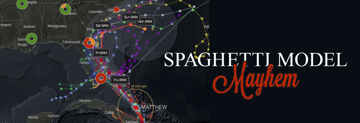
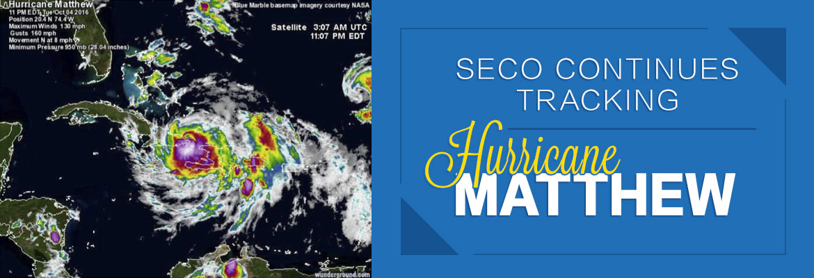
Per the Friday morning National Hurricane Center update, Hurricane Matthew continues to slowly move up the Florida east coast – just off the shore. Matthew is moving at 13 mph and has weakened to a Category 3 hurricane. As of 5 am, the eye is located parallel to Melbourne.


For Central Florida, winds will increase throughout the day. Lake County, Sumter County and the east side of Marion County could feel wind gusts up to 60 mph. Models remain mixed as to if the eye will cross Florida’s shores. Where it will head after it passes the state remains uncertain.


Poles and lines will go down, and power outages will likely be widespread. Because crews are unable to work safely or raise bucket truck booms in winds over 35 mph, outages will be long in duration if crews cannot respond to outages until winds subside and the storm passes.


SECO encourages its members to report outages using smartphones or tablets at the Storm Center application on SECOEnergy.com. It’s easy to report with the last name and house number. Members can contact SECO via Facebook and Twitter and read outage details.


For members less tech savvy, call and talk to a member service rep (or use the prompts to report the outage by phone at 800 732 6141). SECO’s System Operations Center is manned 24/7, and our call centers are also manned 24/7 when severe weather comes through – as will be the case as Hurricane Matthew approaches. Also report downed power lines – call 911 if there is immediate danger.


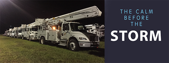
SECO is Storm Ready. Its emergency response plan determines the restoration priority of each feeder. Essential services like shelters, hospitals, schools and government agencies are the highest priority. Next, linemen work to restore power to large groups of members. Then repairs begin on individual services in less populated areas. Additional line crews and tree trimming contractors continue to arrive at SECO to be staged for the restoration effort.


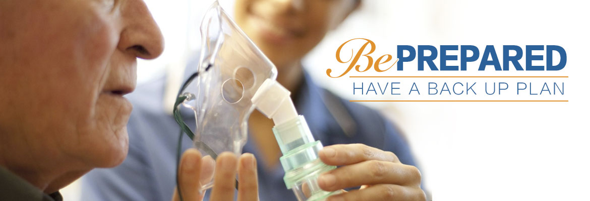
Members who need continuous power for medical devices and do not have a back-up source of power must act now. Shelters are open in the SECO area. Contact your county’s emergency operations center (EOC) to find shelter in your area – do not wait.

• Sumter County 352-689-4400 or visit the website.
• Lake County 352-343-9420 or visit the website.
• Marion County Citizen’s Info line is 352-369-7500 or visit the website.
• Citrus County 352-527-2106 or 352-746-5470 or visit the website.
• Levy County 352-486-5213 or visit the website.
• Hernando County 352-754-4083 or 352-754-4111 or visit the website.
• Pasco County 727-847-8137 or visit the website.


As a not-for-profit electric cooperative, SECO is dedicated to being members’ first source for accurate storm information. Learn more at SECOEnergy.com.

Spaghetti Model Mayhem as Hurricane Matthew Approaches Florida

The spaghetti models for the latest Hurricane Matthew forecast are all over the place, but one thing is clear: It’s coming to Florida, and SECO Energy members will feel effects of the storm on Thursday and Friday.


Per the National Hurricane Center’s 5 pm forecast, Hurricane Matthew is moving northwest at 12 mph. On this track, Matthew will move across the Bahamas tonight and tomorrow, and is expected to be near Florida’s east coast tomorrow night. Strengthening is forecasted during the next couple of days, and Matthew is expected to remain at a Category 3 or stronger while it moves through the Bahamas and approaches Florida.


The forecasted path of Matthew is a parallel track on Florida’s east coast – but models are mixed now in reference to how close the eye will come to Florida’s shores and where it will head after it passes the northern part of the state. What is certain is Central Florida residents east of I-75 will likely experience rain bands and strong tropical-storm-force wind gusts with damage potential. This means power outages – some perhaps long in duration.


SECO encourages its members to report outages using their smartphones or tablets through our online Storm Center application at SECOEnergy.com. It’s easy to report simply by using the last name on the account and the house number. Members can contact SECO via Facebook and Twitter, as details about outages are always posted to these platforms.


For those less tech savvy, members can always call and talk to a member service rep (or use the prompts to report the outage by phone at (800) 732 6141. SECO’s System Operations Center is manned 24/7, and our call centers are also manned 24/7 when severe weather comes through – as will be the case as Hurricane Matthew approaches. Downed power lines can be reported by phone too – but a member who suspects immediate danger should call 911.


SECO is Storm Ready with a comprehensive emergency response plan that determines the system’s restoration priority of each affected feeder. Essential services such as shelters, hospitals, schools and government agencies are the highest priority. Next, line personnel make repairs that will restore power to large groups of members and then repairs begin on individual electric services in less populated areas. SECO has called for additional line crews and tree trimming contractors to respond quickly to outages caused by Hurricane Matthew.


SECO Encourages Member Safety During Hurricane Matthew


For members who need continuous power for medical devices, please know that Hurricane Matthew may be the cause of prolonged outages during and after the storm hits. If you are a SECO member who requires uninterrupted service and you do not have a back-up source of power to operate a medically necessary device, now is the time to act as SECO cannot guarantee continuous service during a severe storm event. Shelters are opening in the SECO area Thursday. Contact the emergency operations center (EOC) in the county where you live and inquire about available shelters in your area. Below is the contact information for the EOCs by county:


As a not-for-profit electric cooperative, SECO is dedicated to being members’ first source for accurate storm information. Learn more at SECOEnergy.com.

SECO Continues Tracking Hurricane Matthew

SECO Energy continues to monitor and track Hurricane Matthew and its path to Florida. SECO is urging members to gather emergency supplies and be ready for service interruptions while the hurricane is passing through Florida and for a period of time thereafter.


As of Wednesday morning, Hurricane Matthew was downgraded to a Category 3 hurricane with sustained winds up to 125 mph. The storm is currently located about 35 miles north-northwest of the eastern tip of Cuba and is moving north at 8 mph. The storm is still predicted to turn northwest Wednesday night and is expected to remain a major hurricane as it moves over the Bahamas Wednesday and Thursday. By Thursday evening, Matthew will be near Florida’s east coast – with the center located 25 to 30 miles off the coast. The state will feel its effects through Friday night.


The forecast for Florida includes rain bands and strong, potentially damaging wind gusts – especially within rain bands and thunderstorms. Members in SECO’s service area can expect heavy rain, gusty winds that may strengthen to tropical-storm-force.


SECO asks members to keep a close watch on the hurricane’s impact on the area and be prepared for the possibility of prolonged service interruptions. Members should check emergency supplies, fill vehicles with gas, stock up on non-perishables and check property for objects that could cause damage during high winds.


Make sure cell phones and tablets are fully charged – include extra chargers in your emergency supplies. Bookmark SECO’s Storm Center on your smartphone or tablet. It’s simple to report an outage using the account last name and house number.


As a not-for-profit electric cooperative, SECO is dedicated to being our members’ first source for accurate storm information. “Like” SECO’s Facebook page and “follow” the company on Twitter to stay updated about storms affecting our area.