Shelters Opening in Preparation of Hurricane Dorian
Shelters are opening in the counties served by SECO Energy that will feel the effects of Hurricane Dorian. SECO urges members who are dependent on electricity to operate life-sustaining devices to seek refuge at a shelter or have a backup source for power before Hurricane Dorian’s high winds and rain cause lengthy power outages.
In Sumter County, two pet-friendly shelters will open at 10 a.m. The Sumter County Fairgrounds at 7620 SR 471 in Webster will be available for the general population. The Wildwood Community Center at 5600 Powell Road in Wildwood is open for citizens with special needs. Sumter County officials will determine if additional shelter openings are necessary. Shelters are available for residents living in mobile homes, recreational vehicles and low-lying flood prone areas and east-coast evacuees.
Lake County is scheduled to open six shelters at noon today. The general public shelter is at Mount Dora High School located at 700 N. Highland Street in Mount Dora. Two public, pet-friendly shelters are opening at Round Lake Elementary 31333 Round Lake Road, Mount Dora and Spring Creek Elementary 44440 Spring Creek Road, Paisley. Special needs and pet-friendly shelters are opening at noon at Leesburg Elementary 2229 South Street, Leesburg and Lost Lake Elementary 1901 Johns Lake Road, Clermont and Umatilla Elementary 401 Lake Street, Umatilla.
At this time, shelters are not opening in Citrus, Hernando, Marion or Pasco Counties. Levy County is prepared to open shelters as needed. Schools are closed Tuesday in Citrus, Marion and Sumter Counties. In Lake County, schools are closed Tuesday and Wednesday.
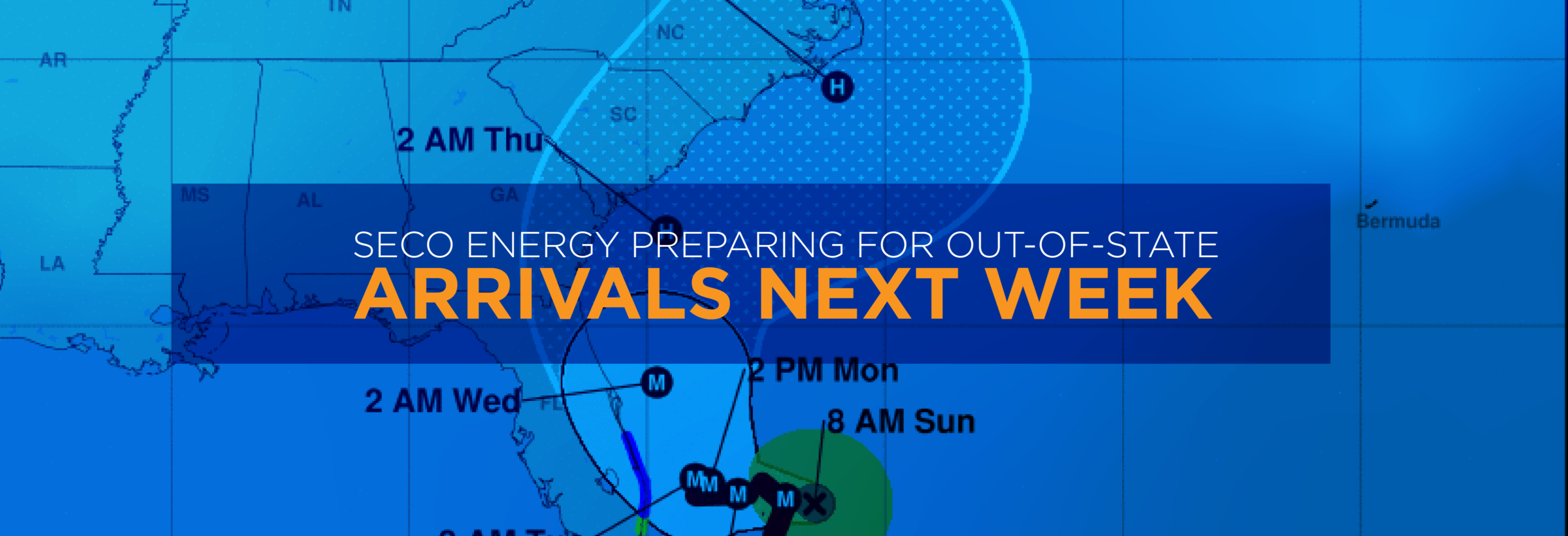
Hurricane Dorian remains a CAT 5 storm with 165 mph sustained winds and has slowed to a 1 mph crawl. It is expected to maintain this slow speed for the next 24 hours. This pace will result in SECO Energy’s service area feeling the first effects around 2 a.m. on Wednesday morning and lasting through noon. The area will experience 25-30 mph sustained winds with 35-60 mph gusts.
CEO Jim Duncan stated, “Forecasters predict Hurricane Dorian will skirt Florida’s east coast and not make landfall in Florida. That track does not put SECO’s service area in the clear. SECO Energy is StormReady and prepared to begin what may be a lengthy restoration event. Crews from out of state begin arriving today to assist. Do not jeopardize your family’s safety – seek shelter in your county if needed.”
SECO Energy’s Hurricane Handbook is available on SECO’s homepage by clicking on the homepage banner. The Hurricane Handbook offers members tips for preparing before, during and after a storm. The cooperative has included tips on generator safety, downed power line safety, electric system 101, Florida’s Move Over Law and more.
StormCenter is SECO Energy’s outage and communications platform for members to report outages, check the status of an existing outage and enroll in outage communications and alerts via email, text, voice or all three. Visit StormCenter today at SECOEnergy.com and bookmark on your smartphone or tablet to report outages quickly and easily. Once the hurricane has passed SECO’s area later next week, members should use our Daily Restoration Plan Map to identify if crews are working in their area that day. Visit SECOEnergy.com and click on the homepage banner to access the map.
Stay up to date on weather affecting SECO Energy’s service area, the latest news releases and cooperative updates by “liking” SECO’s Facebook page and “follow” @SECOEnergy on Twitter.