StormCenter logo

Archive

Hurricane Milton Community Information – Sandbags and Shelter Locations

A list of locations for sandbags and shelters by county, as of Tuesday, October 8, 10:00 a.m.


SUMTER COUNTY


SANDBAGS

Available Tuesday for Sumter County residents October 8 from 8:00 a.m. to 5:00 p.m.


  • Lake Panasoffkee Regional Recreation Park, 1589 CR 459, Lake Panasoffkee, FL, on Tuesday, October 8, from 8:00 AM to 5:00 PM. Sandbag operations will be available during this time according to weather conditions.


To obtain the sand and sandbags, residents will need to provide proof of residence within Sumter County and should bring a shovel if they have one. Residents pick up sandbags, fill them, and place them in their vehicles. There is a 10-sandbag limit per vehicle. Sandbags should be used to restrict floodwaters from entering houses via doorways, garages, and entryways. They are not to be used to provide a barricade around homes or property.


SHELTERS

General Population Shelter:

  • Sumter County Fairgrounds: 7620 SR 471, Webster, FL 33597 – Opening Wednesday 10/9/2024 @ 6:00 a.m.
  • South Sumter High School: 706 N Main Street (State Road 475), Bushnell, FL 33513 – on standby to open if active shelters reach 60% capacity
  • Webster Elementary School: 349 S Market Boulevard (State Road 471), Webster, FL 33597 – on standby to open if active shelters reach 60% capacity

Special Needs Shelters:

  • Wildwood Community Center: 6500 Powell Road, Wildwood, FL 34785 – Opening Wednesday 10/9/2024 @ 6:00 a.m.

Private Shelter:

  • Oxford Assembly of God: 12114 US-301, Oxford, FL 34484 – Opening Wednesday 10/9/2024 @ 6:00 a.m.


MARION COUNTY


SANDBAGS

These locations are self-serve, bags are provided, and a limited number of shovels will be available at the sites. However, citizens are encouraged to bring their own. Officials request that each person limit their use to 10 bags per vehicle. 7:00 a.m. to 7:00 p.m. Tuesday.


  • Tuscawilla Park (Reilly Arts Center): 800 NE Sanchez Ave, Ocala, FL
  • ED Croskey Recreation Center: 1510 NW Fourth St, Ocala, FL
  • Jervey Gantt Park: 2200 SE 36th Ave, Ocala, FL
  • Dunnellon Public Works: 11924 Bostick St., Dunnellon, Florida
  • Wrigley Field: 405 County Rd East 316, Citra, FL
  • John Van Fleet Sports Complex: 14445 NE 14th Street Road, Ocala, FL
  • Belleview Sports Complex: 6501 SE 107th St, Belleview FL
  • Martel Recycling Center: 296 SW 67th Ave Rd, Ocala, FL
  • Marion Oaks: 294 Marion Oaks Lane, Ocala, FL (Behind the Community Center)


SHELTERS

The following locations will open at 6:00 p.m., Tuesday, October 8, 2024, as emergency shelters in preparation for Hurricane Milton. Those seeking shelter should bring their own medications, food, and other essentials. Pet owners seeking shelter for animals should bring their own pet supplies, including crates.


General Population Shelters:

  • Belleview Middle School, 10500 SE 36th Avenue, Belleview, FL
  • Forest High School, 5000 SE Maricamp Road, Ocala, FL
  • Fort McCoy School, 16160 NE Highway 315, Fort McCoy, FL
  • Horizon Academy at Marion Oaks, 365 Marion Oaks Drive, Ocala, FL
  • Liberty Middle School, 4773 SW 95th Street, Ocala, FL
  • Madison Street Academy, 401 NW Martin Luther King Jr. Avenue, Ocala, FL
  • North Marion Middle School, 2085 W Highway 329, Citra, FL


Special Needs Shelters:

  • West Port High School, 3733 SW 80th Avenue, Ocala, FL (pets of special needs residents allowed)


Pet-Friendly Shelter:

  • Lake Weir High School, 10351 SE Maricamp Road, Ocala, FL
  • Vanguard High School, 7 NW 28th Street, Ocala, FL


CITRUS COUNTY


SANDBAGS

Self Service 24/7 – STAFF ASSISTANCE AVAILABLE TUESDAY, OCTOBER 8, from 8:00 a.m. to 5:00 p.m.


  • Citronelle Park: 7826 W Dunklin Rd, Dunnellon
  • The Homosassa Recreation Park: 4210 S Grandmarch Ave, Homosassa
  • Bicentennial Park: 501 N Baseball Point, Crystal River
  • Floral Park: 9530 S Parkside Ave, Floral City
  • Old Hernando Elementary School: 2435 N Florida Ave, Hernando


These Sites Are Now CLOSED

  • Area 1 – 4508 S Grandmarch Ave in Homosassa
  • Area 5 – 7490 W Gulf to Lake Hwy in Crystal River


Please visit the Citrus County government Facebook page for additional updates. Contact Citrus County Road Maintenance Division with any questions: (352) 527-7610.


LEVY COUNTY


SANDBAGS


  • Bronson: Bronson Town Hall, 650 Oak St.
  • Cedar Key: City Hall, 809 6th
  • Inglis: Inglis Municipal Building, 31 Risher Ave.
  • Williston: Empty lot across the street from the Williston Police Department, 5 SW 1st
  • Yankeetown: Yankeetown Water Plant, 6241, Harmony Lane


SHELTERS

Opening Tuesday, October 8, 2024 at 8:00 a.m.


General Population Shelters:

  • Bronson Middle High School: 351 Ishie Avenue

Pet-Friendly Shelter:

  • Bronson Middle High School (Bring a crate, food, one gallon of water per animal, medications, Rabies vaccine certificate, and proof of distemper parvo/feline distemper vaccine. Animal Services will provide vaccines for an additional $10.00 per vaccine.

Special Needs Shelter:

  • Bronson Elementary School: 400 Ishie Ave


For Transportation to the shelter on Tuesday please call 352-486-3485. Transportation must be reserved no later than 5:00 p.m. Tuesday October 8, 2024.


LAKE COUNTY


SANDBAGS

County sandbag locations are open daily from 7:00 a.m. to 7:00 p.m. There is a limit of 10 bags per day per household. Sand and bags will be available on-site – residents should bring their own shovels and will need to fill their own bags. Assistance will be onsite at two locations for those who need help filling and loading their bags.

**Please Note: The sandbag location at Station 112 is closed. It has been moved to nearby St. Faustina Catholic Church**


  • East Lake Sports and Community Complex:
24809 Wallick Road, Sorrento
  • North Lake Regional Park:
40730 Roger Giles Road, Umatilla
  • Astor Fire Station 10:
23023 State Road 40, Astor
  • Minneola Athletic Complex (ASSISTANCE ONSITE): 1300 Fosgate Road (13930 Education Ave), Minneola
  • PEAR Gateway Park: Front Entrance (ASSISTANCE ONSITE)
26701 US Hwy 27, Leesburg
  • Faustia Catholic Church: 15551 N Boggy Marsh Rd., Clermont
  • Hickory Point Recreation Complex:
27315 SR 19, Tavares
  • Tavares OLD Fire Station:
424 East Alfred Street, Tavares;
Open 24 hours
  • Former Public Services Facilities:
400 12th Street, Clermont;
 6: open 2:00 p.m. to 6:00 p.m.
Oct. 7: open 8:00 a.m. to 7:00 p.m.
  • Lady Lake:
Hermosa Street and Gibson Street,
Oct. 7; open 9:00 a.m. – 7:00 p.m.
  • Groveland: Lot next to 310 Crittenden Street;
 7 and Oct. 8: 9:00 a.m. to 6:00 p.m.
15 bag limit per vehicle, self-service bring shovel
  • Susan Street Athletic Complex:
940 Susan Street, Leesburg;
 7 and Oct. 8: 8:00 a.m. to 5:00 p.m.
  • Fire Station 22:
100 W Norton Avenue, Eustis
  • Frank Brown Sports Complex:
1245 E Pine Ave, Mt Dora


SHELTERS

These shelters will open Tuesday, Oct. 08, at 12:00 p.m. Residents are encouraged to bring necessary supplies such as medication, bedding, and a pet carrier or crate.


Pet-Friendly Shelters:

  • Round Lake Elementary: 31333 Round Lake Road, Mt. Dora
  • Spring Creek Elementary: 44440 Spring Creek Road, Paisley
  • Treadway Elementary: 10619 Treadway School Road, Leesburg

Pet-Friendly and Special-Needs Shelters:

  • Astatula Elementary: 13925 Florida Ave., Astatula
  • Villages Elementary: 695 Rolling Acres Rd., Lady Lake


HERNANDO COUNTY


SANDBAGS

Hernando County Government has opened Sandbag Stations beginning Sunday, October 6, 2024, and will run daily from 9:00 a.m. to 6:00 p.m., weather permitting.


  • Linda Pedersen Park:
6300 Shoal Line Blvd.,
Spring Hill, FL 34609
  • Anderson Snow Park:
1360 Anderson Snow Rd.,
Spring Hill, FL 34609
(Enter through the service road between the park and the gymnastics place; the sand is located
at the end)
  • Ridge Manor Community Center:
34240 Cortez Blvd.
Ridge Manor, FL 33523
  • Spring Lake Methodist Church:
4191 Spring Lake Hwy.,
Brooksville, FL 34601


SHELTERS

Opening 10/8/2024 @ 8:00 a.m.


  • West Hernando Middle School Shelter: 14325 Ken Austin Pkwy., Brooksville, FL 34614

General Population, Special Needs, and Pet Friendly

  • Challenger: 13400 Elgin Boulevard Spring Hill, FL 34609
  • The Enrichment Center – Currently Open (800 John Gary Grubbs Blvd, Brooksville, FL 34601


PASCO COUNTY


SANDBAGS

Pasco County has two sandbag stations open 24/7 to help protect your property from potential flooding:


  • Magnolia Valley Golf Course: 7223 Massachusetts Avenue., NPR
  • Pasco Public Works C-Barn: 30908 Warder Road., San Antonio

Due to the potential for coastal and inland flooding, the county is also opening additional locations. These sandbag sites will be open from sunrise to sunset, until further notice:


  • Ben Harrill Recreation Complex: 2830 Gulf Trace Boulevard, Land O’ Lakes
  • Mitchell Park: 4825 Little Road., New Port Richey
  • Veterans Memorial Park: 14333 Hicks Road, Hudson
  • Land O’ Lakes Recreation Center: 3032 Collier Parkway, Land O’ Lakes
  • Pasco Fire Rescue Station #29: 6907 Dairy Road., Zephyrhills


Dade City is also providing sand to city residents:

  • Former Dade City Police Department building: 38042 Pasco Avenue, Dade City

SECO News, October 2017


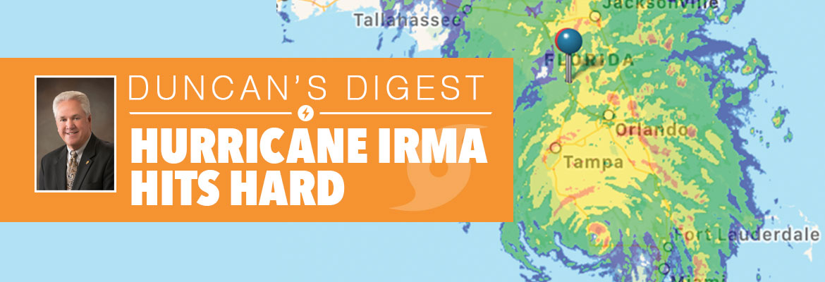
Duncan’s Digest

HURRICANE IRMA HITS HARD


Hurricane Irma is indeed the biggest, baddest, meanest named storm we’ve seen in a long time. Irma’s damage to our system was more significant than we experienced in the infamous 2004 hurricane season.


Hurricane Irma – the aptly named “war goddess” – arrived with an arsenal of hurricane-force winds. She wreaked havoc as she traveled directly through SECO’s service territory as a Category 1 to a Category 3 hurricane, per data from the National Hurricane Center. Power outages began late Sunday evening September 10, and members continued to lose power through Monday morning.


SECO News, October 2017 - Duncan's Digest , Hurricane Irma Hits Hard


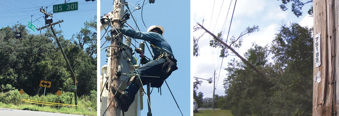
From Irma’s onset until winds subsided Monday mid-day, approximately 139,000 outages were reported by members and captured by our outage management system. Over half of our system was damaged by the hurricane-force winds with lines, transformers and poles on the ground covered by trees and debris.


Executing an emergency action plan before, during and after a named storm is a standard practice for a Florida utility like SECO Energy. Storm hardening and emergency response are key investments for a not-for-profit electric cooperative. To successfully react to a weather crisis, we rely heavily on our tried and true emergency response plan and advanced preparation.


Members always want to know how SECO decides who is first in line for restoration. Florida requires substations and feeders serving hospitals, shelters, schools and government agencies to be restored as the highest priority. The next priority is restoring power to large groups of members, and then to less populated areas with individual electric services.


SECO News, October 2017 - Hurricane Irma Hits Hard, downed power lines, linemen working, damaged poles


Due to SECO’s demographic, we serve a large number of nursing homes and assisted living facilities. During Hurricane Irma, these facilities became a priority as well as they began to run out of generator fuel. The same held true for communication towers a few days into the recovery. Water treatment facilities and lift stations were also a strong consideration.


The bottom line is every member wants power turned back on – now. SECO is sensitive to that, and we understand the discomfort and inconvenience members experience. Personally, I slept on a cot in my office for four nights because my home was without power. I’m sharing that not for sympathy but to emphasize that SECO follows the plan and does not give special treatment or favors.


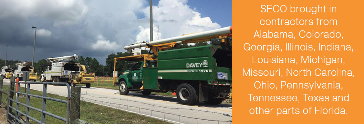
Once an emergency begins, logistics like fuel, food, lodging, manpower and a solid work plan are all critical to a timely restoration. Securing line and tree trimming contractor support from neighboring areas was difficult because Irma had such far-reaching effects. We searched far and wide and brought in contractors from Alabama, Colorado, Georgia, Illinois, Indiana, Louisiana, Michigan, Missouri, North Carolina, Ohio, Pennsylvania, Tennessee, Texas and other parts of Florida.


SECO News, October 2017 - Hurricane Irma Hits Hard, SECO brought in contractors from Alabama, Colorado, Georgia, Illinois, Indiana, Louisiana, Michigan, Missouri, North Carolina, Ohio, Pennsylvania, Tennessee, Texas and other parts of Florida.


Fuel, ice, food and hotel rooms for these folks became a logistical challenge as the state seemingly shut down before, during and after Irma. From the beginning of the restoration effort on Monday, fuel availability for our trucks was limited. Traffic on I-75 southbound delayed the out-of-state contractors’ arrivals. Evacuees understandably fled from coastal areas to central Florida, reducing the availability of hotels to lodge our restoration teams from out of state.


Contract line and tree crews arrived and suited up alongside our SECO home team after winds died down around noon that Monday. These professionals were in it to win it. SECO made significant progress, restoring power to over 90,000 members during the first three days of restoration – 49,000 members remained without power.


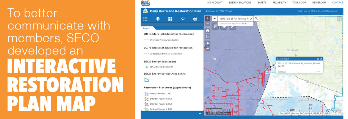
To better communicate with members, SECO developed an interactive restoration plan map that was launched Tuesday evening. The map was updated nightly to reflect the next day’s restoration plan.


SECO News, October 2017 - Hurricane Irma Hits Hard, To better communicate with members, SECO developed an interactive restoration plan map


This resource became a useful communication tool for members seeking information on the timing of their particular area’s restoration. Social media was a blessing throughout the hurricane and restoration, and helped members keep in touch when CenturyLink went down.


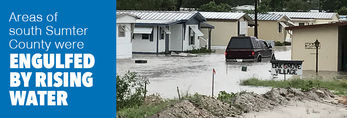
When Thursday dawned, progress slowed as SECO fought through new challenges and obstacles. High waters across roads and in homes prevented restoration in south Sumter County. Areas with significant damage took longer than planned. Stolen wire delayed restoration in Webster, Croom-A-Coochee and Lake Panasoffkee. Crews were redirected to allow restoration to continue in areas where we could restore larger numbers quickly.


SECO News, October 2017 - Hurricane Irma Hits Hard, Areas of south Sumter County were engulfed by rising water


The weather threatened to hinder progress on Friday and Saturday, as the presence of lightning would bring restoration to a stop. We put the word out for farmers to stop cutting hay and for residents to not wash their cars. We prayed and crossed our fingers.


Prayers were answered, and on Saturday at noon, less than 10,000 members were without power. We were determined to have full restoration complete by the end of the day Sunday, September 17. More than 1,200 SECO crews, along with line and tree contractors converged for the last time on our territory to finish rebuilding the remaining lines, clear trees, replace poles, avoid alligators and respond to the remaining small pockets of outages.


Though it was admittedly a rough week for those who lost power, I am proud to say that by Sunday night, 99.9% of SECO members had power restored. Only about 70 accounts in south Sumter County were unable to receive electric service due to high water conditions.


Many of our employees worked 20-hour days, didn’t have power at home and could have auditioned for a role on The Walking Dead. I am grateful for the hard work and dedication of the entire SECO team. I’m also grateful for the thousands of line and tree contractors who traveled thousands of miles to Florida, leaving their families to aid ours during Hurricane Irma restoration. They have my respect and appreciation.


In each major restoration event, there are lessons learned. Sometimes Murphy’s Law prevailed and other times, thankfully, we had favor and won the day. As a team, we celebrated the highs and worried through the lows.


Nature’s Reflections will be back next month. Clearly, Mother Nature made her presence known through Hurricane Irma as these photos show.


I believe in preparing for the worst and praying for the best. Hurricane Irma may be as close to the worst we will ever see. Today, let’s count our blessings and be thankful.


Sincerely,


Jim Duncan

Chief Executive Officer


Read the full October 2017 SECO News here.


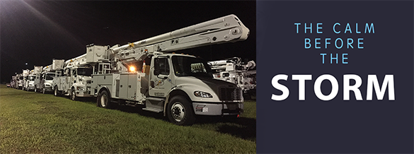
Calm Before the Storm – SECO Braces for Matthew’s Inland Effects

Per the Friday morning National Hurricane Center update, Hurricane Matthew continues to slowly move up the Florida east coast – just off the shore. Matthew is moving at 13 mph and has weakened to a Category 3 hurricane. As of 5 am, the eye is located parallel to Melbourne.


For Central Florida, winds will increase throughout the day. Lake County, Sumter County and the east side of Marion County could feel wind gusts up to 60 mph. Models remain mixed as to if the eye will cross Florida’s shores. Where it will head after it passes the state remains uncertain.


Poles and lines will go down, and power outages will likely be widespread. Because crews are unable to work safely or raise bucket truck booms in winds over 35 mph, outages will be long in duration if crews cannot respond to outages until winds subside and the storm passes.


SECO encourages its members to report outages using smartphones or tablets at the Storm Center application on SECOEnergy.com. It’s easy to report with the last name and house number. Members can contact SECO via Facebook and Twitter and read outage details.


For members less tech savvy, call and talk to a member service rep (or use the prompts to report the outage by phone at 800 732 6141). SECO’s System Operations Center is manned 24/7, and our call centers are also manned 24/7 when severe weather comes through – as will be the case as Hurricane Matthew approaches. Also report downed power lines – call 911 if there is immediate danger.


SECO is Storm Ready. Its emergency response plan determines the restoration priority of each feeder. Essential services like shelters, hospitals, schools and government agencies are the highest priority. Next, linemen work to restore power to large groups of members. Then repairs begin on individual services in less populated areas. Additional line crews and tree trimming contractors continue to arrive at SECO to be staged for the restoration effort.


Members who need continuous power for medical devices and do not have a back-up source of power must act now. Shelters are open in the SECO area. Contact your county’s emergency operations center (EOC) to find shelter in your area – do not wait.

• Sumter County 352-689-4400 or visit the website.
• Lake County 352-343-9420 or visit the website.
• Marion County Citizen’s Info line is 352-369-7500 or visit the website.
• Citrus County 352-527-2106 or 352-746-5470 or visit the website.
• Levy County 352-486-5213 or visit the website.
• Hernando County 352-754-4083 or 352-754-4111 or visit the website.
• Pasco County 727-847-8137 or visit the website.


As a not-for-profit electric cooperative, SECO is dedicated to being members’ first source for accurate storm information. Learn more at SECOEnergy.com.

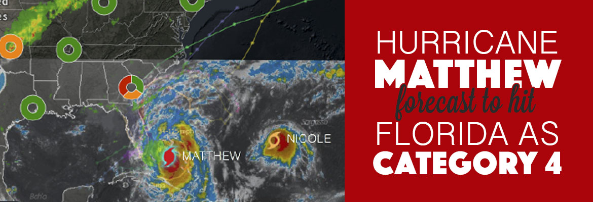
Hurricane Matthew Forecast to Hit Florida as Cat 4

Per the National Hurricane Center’s 8 am forecast, Hurricane Matthew is moving northwest at 12 mph. On this track, Matthew crosses the Bahamas today and approaches Florida’s east coast tonight, strengthening to a category 4 hurricane – which means winds of 130 to 156 mph.


The forecasted path of Matthew remains parallel to Florida’s east coast – but models are mixed as to how close the eye will come to Florida’s shores and where it will head after it passes the state. It is certain that Central Florida residents east of I-75 will experience rain and tropical-storm-force winds.


Poles and lines will go down, and power outages will likely be widespread. Because crews are unable to work safely or raise bucket truck booms in winds over 35 mph, outages will be long in duration if crews cannot respond to outages until winds subside and the storm passes.


SECO encourages its members to report outages using smartphones or tablets at the Storm Center application on our website. It’s easy to report with the last name and house number. Members can contact SECO via Facebook and Twitter and read outage details.


For members less tech savvy, call and talk to a member service rep (or use the prompts to report the outage by phone at 800 732 6141. SECO’s System Operations Center is manned 24/7, and our call centers are also manned 24/7 when severe weather comes through – as will be the case as Hurricane Matthew approaches. Also report downed power lines – call 911 if there is immediate danger.


SECO is Storm Ready. Its emergency response plan determines the restoration priority of each feeder. Essential services like shelters, hospitals, schools and government agencies are the highest priority. Next, linemen work to restore power to large groups of members. Then repairs begin on individual services in less populated areas. All day today, additional line crews and tree trimming contractors are arriving at SECO to be staged for the restoration effort.


Members who need continuous power for medical devices and do not have a back-up source of power must act now. Shelters are open in the SECO area. Contact your county’s emergency operations center (EOC) to find shelter in your area – do not wait.


As a not-for-profit electric cooperative, SECO is dedicated to being members’ first source for accurate storm information.

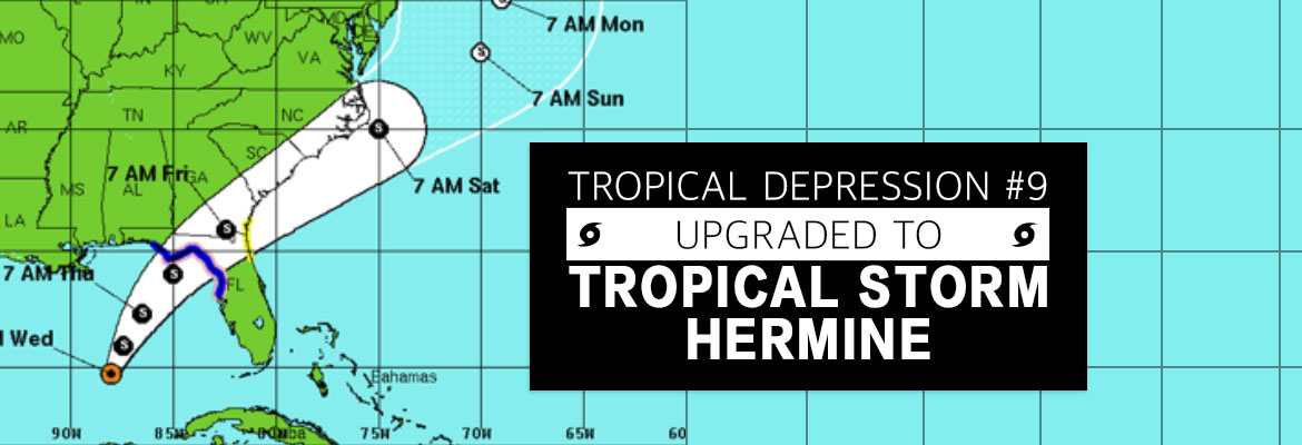
Tropical Depression #9 Upgraded to Tropical Storm Hermine

As of Wednesday afternoon, Tropical Depression #9 is upgraded. Tropical Storm Hermine’s (pronounced Her-MEAN) maximum sustained winds are 40 mph and its location is 400 miles south of Apalachicola and is moving very slowly north at 2 mph. Hermine is expected to increase in speed when turning northeast toward Florida’s west coast. The latest models,predict that Hermine could make landfall somewhere between Apalachicola and Cross City on Thursday as a weak Category 1 hurricane.


In significant storms, SECO Energy engages resources to ensure power is restored quickly and safely. SECO’s Operations crews have already been supplemented with tree trimming crews and contractors. Additional reinforcements are on standby.


SECO Energy, Tropical Depression #9 Upgraded to Tropical Storm Hermine


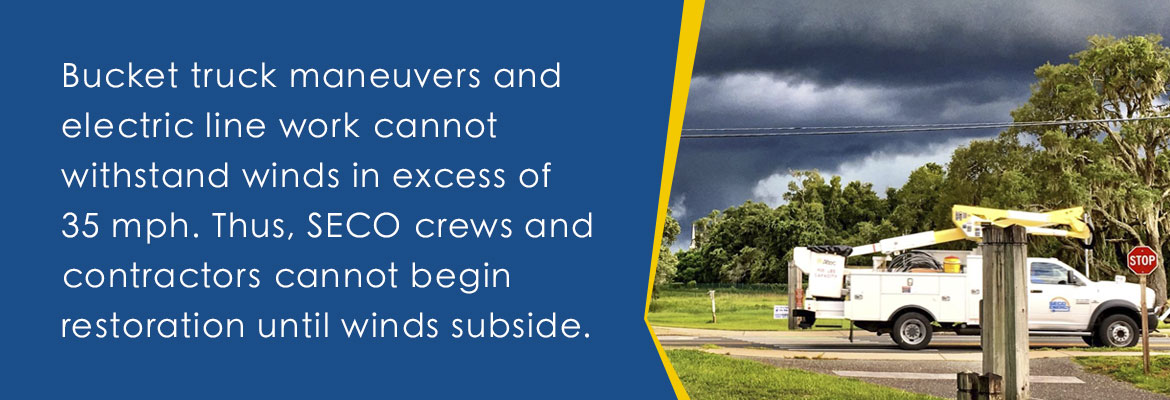
SECO’s emergency restoration plan determines the system’s restoration priority of each affected feeder. Essential services such as shelters, hospitals, fire/law enforcement facilities, schools, and government agencies are the highest priority. Line repairs that will restore power to large groups of members are next, and then individual electric services in less populated areas. It’s important to understand that bucket truck maneuvers and electric line work cannot withstand winds in excess of 35 mph. Thus, SECO crews and contractors cannot begin restoration until winds subside.


Vice President of Corporate Communications & Energy Services Kathryn Gloria stated, “SECO is concerned about our members’ wellbeing. It’s critical to prepare for those rare moments when you must take cover in the dark and wait it out. As this slow-moving storm edges closer to Florida, members prepare to hunker down when the storm makes landfall on Thursday.”


Use these practical suggestions:

  • If using a landline, have a non-electric phone for emergencies.
  • Invest in and charge a battery-operated cell phone charger.
  • Buy a battery-powered radio and a supply of fresh batteries.
  • Keep flashlights and extra batteries handy.
  • Dig out your first aid kit and refill prescription medications.
  • Stock a three-day supply of bottled water.
  • Fill bathtubs with water to flush toilets.
  • Purchase canned or packaged nonperishable food.
  • Buy an old-fashioned crank can opener.
  • Review your homeowners and flood insurance.

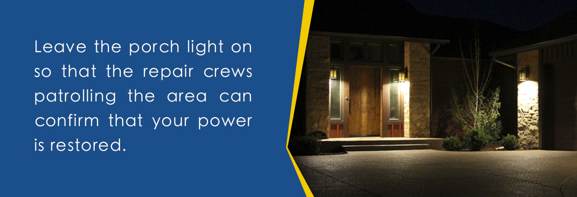
If power is lost, turn off/unplug appliances to protect them when power is restored, to prevent electrical fires and to lessen the chances of a circuit overload when service is restored. Leave the porch light switch on so that you and the repair crews patrolling can confirm that power is restored.


SECO Energy, Tropical Depression #9 Upgraded to Tropical Storm Hermine. Leave your porch lights on.


If it appears that neighbors have power but you do not, check your panel for tripped breakers, as this is common. If the breakers aren’t tripped, report the outage using your smartphone or tablet through the SECO Storm Center – or call us.


If you operate a generator, run it outside in a well-ventilated area, as carbon monoxide emissions from a generator are a silent killer that you can’t see, smell or taste. Do not connect the generator directly to your main electrical panel. If installed incorrectly, generator power could flow into SECO’s electric system, causing injury or death to neighbors or crews who may be under the impression that power lines are not energized.


For more information on preparing, refer to SECO’s Emergency Checklist under the Reliability tab.


As a not-for-profit electric cooperative, SECO is dedicated to being its members’ first source for accurate storm information. “Like” SECO’s Facebook page and “follow” the company on Twitter to stay updated about storms affecting your area.