StormCenter logo

Archive

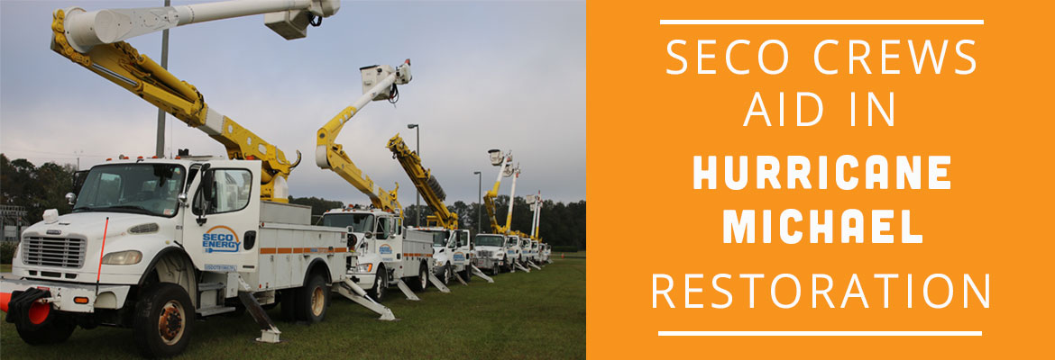
SECO Crews Aid in Hurricane Michael Restoration

SECO Energy organized a module of SECO employees to travel to the Florida Panhandle to aid in power restoration after Hurricane Michael’s 155 mph winds, torrential rains, and immense storm surges ravaged the area. SECO also released contract crews who are also traveling Thursday morning to the damaged areas to aid in restoration.


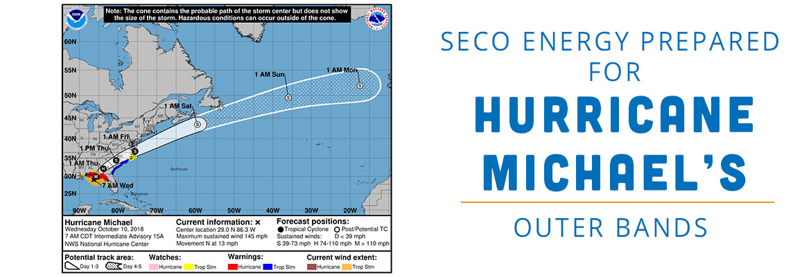
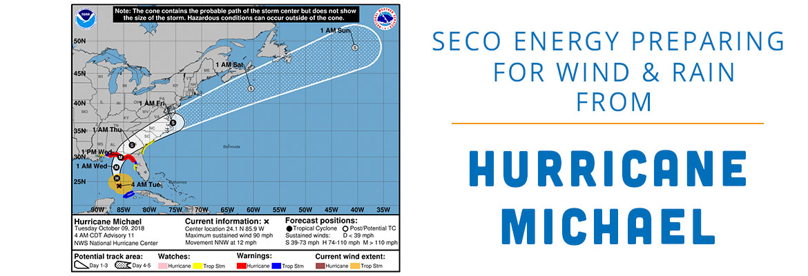
Hurricane Michael made landfall near Mexico Beach, Florida, on Wednesday afternoon as a powerful Category 4 hurricane with 155 mile per hour winds. The hurricane moved swiftly east through Alabama, Georgia and South Carolina before being downgraded to a tropical storm around midnight Wednesday. Hundreds of thousands of consumers are without power in Alabama, Georgia, Florida and South Carolina. Michael is responsible for at least two deaths in Florida.


A module of SECO first class line technicians, a superintendent, a crew supervisor, a mechanic and a project engineer departed from the SECO Energy headquarters compound early Thursday morning to assist in power restoration at Tri-County Electric Cooperative in Madison, Florida. Tri-County serves members in Dixie, Jefferson, Madison and Taylor Counties along the Gulf of Mexico coast.


Wednesday evening, SECO released a portion of its contractor work force to aid in restoration as well. Crews from overhead line contractor Pike are traveling to West Florida Electric Cooperative in Graceville, Florida.


CEO Jim Duncan stated, “Cooperative members in North Florida desperately need assistance. Cooperation among Cooperatives is one of the seven Cooperative Principles, and SECO and its employees are honored to be called upon to aid in power restoration. The cooperative bond is strong, and we believe in working together to help our members’ lives return to normal.”


Duncan added, “My thoughts and prayers are offered for all who were devastated by Hurricane Michael and for the safety of our crews and contractors who are traveling to assist.”


Vice President of Operations John LaSelva stated, “A Category 4 hurricane like Hurricane Michael wreaks havoc on homes, businesses and electric systems that consumers rely on. The news coverage clearly shows that the hurricane’s destruction was catastrophic. SECO employees were quick to volunteer and answer the call for aid. After Hurricane Irma’s destruction in SECO’s territory last year when so many crews came to assist us, SECO employees believe they have a duty to help our neighboring cooperatives and their members. It was a proud moment this morning seeing our employees off and praying for their safety.”


SECO Traveling Module Team Members:


• Bubba Cole
• Kenneth Budd
• Rodney Lipps
• Mark Locklear
• Kenny Merritt
• Gary Zachary
• Robby Pruett
• Eric Fort
• David Olszanski
• Cory McNeal
• Kent Sprague
• Derek Eveleth
• Brandon Blackmon
• Tommy Lakin
• Logan Delk
• Troy Clough
• Robert Recanzone
• Ryan Hendrix
• Rick Walsh
• Rich Freyser


SECO Energy provides online resources to help families prepare for tropical storms and hurricanes. View an emergency checklist, generator safety information and storm preparation tips online. Bookmark SECO’s StormCenter outage map on your smartphone and tablets to easily access the outage reporting platform. Enroll to receive outage communications via voice, text or email. StormCenter is available online at SECOEnergy.com>StormCenter.


“Like” SECO’s Facebook page and “follow” @SECOEnergy on Twitter for news releases and cooperative updates. Visit our Community page online to learn more about SECO’s corporate citizenship and other community outreach initiatives.

SECO Energy Prepared for Hurricane Michael’s Outer Bands

SECO Energy has been closely monitoring Hurricane Michael and its outer storm bands that bring the possibility of heavy rainfall, winds and even tornado threats into Central Florida.


According to the National Hurricane Center (NHC), as of 7 a.m. CDT on Wednesday, Hurricane Michael is moving north at 12 mph and is located 90 miles southwest of Panama City in the Florida Panhandle. Michael has quickly picked up speed and intensity to become a Category 4 hurricane. Forecasters project landfall will be early this afternoon between Panama City and Pensacola.


Tropical storm force winds extend 150 miles from the hurricane’s center. The hurricane’s current position puts SECO’s service territory outside of this range. SECO’s area is forecast to have winds in the 20 mph range, but wind gusts and rain in the outer bands will impact Marion and Levy Counties.


Though wind speeds will not be hurricane or tropical storm force in SECO’s territory, strong storm bands passing through SECO’s service territory are a significant threat. Members should prepare for a rainy Wednesday and possibly Thursday. Heavy rains coupled with wind, could cause trees to fall and result in power outages. Tornadoes spawned by these winds and rains are a danger as well.


After the threat of storm bands from Hurricane Michael have passed the area, SECO plans to release contracted Pike crews to the North Florida areas damaged by the hurricane to aid in restoration. Additionally, a module of SECO employees will be sent for restoration aid after hurricane dangers have passed.


CEO Jim Duncan asks members to remain vigilant, “Hurricane Michael will not make landfall near SECO’s service territory, but members will experience rains and high wind gusts. Be alert for the possibility of tornadoes which can be extremely dangerous. My thoughts and prayers go out to the Panhandle residents in the direct path. I’m grateful that SECO is in the position to send reinforcements to damaged areas.”


SECO Energy is StormReady and is committed to keeping members informed of weather that impacts the area. Visit Storm Preparation online to view an emergency checklist and storm preparation ideas. Watch our Facebook and Twitter pages for Tropical Storm Michael updates. Most important, be sure you’ve bookmarked our new StormCenter outage map and set your email, text and voice notifications preferences. StormCenter is mobile friendly and designed to perform on smartphones and tablets.

SECO Energy Preparing for Wind and Rain from Hurricane Michael

SECO Energy is preparing for the possibility of high winds, rain and the threat of tornadoes in Central Florida from Hurricane Michael’s outer bands.


As of 7 a.m. CDT on Tuesday, Hurricane Michael has picked up speed and is moving north-northwestward through the southern Gulf of Mexico at 12 mph. Hurricane Michael is currently a Category 2 hurricane with winds speeds between 96 and 110 mph. Tropical storm force winds extend 150 miles from the hurricane’s center.


According to the National Hurricane Center (NHC), Michael is strengthening and forecasters believe the storm will continue to increase in speed and intensity before making landfall near Panama City in the Florida Panhandle Wednesday afternoon.


SECO forecasters project the strongest winds to remain outside of our service area. Marion and Levy County members will experience the brunt of the strong winds, but still well below 30 mph. The tropical storm force wind speeds should remain at least 50 miles outside of SECO’s territory.


Though wind speeds will not be hurricane force, be only slightly high, strong storm bands passing through SECO’s service territory are a significant threat. Members should prepare for large amounts of rain beginning Tuesday and lasting through Thursday, coupled with wind, could cause trees to fall and result in power outages. Additionally, the threat of tornadoes will increase on Wednesday and into Thursday. Strong storms have impacted the east coast early this morning.


Citrus County’s Emergency Operating Center (EOC) is activating as of 5 p.m. today, and they have issued an evacuation order for coastal areas and manufactured homes as of 3 p.m. today. Citrus County is opening four shelters today, and schools are closed through Wednesday. The Sumter, Lake, Marion, Levy, Hernando and Pasco EOCs are monitoring the storm closely. A coastal evacuation order is in effect in Levy and two shelters open there today.


CEO Jim Duncan assures members that SECO is prepared for inclement weather created by Hurricane Michael. Duncan stated, “SECO continues to closely monitor Hurricane Michael’s progress as it travels through the Gulf of Mexico. We are prepared for Hurricane Michael’s rain bands and winds that will reach into our service territory. SECO’s employees, contract crews and leadership team are all prepared to escalate our response if Hurricane Michael’s path shifts toward SECO’s area.”


Duncan added, “Members should continue to keep a close eye on Hurricane Michael. Forecasted tracks have been known to shift hourly right up until landfall. Gather your hurricane supplies now if you have not already done so.”


SECO Energy is StormReady and is committed to keeping members informed of weather that impacts the area. Visit our Storm Preparation page online to view an emergency checklist and storm preparation ideas. Watch our Facebook and Twitter pages for Tropical Storm Michael updates. Most important, be sure you’ve bookmarked our new StormCenter outage map and set your email, text and voice notifications preferences. StormCenter is mobile friendly and designed to perform on smartphones and tablets.

SECO Monitoring Soon-to-be Hurricane Michael

SECO Energy is monitoring the soon-to-be Hurricane Michael as it moves north toward Florida’s gulf coast.


The current Tropical Storm Michael is on the verge of being upgraded to Hurricane Michael. As of 4 a.m. CDT on Monday, Hurricane Michael is slowly moving north at 7 mph with sustained winds of 70 mph.


The National Hurricane Center (NHC) forecasts Michael to increase in both speed and intensity over the next 48 hours. The storm is predicted to make landfall in the Apalachicola area late Wednesday night into early Thursday morning. As Michael moves into the Gulf of Mexico, it may strengthen significantly – forecasters predict Michael’s strength at landfall may be as high as a Category 2 or 3.


SECO members should prepare for the likelihood of gusty winds for most of SECO’s seven county service area. SECO members in the western portions of the service area, including large numbers in Citrus, Marion and Sumter Counties, will likely experience the strongest sustained winds.


CEO Jim Duncan is urging SECO members to prepare for Michael. Duncan stated, “Tropical Storm Michael, soon to become Hurricane Michael, is on track to make landfall on Florida’s west coast. Ensure that your hurricane supplies are fully stocked and that you and your family are prepared for the possibility that Michael’s high wind speeds will cause power outages. At SECO, we are carefully watching this storm, and I encourage our members to do the same.”


SECO Energy is StormReady and is committed to keeping members informed of weather that impacts the area. Learn more about Storm Preparation online and view an emergency checklist. Watch our Facebook and Twitter pages for Tropical Storm Michael updates. Most important, be sure you’ve bookmarked our new StormCenter outage map and set your email, text and voice notifications preferences. StormCenter is mobile friendly and designed to perform on smartphones and tablets.