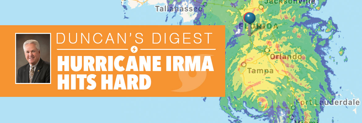
StormCenter logo

Archive

SECO Energy Preparing for Tropical Storm Dorian

SECO Energy is preparing for the possibility that Tropical Storm Dorian will affect parts of its service territory. Forecasters predict Tropical Storm Dorian could make an east coast Florida landfall as early as late Sunday night and reach hurricane strength while traveling through the Atlantic Ocean.


According to the National Hurricane Center (NHC), Dorian’s current wind speeds are 60 mph and the system is moving northwest at 13 mph. The storm’s eye is predicted to travel across Puerto Rico on Thursday.


The models remain uncertain as to Dorian’s track as it approaches Florida. Current modeling suggests Dorian will remain on a northwestern path, drifting north along the coast before turning into Florida to make landfall near Daytona Beach or Jacksonville late Sunday night into early Monday morning. Tropical Storm Dorian could strengthen to a Category 2 or 3 hurricane before landfall. Predictions will continue to change after Dorian exits Puerto Rico on Friday.


SECO members will likely feel the effects of Tropical Storm Dorian Sunday evening into Monday. If Dorian strengthens over the warm Atlantic waters and takes a Florida turn, SECO members could experience tropical storm force winds and rain on Sunday and Monday. Tornadoes brewing from the tropical storm or hurricane force winds is a threat as well.


CEO Jim Duncan urges members to prepare for Dorian. Duncan stated, “Tropical Storm Dorian could impact SECO members as early as Sunday evening. Even though the models are still uncertain of Dorian’s ultimate path, take the time today and tomorrow to prepare your family and home for this storm. Watch the weather reports, prepare in advance for Dorian to make landfall in Florida and possibly strengthen to a hurricane.”


StormCenter is SECO Energy’s outage and communications platform for members to report outages, check the status of an existing outage and enroll in outage communications and alerts via email, text, voice or all three. Visit StormCenter today and bookmark on your smartphone or tablet to report outages quickly and easily.


SECO has designed a new Hurricane Handbook to help members prepare before, during and after a storm. The Hurricane Handbook is available online.


Stay up to date on weather affecting SECO Energy’s service area, the latest news releases and cooperative updates by “liking” SECO’s Facebook page and “follow” @SECOEnergy on Twitter.

SECO News, June 2019

DUNCAN’S DIGEST


Atlantic hurricane season makes its formal appearance on June 1 and ends November 30. In early May, however, the National Hurricane Center (NHC) was already tracking its first tropical disturbance in the Atlantic. NHC, a part of NOAA, at the time this publication went to print, had not released its official forecast.

May 2018 SECO News Duncan's Digest

The Weather Channel 2019 outlook calls for a total of 14 named Atlantic storms, seven hurricanes and three “major” hurricanes. That forecast is slightly above the 30-year average of 12 named storms, six hurricanes and three major hurricanes. A major hurricane is a Category 3 or stronger which means winds greater than 111 mph.


Unfortunately, no forecast can accurately predict the future. The lifesaving approach is to expect the unexpected and prepare in advance for the possibility of a power outage. Gather your hurricane supplies now. Water and plywood sell out when storms threaten. It’s essential to stock non-perishable food to sustain each family member for at least three days. If you need guidance, view SECO’s Emergency Preparation Checklist online.


Whether you plan to evacuate or stay put during a major event, enroll in outage notifications through StormCenter. Choose email, voice or text message – or all three. Take a tour of the outage map. Search for and bookmark your address. Create a SECO Energy StormCenter icon on the home screen of your smartphone or tablet.


We’ve added a new StormCenter feature. You can now check the status of a reported power outage. Visit StormCenter, click on “Check Status.” Input your last name and house number, account number or phone number on record.


StormCenter provides updates that include the time the outage began, estimated restoration time, crew status, cause if identified and when the outage was restored.


SECO has developed one of the nation’s most comprehensive Emergency Restoration Plans to respond to major storm damage. Restoring service to the largest number of members in the quickest amount of time is our goal, but with required priorities for shelters, schools, hospitals and government buildings.


If you or a family member have special needs, visit www.FloridaDisaster.org to locate your county and join the statewide Special Needs Registry. Other valuable resources for emergency planning are the National Weather Service and the American Red Cross.


Don’t be caught unprepared for the 2019 Atlantic hurricane season. SECO Energy is StormReady and equipped to respond quickly to outages affecting members. We are here for you. It is our privilege to serve your family’s energy needs.


Sincerely,


Jim Duncan

Chief Executive Officer


SECO CHAMPIONS JERRY BOLDUC JUNE 2019

Meet SECO Champion Jerry Bolduc – an example of our 400+ SECO Champion employees. Jerry is dedicated to providing exceptional service to members, co-workers and communities.


JERRY BOLDUC – LEAD PROJECT ENGINEER


LENGTH OF SERVICE – 14 YEARS


“SECO is amazing.”


SECO Champion Jerry Bolduc is a Lead Project Engineer at our SECO Headquarters. Before working at SECO, Jerry was employed by a large investor-owned utility. As a SECO member and an employee, he appreciates the cooperative difference in service that SECO offers members. During the three back-to-back hurricanes in 2004, Jerry assessed damaged areas and directed contract crews across the service territory. He was amazed by SECO’s storm response and the efficiency and organization shown during major restoration efforts. Originally from Canada, Jerry moved to Central Florida 20 years ago. He has participated in Ironman Triathlon Events including Escape from Alcatraz where he swam with sharks in San Francisco Bay. Jerry enjoys working in the field in sunny Florida (no snow) and is proud to be a SECO member, too.

SECO News HVAC Tune-Up and Filter Change June 2019

HVAC TUNE-UP AND FILTER CHANGE


Summer heat is quickly approaching. Weather.com predicts June through August temperatures will be above average in our area. Before your HVAC system begins its summer workout, schedule a tune-up with a reputable HVAC technician.


The technician should thoroughly inspect your HVAC to ensure it’s in good running condition. The system may need to be cleaned or serviced. Preventative maintenance is easier on the wallet than major repairs down the road. A well-tuned HVAC runs more efficiently, uses less energy and saves on cooling and heating costs.


Is it time to change your HVAC filter? A clean HVAC filter also helps your system run efficiently. Follow the manufacturer’s guidelines and change filters as recommended.

Power Line Safety June 2019 SECO News

POWER LINE SAFETY


Downed power lines are a safety hazard. Car accidents involving power poles, trees taking down a line or poles broken by heavy wind or rain have the potential to bring us too close to electric lines.


Electric energy can burn, shock, injure or kill you. Never assume a power line is safe to touch. Always assume a power line is live and has the ability to harm you. Children are especially curious and may knowingly or unknowingly approach a downed line. Talk with your kids and grandkids about the dangers of downed power lines.


Warn children to never play near or on substation fencing. Do not climb trees near power lines or allow kites, toy planes or balloons to touch power lines. Don’t release helium balloons at a birthday party or other celebration. These can tangle in lines or become deadly for Florida wildlife.


If you see a downed line, stay away and warn others away as well. Call 911 immediately to report the downed line.

SECO News June 2019 Relay For Life 6th Annual Golf Tournament

RELAY FOR LIFE – 6TH ANNUAL GOLF TOURNAMENT


Thank you to all players, sponsors and employees who participated in SECO Energy’s 6th Annual Relay For Life Golf Tournament “Tee-Up for a Cure” at Arlington Ridge Golf Club in Leesburg on Saturday, May 4th. Players enjoyed 18-holes of golf, chance to win door prizes and fellowship.


The Relay For Life Golf Tournament sponsored by SECO raised $16,600 for the American Cancer Society.


SECO and its employees are long-time supporters of the American Cancer Society and its premier annual Relay For Life events. Join SECO and its Commitment to Community by partnering with your not-for-profit cooperative on a virtual SECO Relay For Life team.


Join a SECO Energy team by visiting Relay.ACSevents.org and look for “Find a Participant or Team” and choose “Team.” Enter team name: “SECO Energy” and click “Search.” Choose a local Relay event and virtually join Team SECO and the American Cancer Society in the fight against cancer.


Read the full June 2019 SECO News online.

SECO Energy Prepared for Hurricane Michael’s Outer Bands

SECO Energy has been closely monitoring Hurricane Michael and its outer storm bands that bring the possibility of heavy rainfall, winds and even tornado threats into Central Florida.


According to the National Hurricane Center (NHC), as of 7 a.m. CDT on Wednesday, Hurricane Michael is moving north at 12 mph and is located 90 miles southwest of Panama City in the Florida Panhandle. Michael has quickly picked up speed and intensity to become a Category 4 hurricane. Forecasters project landfall will be early this afternoon between Panama City and Pensacola.


Tropical storm force winds extend 150 miles from the hurricane’s center. The hurricane’s current position puts SECO’s service territory outside of this range. SECO’s area is forecast to have winds in the 20 mph range, but wind gusts and rain in the outer bands will impact Marion and Levy Counties.


Though wind speeds will not be hurricane or tropical storm force in SECO’s territory, strong storm bands passing through SECO’s service territory are a significant threat. Members should prepare for a rainy Wednesday and possibly Thursday. Heavy rains coupled with wind, could cause trees to fall and result in power outages. Tornadoes spawned by these winds and rains are a danger as well.


After the threat of storm bands from Hurricane Michael have passed the area, SECO plans to release contracted Pike crews to the North Florida areas damaged by the hurricane to aid in restoration. Additionally, a module of SECO employees will be sent for restoration aid after hurricane dangers have passed.


CEO Jim Duncan asks members to remain vigilant, “Hurricane Michael will not make landfall near SECO’s service territory, but members will experience rains and high wind gusts. Be alert for the possibility of tornadoes which can be extremely dangerous. My thoughts and prayers go out to the Panhandle residents in the direct path. I’m grateful that SECO is in the position to send reinforcements to damaged areas.”


SECO Energy is StormReady and is committed to keeping members informed of weather that impacts the area. Visit Storm Preparation online to view an emergency checklist and storm preparation ideas. Watch our Facebook and Twitter pages for Tropical Storm Michael updates. Most important, be sure you’ve bookmarked our new StormCenter outage map and set your email, text and voice notifications preferences. StormCenter is mobile friendly and designed to perform on smartphones and tablets.

SECO Monitoring Soon-to-be Hurricane Michael

SECO Energy is monitoring the soon-to-be Hurricane Michael as it moves north toward Florida’s gulf coast.


The current Tropical Storm Michael is on the verge of being upgraded to Hurricane Michael. As of 4 a.m. CDT on Monday, Hurricane Michael is slowly moving north at 7 mph with sustained winds of 70 mph.


The National Hurricane Center (NHC) forecasts Michael to increase in both speed and intensity over the next 48 hours. The storm is predicted to make landfall in the Apalachicola area late Wednesday night into early Thursday morning. As Michael moves into the Gulf of Mexico, it may strengthen significantly – forecasters predict Michael’s strength at landfall may be as high as a Category 2 or 3.


SECO members should prepare for the likelihood of gusty winds for most of SECO’s seven county service area. SECO members in the western portions of the service area, including large numbers in Citrus, Marion and Sumter Counties, will likely experience the strongest sustained winds.


CEO Jim Duncan is urging SECO members to prepare for Michael. Duncan stated, “Tropical Storm Michael, soon to become Hurricane Michael, is on track to make landfall on Florida’s west coast. Ensure that your hurricane supplies are fully stocked and that you and your family are prepared for the possibility that Michael’s high wind speeds will cause power outages. At SECO, we are carefully watching this storm, and I encourage our members to do the same.”


SECO Energy is StormReady and is committed to keeping members informed of weather that impacts the area. Learn more about Storm Preparation online and view an emergency checklist. Watch our Facebook and Twitter pages for Tropical Storm Michael updates. Most important, be sure you’ve bookmarked our new StormCenter outage map and set your email, text and voice notifications preferences. StormCenter is mobile friendly and designed to perform on smartphones and tablets.

SECO News, October 2017


Duncan’s Digest

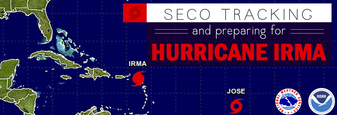
HURRICANE IRMA HITS HARD


Hurricane Irma is indeed the biggest, baddest, meanest named storm we’ve seen in a long time. Irma’s damage to our system was more significant than we experienced in the infamous 2004 hurricane season.


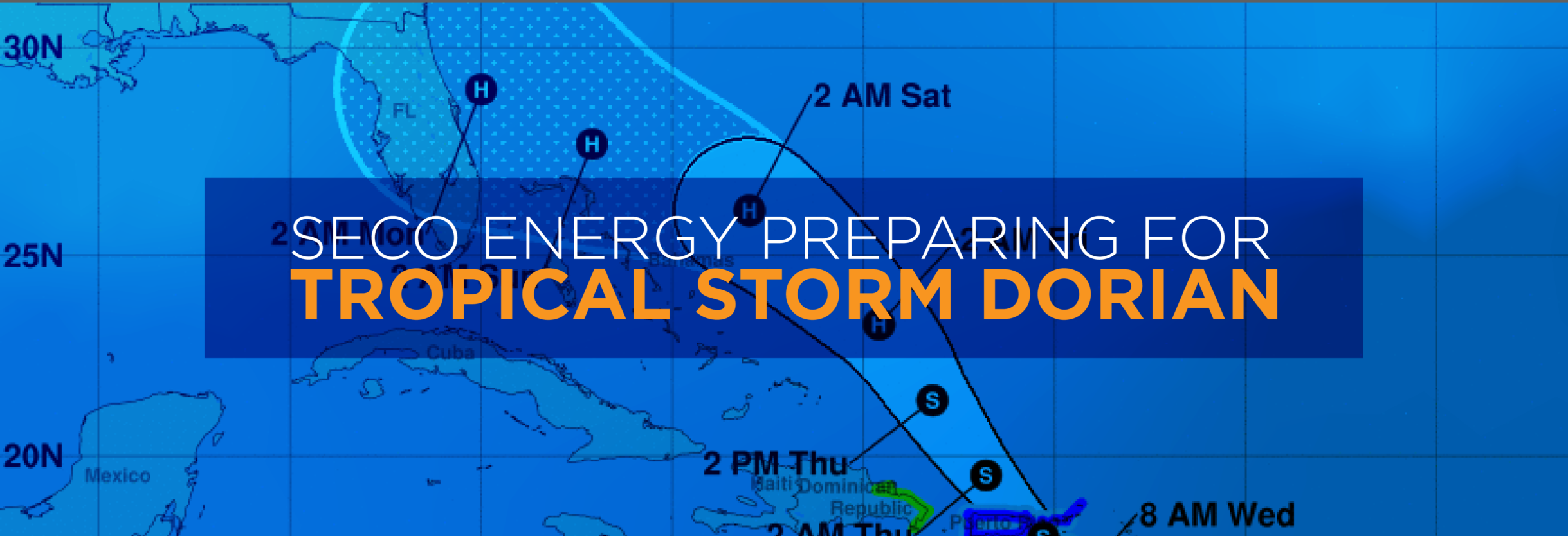
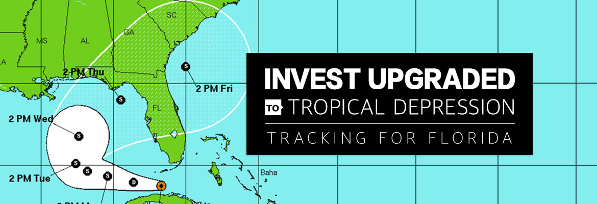
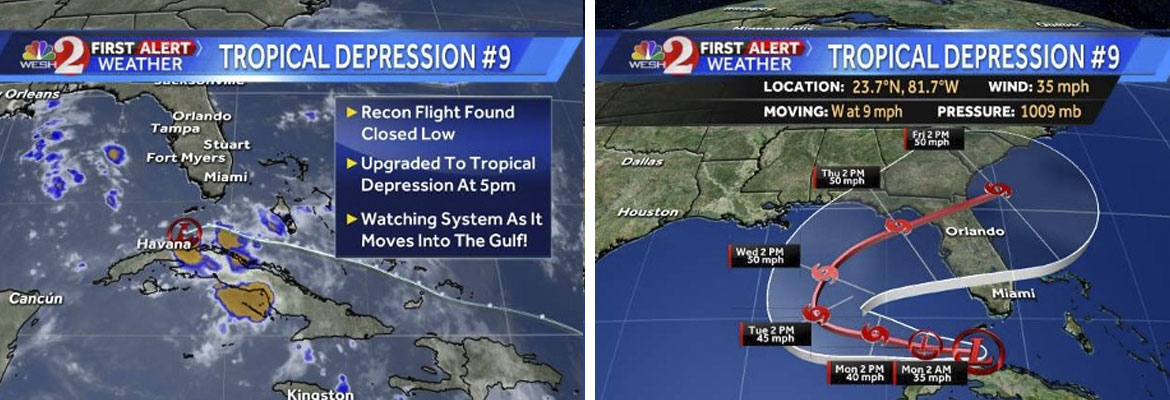
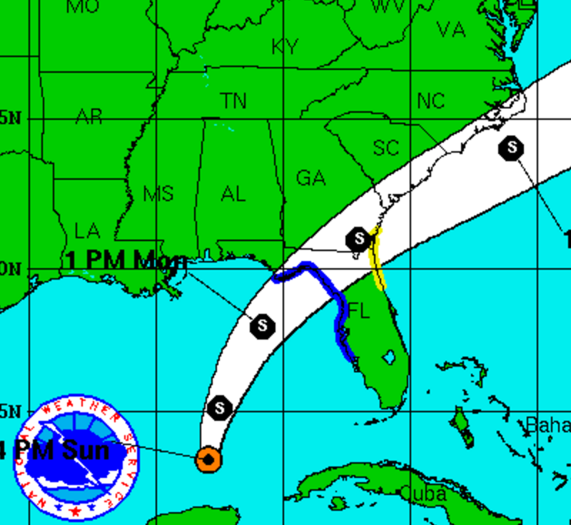
Hurricane Irma – the aptly named “war goddess” – arrived with an arsenal of hurricane-force winds. She wreaked havoc as she traveled directly through SECO’s service territory as a Category 1 to a Category 3 hurricane, per data from the National Hurricane Center. Power outages began late Sunday evening September 10, and members continued to lose power through Monday morning.


SECO News, October 2017 - Duncan's Digest , Hurricane Irma Hits Hard


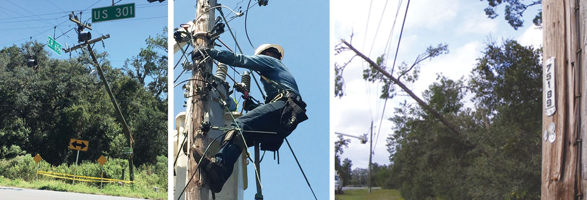
From Irma’s onset until winds subsided Monday mid-day, approximately 139,000 outages were reported by members and captured by our outage management system. Over half of our system was damaged by the hurricane-force winds with lines, transformers and poles on the ground covered by trees and debris.


Executing an emergency action plan before, during and after a named storm is a standard practice for a Florida utility like SECO Energy. Storm hardening and emergency response are key investments for a not-for-profit electric cooperative. To successfully react to a weather crisis, we rely heavily on our tried and true emergency response plan and advanced preparation.


Members always want to know how SECO decides who is first in line for restoration. Florida requires substations and feeders serving hospitals, shelters, schools and government agencies to be restored as the highest priority. The next priority is restoring power to large groups of members, and then to less populated areas with individual electric services.


SECO News, October 2017 - Hurricane Irma Hits Hard, downed power lines, linemen working, damaged poles


Due to SECO’s demographic, we serve a large number of nursing homes and assisted living facilities. During Hurricane Irma, these facilities became a priority as well as they began to run out of generator fuel. The same held true for communication towers a few days into the recovery. Water treatment facilities and lift stations were also a strong consideration.


The bottom line is every member wants power turned back on – now. SECO is sensitive to that, and we understand the discomfort and inconvenience members experience. Personally, I slept on a cot in my office for four nights because my home was without power. I’m sharing that not for sympathy but to emphasize that SECO follows the plan and does not give special treatment or favors.


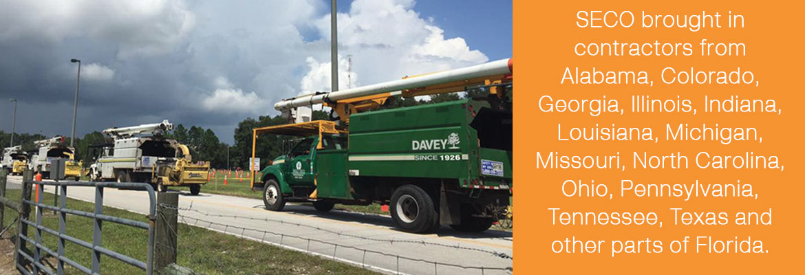
Once an emergency begins, logistics like fuel, food, lodging, manpower and a solid work plan are all critical to a timely restoration. Securing line and tree trimming contractor support from neighboring areas was difficult because Irma had such far-reaching effects. We searched far and wide and brought in contractors from Alabama, Colorado, Georgia, Illinois, Indiana, Louisiana, Michigan, Missouri, North Carolina, Ohio, Pennsylvania, Tennessee, Texas and other parts of Florida.


SECO News, October 2017 - Hurricane Irma Hits Hard, SECO brought in contractors from Alabama, Colorado, Georgia, Illinois, Indiana, Louisiana, Michigan, Missouri, North Carolina, Ohio, Pennsylvania, Tennessee, Texas and other parts of Florida.


Fuel, ice, food and hotel rooms for these folks became a logistical challenge as the state seemingly shut down before, during and after Irma. From the beginning of the restoration effort on Monday, fuel availability for our trucks was limited. Traffic on I-75 southbound delayed the out-of-state contractors’ arrivals. Evacuees understandably fled from coastal areas to central Florida, reducing the availability of hotels to lodge our restoration teams from out of state.


Contract line and tree crews arrived and suited up alongside our SECO home team after winds died down around noon that Monday. These professionals were in it to win it. SECO made significant progress, restoring power to over 90,000 members during the first three days of restoration – 49,000 members remained without power.


To better communicate with members, SECO developed an interactive restoration plan map that was launched Tuesday evening. The map was updated nightly to reflect the next day’s restoration plan.


SECO News, October 2017 - Hurricane Irma Hits Hard, To better communicate with members, SECO developed an interactive restoration plan map


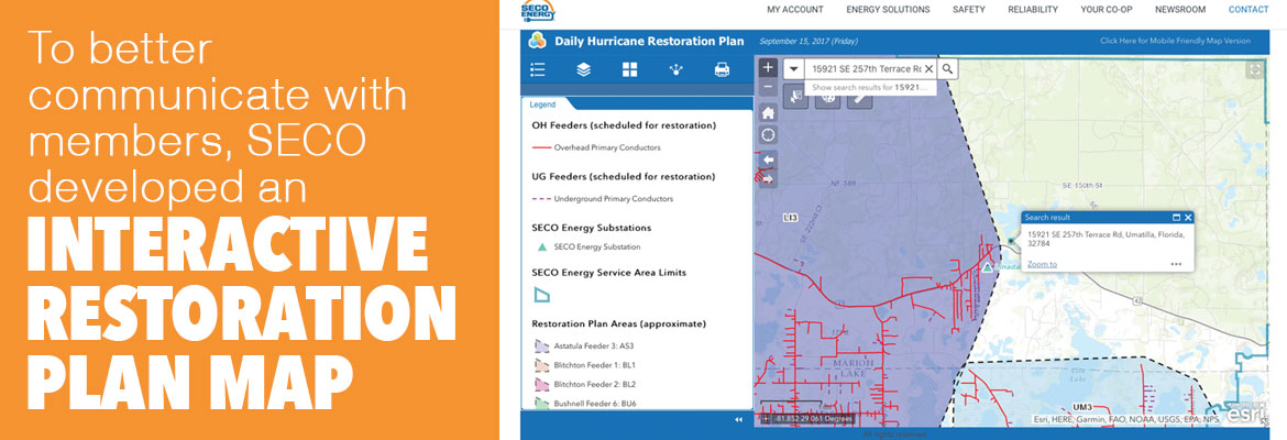
This resource became a useful communication tool for members seeking information on the timing of their particular area’s restoration. Social media was a blessing throughout the hurricane and restoration, and helped members keep in touch when CenturyLink went down.


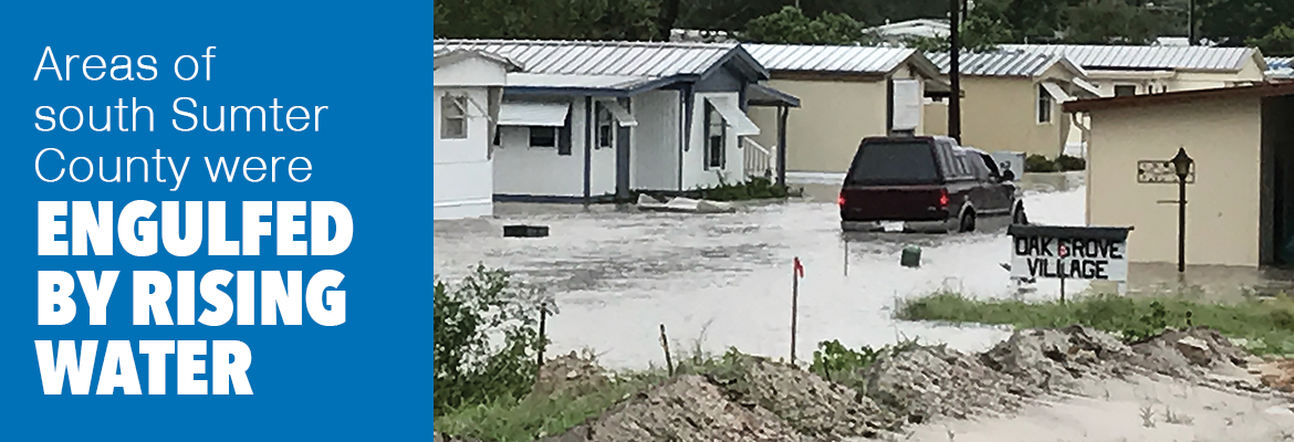
When Thursday dawned, progress slowed as SECO fought through new challenges and obstacles. High waters across roads and in homes prevented restoration in south Sumter County. Areas with significant damage took longer than planned. Stolen wire delayed restoration in Webster, Croom-A-Coochee and Lake Panasoffkee. Crews were redirected to allow restoration to continue in areas where we could restore larger numbers quickly.


SECO News, October 2017 - Hurricane Irma Hits Hard, Areas of south Sumter County were engulfed by rising water


The weather threatened to hinder progress on Friday and Saturday, as the presence of lightning would bring restoration to a stop. We put the word out for farmers to stop cutting hay and for residents to not wash their cars. We prayed and crossed our fingers.


Prayers were answered, and on Saturday at noon, less than 10,000 members were without power. We were determined to have full restoration complete by the end of the day Sunday, September 17. More than 1,200 SECO crews, along with line and tree contractors converged for the last time on our territory to finish rebuilding the remaining lines, clear trees, replace poles, avoid alligators and respond to the remaining small pockets of outages.


Though it was admittedly a rough week for those who lost power, I am proud to say that by Sunday night, 99.9% of SECO members had power restored. Only about 70 accounts in south Sumter County were unable to receive electric service due to high water conditions.


Many of our employees worked 20-hour days, didn’t have power at home and could have auditioned for a role on The Walking Dead. I am grateful for the hard work and dedication of the entire SECO team. I’m also grateful for the thousands of line and tree contractors who traveled thousands of miles to Florida, leaving their families to aid ours during Hurricane Irma restoration. They have my respect and appreciation.


In each major restoration event, there are lessons learned. Sometimes Murphy’s Law prevailed and other times, thankfully, we had favor and won the day. As a team, we celebrated the highs and worried through the lows.


Nature’s Reflections will be back next month. Clearly, Mother Nature made her presence known through Hurricane Irma as these photos show.


I believe in preparing for the worst and praying for the best. Hurricane Irma may be as close to the worst we will ever see. Today, let’s count our blessings and be thankful.


Sincerely,


Jim Duncan

Chief Executive Officer


Read the full October 2017 SECO News here.


SECO Tracking and Preparing for Hurricane Irma

SECO Energy is tracking Hurricane Irma and continues to prepare for a track that will affect its service territory.


Currently, Hurricane Irma is a Category 5 storm with wind speeds over 180 miles per hour. The storm is located five miles north of Barbuda, and is moving west-northwestward at 15 miles per hour. Forecasters predict that Hurricane Irma will continue on this current path until at least Friday night, passing between Cuba and the southern Bahamas.


The National Hurricane Center (NHC) is predicting Hurricane Irma will make landfall in Dade County. The major models predicting Irma’s path shifted a bit easterly overnight, and predictions will continue to fluctuate over the next couple of days.


SECO’s service area will likely experience heavy winds, torrential rains and the possibility of tornadoes spawned by Hurricane Irma. Members should be prepared for the possibility of lengthy power outages.


SECO’s employees are Storm Ready and waiting to respond if outages occur. SECO is prepared for inclement weather and reminds members that it is best to be informed and prepared. All SECO members should continue to seek out supplies for their emergency kits, and be ready to wait out the storm.


If you have a portable or backup generator, now is the time to test that it is running properly and you have an adequate supply of fuel on hand. Members can visit SECO’s website for storm preparation tips and view an emergency checklist. For members with smartphones or tablets, bookmark SECO’s Storm Center for easy outage reporting and updates.


As a not-for-profit electric cooperative, SECO is dedicated to being our members’ first source for accurate storm information. “Like” SECO’s Facebook page and “follow” the company on Twitter to stay updated about storms affecting our area.

SECO Gears up for Hurricane Matthew

SECO Energy is geared up for Hurricane Matthew – a Category 4 Hurricane – and its possible impact on the area and its members. SECO continues to monitor and track the storm as it passes over Jamaica and Cuba on its way to Florida’s east coast waters.


As of Tuesday afternoon per the NHC forecast, Hurricane Matthew is moving toward the north at 10 mph. On this track, the eye will move over eastern Cuba later this afternoon. A turn toward the north-northwest is expected by Wednesday, followed by a northwest turn Wednesday night. Maximum sustained winds remain near 145 mph with higher gusts. Matthew is expected to remain a powerful hurricane through at least Wednesday night.


Locally in Central Florida, expect heavy, continuous rains and gusty winds beginning as early as Wednesday afternoon. Conditions are meant to deteriorate on Thursday with the strongest storms forming between 2 am on Friday and continuing through about 7 pm Friday.


SECO is Storm Ready with a comprehensive emergency response plan that determines the system’s restoration priority of each affected feeder. Essential services such as shelters, hospitals, schools and government agencies are the highest priority. Next, line personnel make repairs that will restore power to large groups of members and then repairs begin on individual electric services in less populated areas. SECO has called for additional line crews and tree trimming contractors to respond quickly to outages caused by Hurricane Matthew.


SECO is urging members to be prepared for outages that may occur. Members may experience extended outages if tropical-storm-force winds linger in the area. It’s important to understand that line and tree crews cannot perform electric line work and bucket truck maneuvers during sustained winds of over 35 mph.


If you rely on a generator during storm season, remember to read and follow all manufacturer’s safety warnings. Visit the Generator Safety section of our website to learn more about being safe when using a generator.


Ensure your smartphone or tablet is fully charged and bookmark SECO’s Storm Center to report outages online. It’s simple to report an outage using the account last name and house number.


As a not-for-profit electric cooperative, SECO is dedicated to being our members’ first source for accurate storm information. “Like” SECO’s Facebook page and “follow” the company on Twitter to stay updated about storms affecting SECO’s area.

INVEST UPGRADED TO TROPICAL DEPRESSION TRACKING FOR FLORIDA

At 5 p.m. on Sunday, National Hurricane Center upgraded Invest 99 to Tropical Depression #9 (TD#9). The storm is currently located in the Florida Straits between Cuba and the Keys. Wind speed is 35 mph and the storm is moving west at 9 mph. The NHC is projecting movement to the west and then a turn to the north or northeast over the next few days. The models are projecting that the storm will eventually move north and either make a hard turn into Florida or move into the Florida Panhandle. Please see the hyperlinks or the attached graphic as a reference.


The forecast above is based on the NHC projections for the state. For SECO’s service area specifically, the cooperative is estimating that a turn to the north and east may begin Tuesday, with a Thursday evening landfall in the Panhandle – but that is an estimate. Regardless of exact landfall location, SECO’s service area will likely experience 35 to 40 mph wind gusts on Thursday and Friday. Heavy rain will be possible all week and especially on Thursday and Friday. Members can expect tree-caused outages due to the wind and rain.


SECO is Storm Ready. Our locally-based customer service staff is ready and available to respond to member inquiries in person, by phone or online. SECO’s System Operations directs the SECO cavalry 24 hours a day, seven days a week – each truck is equipped to respond to member concerns or service interruptions in the field quickly and safely. Additional operations personnel are staged to respond quickly. Members should ensure their smartphones/tablets are charged and report outages online through Storm Center.


SECO Energy, INVEST UPGRADED TO TROPICAL DEPRESSION TRACKING FOR FLORIDA, storm models


SECO has provided an emergency checklist for members here.


As a not-for-profit electric cooperative, SECO is dedicated to being its members’ first source for accurate storm information. “Like” SECO’s Facebook page and “follow” the company on Twitter to stay updated about storms affecting your area. For members who rely on back-up generators during storm season, remember to read and follow all manufacturer’s safety warnings. Visit SECO’s website to learn more about generator safety.

Tropical Storm Colin – Sunday evening update

The National Hurricane Center has upgraded the tropical depression to Tropical Storm Colin. The TS is now moving north at approximately 8 mph and is projected to make landfall in the Big Bend area of Florida. All models continue to focus on that area – see attached. This storm is lopsided with all the severe weather on the east side of the storm system and nothing on the west side. This means the worst rain and wind is on the side of the storm that will pass by or on top of SECO Energy.

The current track of TS Colin means that Citrus, Marion and Sumter Counties can expect the worst impact from the storm. Lake County will still see periods of rain and rain bands from TS Colin – just not as severe as the other SECO Energy counties. Since TS Colin is moving slow, it may be late on Monday before SECO sees the worst. The rain bands extend many miles to the east and north. The wind forecast for our area remains unchanged – sustained winds around 20 mph with stronger gusts in thunderstorms. SECO is STORM READY. Please be sure your phone is charged and that you bookmark our Storm Center link to report outages online.

Kathryn Gloria, Vice President of Corporate Communications and Energy Services is reminding members that SECO is Storm Ready for its members. “SECO is prepared for the almost daily afternoon storms that affect our service area and we are prepared for stronger storms as well. As a not-for-profit electric cooperative, we are dedicated to being our members’ first source for accurate storm information. “Like” SECO’s Facebook page and “follow” us on Twitter to stay updated about storms affecting our members.”

For members who rely on back-up generators during storm season, remember to read and follow all manufacturer’s safety warnings. Visit SECO’s website to learn more about generator safety and preparing for storm season.