StormCenter logo

Archive

Tropical Storm Emily Heading to Central Florida

SECO Energy is monitoring Tropical Storm Emily as it passes through its service area today and Tuesday.


Tropical Storm Emily, formerly named Tropical Depression Six, formed off the coast of Tampa early Monday morning. The storm is heading east at 8 miles per hour and is expected to trek eastward across Central Florida today, impacting SECO’s service area.


The storm is predicted to produce heavy rains and winds less than 35 miles per hour. The forecast is still mostly uncertain, Tropical Storm Emily developed very quickly from a depression to a tropical storm overnight. The storm should make initial landfall near the Tampa Bay area.


The system is not expected to develop intensity and will be through Florida and into the Atlantic waters early Tuesday morning.

SECO Energy is Storm Ready, Tropical Storm Emily is predicted to produce heavy rains and winds less than 35 mph


SECO employees are Storm Ready and waiting to respond if outages occur from Tropical Storm Emily. Tropical Storm Emily will be the first storm to impact Central Florida during the 2017 Atlantic Hurricane Season. SECO is prepared for the possibility of inclement weather and would like to remind members that it is best to be informed and prepared.


SECO offers storm preparation tips and an emergency checklist online. As a not-for-profit electric cooperative, SECO is dedicated to being our members’ first source for accurate storm information. “Like” SECO’s Facebook page and “follow” the company on Twitter to stay updated about storms affecting our area.

SECO News, May 2017

SECO News, May 2017 - Duncan's Digest, Storm Ready

Duncan’s Digest – Storm Ready


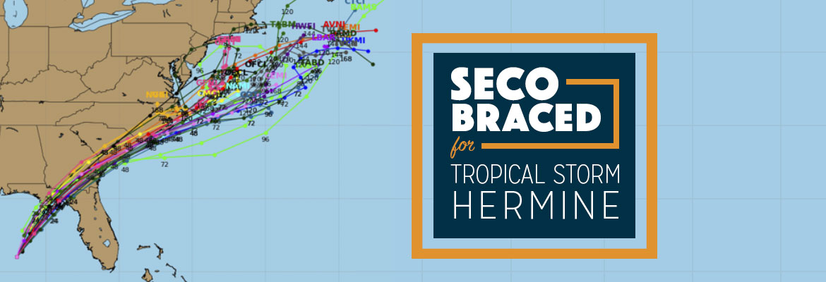
Atlantic Hurricane season is just around the corner – beginning on June 1. The Old Farmer’s Almanac advises us to watch for tropical storm threats in mid-May, predicts a rainy summer and forecasts the possibility of hurricanes in September. Colorado State University’s Tropical Meteorology study was recently released and it calls for the number of named storms and hurricanes to be slightly below historical averages. Still, per NOAA’s Hurricane Research Division, the U.S. averages one to two hurricane landfalls each season, so we have to prepare even with a below average hurricane forecast.


“Storm Ready” isn’t just a slogan. We invest in and prepare for the worst, but hope and pray for the best. “Storm Ready” is using social media to update members about severe weather and its possible impact to our service area. “Storm Ready” is SECO’s System Operations Center that is staffed 24 hours a day, 7 days a week. “Storm Ready” means that Operations crews and support staff are available for restoration around-the-clock. “Storm Ready” means that local Call Centers and Member Service Centers are fully staffed to help you weather the storm.


SECO can help you get your family “Storm Ready” as well. Visit our website’s Storm Preparation section for an Emergency Checklist. Before inclement weather arrives, bookmark SECO’s Storm Center page on your smartphone or tablet in case you need to report a power outage, and update your primary contact phone number and email address through your online account (called SmartHub at SECOEnergy.com). “Like” SECO’s Facebook page and “follow” the cooperative on Twitter for weather information and warnings.


It’s time to check your emergency kit – now. Make sure your supplies are fully stocked and that medicines, water and foodstuffs aren’t out-of-date. Remember, emergency supplies sell out quickly when storms and hurricanes are imminent.


SECO News, May 2017 - Duncan's Digest, Storm Ready


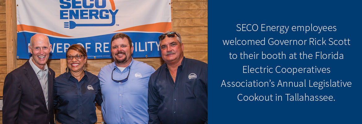
During the 2016 Atlantic Hurricane Season, Florida Governor Rick Scott engaged with utility leaders collaboratively and encouraged us across the state to work together to restore all consumers’ power as quickly as possible. “Storm Ready” also applies to SECO’s willingness to lend a hand to assist our fellow cooperatives, as well as state municipal and investor-owned utilities when possible. In February, SECO assisted Clay Electric Cooperative when its members were affected by widespread outages due to a strong storm. Since SECO’s system held up well in that storm and the few members who experienced outages had their service restored the same day, the SECO team jumped into action and sent 20 employees to help restore power to Clay members.


SECO News, May 2017- Annual Meeting Recap


Annual Meeting Recap


Attendance boomed at SECO Energy’s 79th Annual Meeting of the Membership on Saturday, March 25. Thousands of members, guests, vendors and VIPs enjoyed hot breakfast biscuits, sweet treats, energy efficiency displays, live entertainment, gifts and a chance to win grand prizes and various door prizes. Members received a copy of SECO’s 2016 Annual Report and a gift bag with two commemorative insulated steel tumblers. SECO and its wholesale power provider Seminole Electric distributed over 6,000 LED bulbs to members. Members visited SECO’s vendor-partners who were on hand to display their energy-saving products and services in the Energy Showcase.


Margo Rochelle & Rodeo Drive provided live entertainment, playing current country tunes and old favorites while members sang along and line danced. A special character, LED Lucy, brightened the day with her antics and smiles.


Members took home loads of door prizes. The grand prizes up for grabs were four cash prizes, a refurbished Dodge Dakota truck, and a refurbished electric golf cart.


SECO News, May 2017- Annual Meeting , pictures form 79th annual meeting of SECO Members


This year’s grand prize winners are:

  • Michael Niemiec from Inverness won the refurbished 2005 Dodge Dakota truck.
  • Lake Panasoffkee’s Shannon Jessup was the winner of the refurbished electric golf cart from The Villages Golf Carts.
  • The Villages resident Edward Maffuccio was the happy winner of the $1,500 cash prize.
  • Clark Smith from Webster won the $1,000 cash prize.
  • Christine Bartow from The Villages and Edward James from Leesburg both won a $500 cash prize.


Congratulations to all winners, and thank you for attending the event. Mark your calendar, as next year’s Annual Meeting is scheduled for Saturday, March 17, 2018. Hope you can join us for our 80th Annual Meeting!


SECO News, May 2017 - Save Money Save Energy


Save Energy, Save Money


Summer is almost here – set your HVAC thermostat at 78 or higher in the summer and always keep your fan setting on “Auto.” Invest in a programmable thermostat and save $180 annually per ENERGY STAR®.


SECO News, May 2017 - Safety Corner, Downed Power Lines


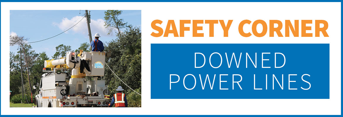
Safety Corner – Downed Power Lines


Always assume overhead power lines are live and dangerous – even when lines and poles are downed during storms or accidents. Warn children to never touch a downed line with any part of their body or another object such as a stick or bat. Instruct children to leave the area immediately and call for help if they see a downed line.


Read the full May 2017 SECO News here.

SECO Braced for Tropical Storm Hermine

On Thursday morning, Tropical Storm Hermine turned northeast and is moving at 12 mph. Hermine’s maximum sustained winds are 60 mph with higher gusts, and tropical-storm-force winds extend up to 140 miles east of the center. Current models show the track to our west. Hermine is forecast to hit the Florida coast as a hurricane tonight or early Friday morning between Apalachicola and Cross City. Once inland, Hermine should diminish in intensity and track across northwest Florida into southeast Georgia by Friday morning.


SECO Energy is Storm Ready and is braced for Hermine’s impact on its service area. Members should expect 4-8 inches of rain during the event with isolated higher totals. Strong winds will occur on Friday and will have more of an impact on SECO’s service territory than before Hermine makes landfall. Isolated tornado threats remain a concern until Hermine passes away from the state on Friday.


SECO has enacted its emergency restoration plan in preparation for Hermine’s effects. Bucket trucks and line work cannot withstand winds in excess of 35 mph. Once winds subside, SECO’s Operations crews and additional contractor and tree trimming crews will work together to restore power quickly and safely. Additional reinforcements are on standby.


The company’s emergency restoration plan determines the system’s restoration priority of each affected feeder. Essential services such as shelters, hospitals, fire/law enforcement facilities, schools, and government agencies are the highest priority. Line repairs that will restore power to large groups of members are next, and then individual electric services in less populated areas. SECO urges members to continue tracking Hermine and prepare to wait out the storm as it passes through Central Florida.


Use these practical suggestions:

  • If using a landline, have a non-electric phone for emergencies.
  • Invest in and charge a battery-operated cell phone charger.
  • Buy a battery-powered radio and a supply of fresh batteries.
  • Keep flashlights and extra batteries handy.
  • Dig out your first aid kit and refill prescription medications.
  • Stock a three-day supply of bottled water.
  • Fill bathtubs with water to flush toilets.
  • Purchase canned or packaged nonperishable food.
  • Buy an old-fashioned crank can opener.
  • Review your homeowners and flood insurance policies.


If neighbors have power but you do not, check your panel for tripped breakers, as this is common. If the breakers aren’t tripped, report the outage using your smartphone or tablet through the SECO Storm Center – or call us.


As a not-for-profit electric cooperative, SECO is dedicated to being its members’ first source for storm information. “Like” SECO’s Facebook page and “follow” the company on Twitter to stay updated.

SUNDAY UPDATE-INVEST MODELS SHOW FL SWING

SUNDAY WEATHER UPDATE – the models have changed

This morning’s forecast and models  of the system we’ve been watching show that the projected track has changed. The models are split now –  some showing the system turning NW after entering the Gulf and moving across Central and Northern Florida.  The NHC forecast states that gusty winds and heavy rainfall will hit South Florida and The Keys later today.  The NHC warns that the central and northern Florida and the eastern Gulf areas should monitor the disturbance.  A NOAA Hurricane Hunter aircraft is scheduled to investigate the system this afternoon.  We will send out another update after that.
SECO is Storm Ready. Our locally-based customer service staff is ready and available to respond to member inquiries in person, by phone or online. SECO’s System Operations directs the SECO cavalry 24 hours a day, seven days a week – each truck is equipped to respond to member concerns or service interruptions in the field quickly and safely.  Members should ensure their smartphones/tablets are charged and report outages online through Storm Center.


SECO is urging members to always be prepared. View our emergency checklist. As a not-for-profit electric cooperative, SECO is dedicated to being its members’ first source for accurate storm information. “Like” SECO’s Facebook page and “follow” the company on Twitter to stay updated about storms affecting your area.


For members who rely on back-up generators during storm season, remember to read and follow all manufacturer’s safety warnings.Learn more about generator safety here.

Tropical Storm Colin Update

Governor Scott has declared a state of emergency for SECO Energy’s service area as Tropical Storm Colin moves into the Central Florida area. A tropical storm warning has been issued for SECO’s entire service territory.


The National Hurricane Center forecast is showing Colin making landfall this evening near the Big Bend and Panhandle area. The impact may cause storm force winds of 39 mph up to 57 mph with possible tornadoes through early Tuesday morning.


Tropical Storm Colin poses a severe threat to the State of Florida and requires timely precautions. SECO members could see heavy rain and gusting winds as Colin move through the state. SECO members should visit www.secoenergy.com to receive updates and report outages.


Kathryn Gloria, Vice President of Corporate Communications and Energy Services is reminding members that SECO is Storm Ready for its members. “SECO is prepared for the almost daily afternoon storms that affect our service area and we are prepared for stronger storms as well. As a not-for-profit electric cooperative, we are dedicated to being our members’ first source for accurate storm information. “Like” SECO’s Facebook page and “follow” us on Twitter to stay updated about storms affecting our members.”


For members who rely on back-up generators during storm season, remember to read and follow all manufacturer’s safety warnings. Learn more about generator safety and preparing for storm season.