StormCenter logo

Archive

Sunshine State Stats, September 2017

September 2017’s Sunshine State Stats and the local weather was about the same as the previous September – with the exception of Cat 2/3 Hurricane Irma that barreled through the center of the state on Sunday, September 9.   The average temperature came in at 82°, while September of 2016 was a degree higher with an average temperature of 83°. Rainfall came in at 9.68 inches compared to last September at 6.14 inches. This was mainly due to Hurricane Irma.


There were 514 cooling degree days and 0 heating degree days for September 2017, while last year there were 502 cooling degree days with 0 heating degree days. The Degree Days are based on how much warmer or cooler the average temperature at a particular location is than 65°F. In other words, if the average temperature is 70° degrees outside on a particular day, there are 5 Cooling Degree Days for that day in that location.


SECO Energy's Sunshine State Stats for September 2017 - September's monthly averages and stats


October is forecast to be slightly warmer than normal with precipitation being higher than normal compared to last year. The hot and humid days of 2017 are almost behind us –  bringing lower energy bills. If you want to check historical usage, log into SmartHub to view past bills and charts.


If your usage is high, SECO offers several energy-efficiency tools to help you identify energy wasters. Take the Home Energy Assessment to receive a detailed email tailored to your home’s features and lifestyle. The energy-saving advice will provide low-cost ways to decrease your usage – and your electric bill.


To easily calculate how much energy your appliances, lighting, electronic devices, and other energy-using items in your home consume, use the Energy Estimator. If you want a member of our Energy Services team to come to your home to perform a free energy audit, contact us today to book an appointment.

SECO’s System 99.9% Recovered After Hurricane Irma

SECO Energy completed the final stage of its Hurricane Irma restoration effort on Sunday. At the end of Sunday, the not-for-profit electric cooperative completed power restoration for 99.9 percent of all members affected by Hurricane Irma.


SECO’s infrastructure suffered significant damage as Hurricane Irma traveled directly through its service territory with winds that ranged from a Category 1 to a Category 3 hurricane, per data from the National Hurricane Center. Power outages began Sunday evening, September 10, as Irma’s tropical-storm-force winds entered Central Florida. Members continued to lose power throughout Sunday night and Monday morning when winds increased to hurricane-force speeds. When winds subsided, more than half of SECO’s system was down and more than half of the cooperative’s members were without power.


Restoration began on Monday, September 11, at noon. More than 1,200 SECO crews and line/tree contractors were deployed in full force throughout the system over the next six days to restore power. At the end of the day on Sunday, September 17, SECO’s system was more than 99.9% restored. Only about 70 accounts in South Sumter County are unable to receive electric service at this time due to high water.


The damage to SECO’s system from Hurricane Irma was much more significant than even the damage from the 2004 hurricanes. The damage and disruptions from Hurricane Irma, were unprecedented in SECO’s service territory and across the state.


Today, line and tree trimming contractors are preparing to return home. If a member experiences a new outage, it should be reported at Storm Center using the last name and house number.


For SECO members who were without power, it was a long week. SECO Energy thanks them for their patience and understanding as crews worked to bring substations back online, rebuild feeder lines, replace thousands of broken poles and clear trees from infrastructure. Most important, the company is overwhelmed by and grateful for the thoughtful outreach by hundreds of members across the service area. Citizens brought pizza, sandwiches, cookies, goodie bags and more to the crews in the field and employees in our locations. Members sent notes of encouragement and posted signs of gratitude along the roads.


SECO members are still facing the after effects of Hurricane Irma. A colossal amount of tree branches, trunks and debris remains on the ground and near roadways. Members should call the county where they reside and ask for the debris to be removed. For members who have damage to their homes or property, please call your homeowners’ insurance carrier, county emergency services or FEMA. If you need financial assistance with everyday living expenses due to the hardship of Hurricane Irma, please contact Florida 2-1-1.


As a not-for-profit electric cooperative, SECO is dedicated to being our members’ first source for accurate storm information. “Like” SECO’s Facebook page and “follow” the company on Twitter to stay updated about storms affecting our area.

Hurricane Irma Power Outage Numbers Dwindling

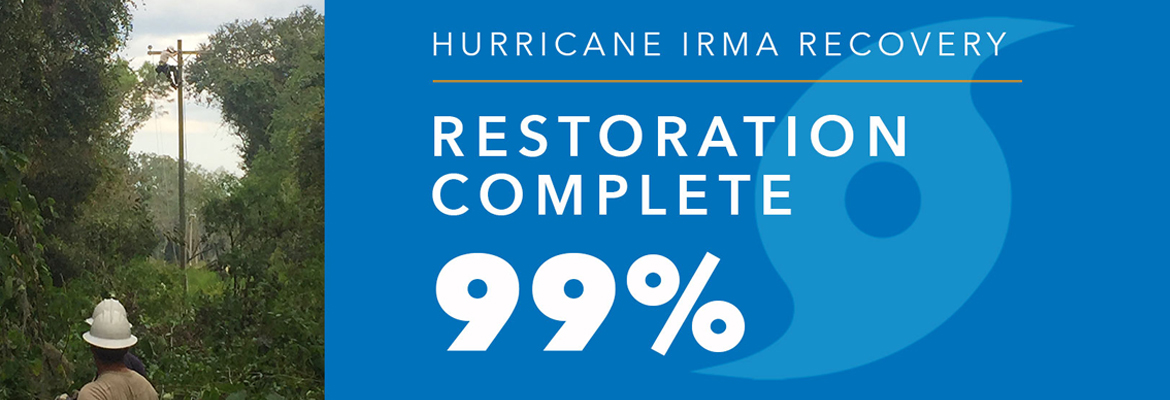
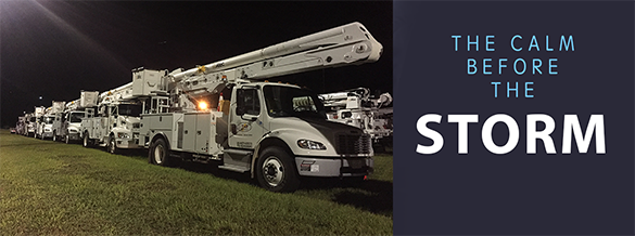
The number of power outages caused by Hurricane Irma’s wrath as it blazed through SECO Energy’s territory are dwindling. SECO crews along with hundreds of contract line and tree trimming crews continued tackling the sections of SECO’s service area hardest hit by Hurricane Irma.


On Monday morning when hurricane winds subsided, our systems indicated more than 110,000 reported power outages out of SECO’s 200,000 members. Crews began rebuilding and repairing feeder lines after winds subsided at noon on Monday. As of Saturday, at 12 pm, SECO’s Storm Center outage map indicates less than 10,000 members remained without power. Restoration and recovery in some communities is a long process due to significant damage and high water. SECO’s goal is full restoration for all members by Sunday at noon.


SECO understands that members with prolonged outages are frustrated. Isolated thunderstorms on Friday hampered efforts in a few areas, but fortunately, widespread storms that were forecast held off. Crews made good progress throughout the day and overnight. Saturday’s forecast calls for a 50% chance of thunderstorms, keep your fingers crossed and pray the rains stay away. If lightning conditions occur, line work comes to a stop for safety reasons.


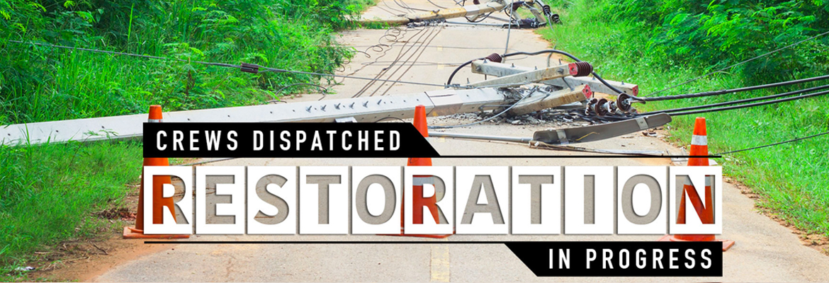
Florida mandates that facilities such as hospitals, shelters, schools and government offices are given highest priority when restoration begins. SECO restored power to these facilities first. Assisted-living, non-hospital medical facilities, nursing homes, gas stations and communications towers running on generator power began running out of fuel Thursday. These necessarily became a priority. SECO’s crews are pulled in many directions so members may see crews leaving residential areas that are not yet completely restored. Homes in one subdivision on one side of the street may have power while the other side does not. This can occur where one line ends and another line begins.


The electric system design is complicated, and we’ve developed an online visual to help members understand where the feeders/lines are located. SECO’s interactive restoration plan map was updated overnight to reflect Saturday’s planned restoration areas. Members can use the daily restoration plan map to input their service address and determine if their area is included in the current day’s restoration plan. Substations are labeled as a reference and feeders are outlined in polygons. To use the map, visit www.SECOEnergy.com and hover over “Contact Us” in the top right corner. Select “Daily Restoration Plan.”


The following is a summary of substations and feeders where crews are or will be TODAY performing repairs and restoration:


Sumterville District Office:
• Wildwood substation north of CR-222 in Sumter County.
• Lake Ella substation in Fruitland Park in Lake County.
• Bushnell substation in Sumter County on CR-48.
• Lake Panasoffkee substation on CR 416N in Sumter County.
• Sumterville substation on South Hwy 301 in Sumter County.
• Webster substation on CR 753 in Sumter County.


Eustis District Office:
• Sorrento substation on CR 437 in Lake County.
• Deer Island substation on CR 448 in Tavares.
• Linadale substation in Umatilla in Lake County.
• St. Johns substation in Lake County off Lake Mack Drive in Deland.
• Paisley substation off Maggie Jones Road in Lake County.


Ocala District Office:
• Dallas substation serving CR-42 and Hwy 301 in Marion County.
• Belleview substation serving Belleview and Summerfield in Marion County.
• Timberwood substation in Marion County off 60th Avenue in Ocala.
• Waterways substation on SW 49th Ave in Ocala.
• Martel substation in NW Ocala off 110th Ave in Marion County.
• Ocala substation on SW 80th Street in Marion County.
• Blitchton substation on NW Hwy 464 in Morriston.
• Marion Oaks substation in Ocala on SW 134 Loop in Marion County.
• Lady Lake substation on Griffin Ave in Lake County.
• Summerglen substation on SW 16th Ave in Ocala.


Please keep in mind that Hurricane Irma just left SECO’s service area late Monday morning. Even the storms of 2004 didn’t hit SECO’s area this hard and with this much damage. The system disruption is unprecedented and SECO is doing its best to quickly and fully recover.


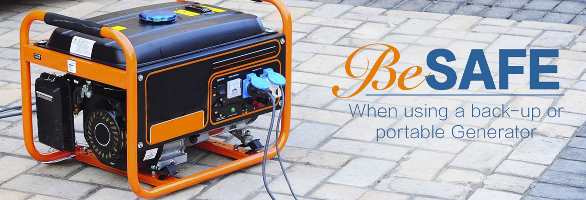
During this time of prolonged outages from Hurricane Irma, if you are using a generator, never let it operate in an enclosed space such as your home, garage or enclosed porch. Generators emit carbon monoxide, a silent, odorless killer. There are multiple reports of Central Floridians who have been rushed to the hospital for carbon monoxide poisoning, and some of these cases were fatal. Read and follow manufacturer’s safety warnings when operating a generator.


As a not-for-profit electric cooperative, SECO is dedicated to being our members’ first source for accurate storm information. “Like” SECO’s Facebook page and “follow” the company on Twitter to stay updated about storms affecting our area.

SECO Extends Gratitude to Hurricane Matthew Partners

In early October, Hurricane Matthew – an extremely powerful Category 3 hurricane – traveled north along Florida’s east coast bringing strong winds and rain gusts to SECO Energy’s service area. SECO enacted its emergency restoration plan to prepare for and recover from Hurricane Matthew successfully – due in part to the assistance from additional contractors and vendors. Their speedy response and willingness to help were truly awe-inspiring.


SECO proactively organized an army of additional line crews, tree contractors and hospitality-related vendors to aid in its restoration efforts before, during and after Hurricane Matthew. It took an immense collaborative effort to restore power to over 28,000 SECO members in under 36 hours. The average outage was only 129 minutes. SECO members would have been without power for much longer without the willingness and dedication of its employees, contractors and vendors.


SECO Energy CEO Jim Duncan stated, “Florida’s Governor, Rick Scott, was engaged and encouraging before, during and after the event. SECO appreciates the thousands of hard working utility workers who joined forces to restore power to millions of Floridians. Without question, SECO is Storm Ready and willing to lend a hand to assist our fellow cooperatives, as well as state municipal and investor-owned utilities during times of crisis.”


Members can “like” SECO Energy’s Facebook page and “follow” the company on Twitter for cooperative updates and the latest news releases.

Calm Before the Storm – SECO Braces for Matthew’s Inland Effects

Per the Friday morning National Hurricane Center update, Hurricane Matthew continues to slowly move up the Florida east coast – just off the shore. Matthew is moving at 13 mph and has weakened to a Category 3 hurricane. As of 5 am, the eye is located parallel to Melbourne.


For Central Florida, winds will increase throughout the day. Lake County, Sumter County and the east side of Marion County could feel wind gusts up to 60 mph. Models remain mixed as to if the eye will cross Florida’s shores. Where it will head after it passes the state remains uncertain.


Poles and lines will go down, and power outages will likely be widespread. Because crews are unable to work safely or raise bucket truck booms in winds over 35 mph, outages will be long in duration if crews cannot respond to outages until winds subside and the storm passes.


SECO encourages its members to report outages using smartphones or tablets at the Storm Center application on SECOEnergy.com. It’s easy to report with the last name and house number. Members can contact SECO via Facebook and Twitter and read outage details.


For members less tech savvy, call and talk to a member service rep (or use the prompts to report the outage by phone at 800 732 6141). SECO’s System Operations Center is manned 24/7, and our call centers are also manned 24/7 when severe weather comes through – as will be the case as Hurricane Matthew approaches. Also report downed power lines – call 911 if there is immediate danger.


SECO is Storm Ready. Its emergency response plan determines the restoration priority of each feeder. Essential services like shelters, hospitals, schools and government agencies are the highest priority. Next, linemen work to restore power to large groups of members. Then repairs begin on individual services in less populated areas. Additional line crews and tree trimming contractors continue to arrive at SECO to be staged for the restoration effort.


Members who need continuous power for medical devices and do not have a back-up source of power must act now. Shelters are open in the SECO area. Contact your county’s emergency operations center (EOC) to find shelter in your area – do not wait.

• Sumter County 352-689-4400 or visit the website.
• Lake County 352-343-9420 or visit the website.
• Marion County Citizen’s Info line is 352-369-7500 or visit the website.
• Citrus County 352-527-2106 or 352-746-5470 or visit the website.
• Levy County 352-486-5213 or visit the website.
• Hernando County 352-754-4083 or 352-754-4111 or visit the website.
• Pasco County 727-847-8137 or visit the website.


As a not-for-profit electric cooperative, SECO is dedicated to being members’ first source for accurate storm information. Learn more at SECOEnergy.com.

Spaghetti Model Mayhem as Hurricane Matthew Approaches Florida

The spaghetti models for the latest Hurricane Matthew forecast are all over the place, but one thing is clear: It’s coming to Florida, and SECO Energy members will feel effects of the storm on Thursday and Friday.


Per the National Hurricane Center’s 5 pm forecast, Hurricane Matthew is moving northwest at 12 mph. On this track, Matthew will move across the Bahamas tonight and tomorrow, and is expected to be near Florida’s east coast tomorrow night. Strengthening is forecasted during the next couple of days, and Matthew is expected to remain at a Category 3 or stronger while it moves through the Bahamas and approaches Florida.


The forecasted path of Matthew is a parallel track on Florida’s east coast – but models are mixed now in reference to how close the eye will come to Florida’s shores and where it will head after it passes the northern part of the state. What is certain is Central Florida residents east of I-75 will likely experience rain bands and strong tropical-storm-force wind gusts with damage potential. This means power outages – some perhaps long in duration.


SECO encourages its members to report outages using their smartphones or tablets through our online Storm Center application at SECOEnergy.com. It’s easy to report simply by using the last name on the account and the house number. Members can contact SECO via Facebook and Twitter, as details about outages are always posted to these platforms.


For those less tech savvy, members can always call and talk to a member service rep (or use the prompts to report the outage by phone at (800) 732 6141. SECO’s System Operations Center is manned 24/7, and our call centers are also manned 24/7 when severe weather comes through – as will be the case as Hurricane Matthew approaches. Downed power lines can be reported by phone too – but a member who suspects immediate danger should call 911.


SECO is Storm Ready with a comprehensive emergency response plan that determines the system’s restoration priority of each affected feeder. Essential services such as shelters, hospitals, schools and government agencies are the highest priority. Next, line personnel make repairs that will restore power to large groups of members and then repairs begin on individual electric services in less populated areas. SECO has called for additional line crews and tree trimming contractors to respond quickly to outages caused by Hurricane Matthew.


SECO Encourages Member Safety During Hurricane Matthew


For members who need continuous power for medical devices, please know that Hurricane Matthew may be the cause of prolonged outages during and after the storm hits. If you are a SECO member who requires uninterrupted service and you do not have a back-up source of power to operate a medically necessary device, now is the time to act as SECO cannot guarantee continuous service during a severe storm event. Shelters are opening in the SECO area Thursday. Contact the emergency operations center (EOC) in the county where you live and inquire about available shelters in your area. Below is the contact information for the EOCs by county:


As a not-for-profit electric cooperative, SECO is dedicated to being members’ first source for accurate storm information. Learn more at SECOEnergy.com.

Generator Power Safety and Medical Devices

As a not-for-profit electric cooperative, SECO Energy is dedicated to being its members’ first source for electric safety communication and resources during major weather events such as Hurricane Matthew.


Members who use generators during service interruptions should only use with safety in mind.  Generators should never be used in an enclosed space – generator engines emit carbon monoxide (CO). If CO is inhaled, it can be fatal to humans and pets, as it is a colorless, odorless, invisible killer.  Do not attempt to use a generator when it is wet, as this poses a risk for electrocution and death.  Always read and follow the manufacturer’s safety instructions contained in the generator operations manual.


SECO Encourages Member Safety During Hurricane Matthew


For members who may need continuous power to run life-saving machines, please be aware that Hurricane Matthew may be the cause of prolonged outages during and after the storm hits. If you are a SECO member who requires uninterrupted service and you do not have a back-up source of power to operate a medically necessary device, now is the time to act as SECO cannot guarantee continuous service during a severe storm event. Contact the emergency operations center (EOC) in the county where you live and inquire about available shelters in your area. Below is the contact information for the EOCs by county:


SECO reminds members to never touch downed power lines.  Even if a line is down, it could still be live and lead to electrocution and death.  Do not allow children to play near downed lines or trees downed during storms.  Please report any service interruptions or downed power lines through SECO’s Storm Center or call 800-732-6141.


SECO Encourages Member Safety During Hurricane Matthew


“Like” SECO’s Facebook page and “follow” the company on Twitter to stay updated about storms affecting the area.

SECO Continues Tracking Hurricane Matthew

SECO Energy continues to monitor and track Hurricane Matthew and its path to Florida. SECO is urging members to gather emergency supplies and be ready for service interruptions while the hurricane is passing through Florida and for a period of time thereafter.


As of Wednesday morning, Hurricane Matthew was downgraded to a Category 3 hurricane with sustained winds up to 125 mph. The storm is currently located about 35 miles north-northwest of the eastern tip of Cuba and is moving north at 8 mph. The storm is still predicted to turn northwest Wednesday night and is expected to remain a major hurricane as it moves over the Bahamas Wednesday and Thursday. By Thursday evening, Matthew will be near Florida’s east coast – with the center located 25 to 30 miles off the coast. The state will feel its effects through Friday night.


The forecast for Florida includes rain bands and strong, potentially damaging wind gusts – especially within rain bands and thunderstorms. Members in SECO’s service area can expect heavy rain, gusty winds that may strengthen to tropical-storm-force.


SECO asks members to keep a close watch on the hurricane’s impact on the area and be prepared for the possibility of prolonged service interruptions. Members should check emergency supplies, fill vehicles with gas, stock up on non-perishables and check property for objects that could cause damage during high winds.


Make sure cell phones and tablets are fully charged – include extra chargers in your emergency supplies. Bookmark SECO’s Storm Center on your smartphone or tablet. It’s simple to report an outage using the account last name and house number.


As a not-for-profit electric cooperative, SECO is dedicated to being our members’ first source for accurate storm information. “Like” SECO’s Facebook page and “follow” the company on Twitter to stay updated about storms affecting our area.

SUNDAY UPDATE-INVEST MODELS SHOW FL SWING

SUNDAY WEATHER UPDATE – the models have changed

This morning’s forecast and models  of the system we’ve been watching show that the projected track has changed. The models are split now –  some showing the system turning NW after entering the Gulf and moving across Central and Northern Florida.  The NHC forecast states that gusty winds and heavy rainfall will hit South Florida and The Keys later today.  The NHC warns that the central and northern Florida and the eastern Gulf areas should monitor the disturbance.  A NOAA Hurricane Hunter aircraft is scheduled to investigate the system this afternoon.  We will send out another update after that.
SECO is Storm Ready. Our locally-based customer service staff is ready and available to respond to member inquiries in person, by phone or online. SECO’s System Operations directs the SECO cavalry 24 hours a day, seven days a week – each truck is equipped to respond to member concerns or service interruptions in the field quickly and safely.  Members should ensure their smartphones/tablets are charged and report outages online through Storm Center.


SECO is urging members to always be prepared. View our emergency checklist. As a not-for-profit electric cooperative, SECO is dedicated to being its members’ first source for accurate storm information. “Like” SECO’s Facebook page and “follow” the company on Twitter to stay updated about storms affecting your area.


For members who rely on back-up generators during storm season, remember to read and follow all manufacturer’s safety warnings.Learn more about generator safety here.